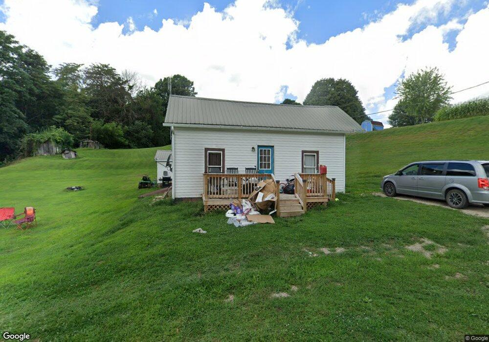
315 Coal Run Dr Lowell, OH 45744
Estimated Value: $58,446 - $105,000
1
Bed
1
Bath
672
Sq Ft
$131/Sq Ft
Est. Value
About This Home
This home is located at 315 Coal Run Dr, Lowell, OH 45744 and is currently estimated at $88,362, approximately $131 per square foot. 315 Coal Run Dr is a home with nearby schools including Fort Frye High School.
Ownership History
Date
Name
Owned For
Owner Type
Purchase Details
Closed on
May 10, 2012
Sold by
Huggins James S
Bought by
Wallace Paul A
Current Estimated Value
Create a Home Valuation Report for This Property
The Home Valuation Report is an in-depth analysis detailing your home's value as well as a comparison with similar homes in the area
Home Values in the Area
Average Home Value in this Area
Purchase History
| Date | Buyer | Sale Price | Title Company |
|---|---|---|---|
| Wallace Paul A | $20,000 | Attorney |
Source: Public Records
Tax History Compared to Growth
Tax History
| Year | Tax Paid | Tax Assessment Tax Assessment Total Assessment is a certain percentage of the fair market value that is determined by local assessors to be the total taxable value of land and additions on the property. | Land | Improvement |
|---|---|---|---|---|
| 2024 | $373 | $11,630 | $4,580 | $7,050 |
| 2023 | $364 | $11,630 | $4,580 | $7,050 |
| 2022 | $366 | $11,630 | $4,580 | $7,050 |
| 2021 | $377 | $11,690 | $6,000 | $5,690 |
| 2020 | $372 | $11,690 | $6,000 | $5,690 |
| 2019 | $377 | $11,690 | $6,000 | $5,690 |
| 2018 | $358 | $11,100 | $5,710 | $5,390 |
| 2017 | $359 | $11,100 | $5,710 | $5,390 |
| 2016 | $665 | $11,100 | $5,710 | $5,390 |
| 2015 | $351 | $10,370 | $5,780 | $4,590 |
| 2014 | $618 | $10,370 | $5,780 | $4,590 |
| 2013 | $167 | $10,370 | $5,780 | $4,590 |
Source: Public Records
Map
Nearby Homes
- 497 Wilson Dr
- 590 Stony Run Rd
- 21870 State Route 339
- 500 Applegate Dr
- 717 Mitchell Ave
- 6 Spring St
- 4 Center St
- 5 Center St
- 3 Center St
- 35415 Hanson Rd
- 9333 Muskingum River Rd
- 0 Ohio 339
- 0 Cats Creek Unit 5147474
- 4150 Watertown Rd
- 627 Strahler Rd
- 16200 Crooked Tree Rd
- 0 Township Road 70
- 323 5th St
- 5788 Buchanan Rd
- 00 Ohio 530
- 65 Sandy Rd
- 585 Coal Run Dr
- 1560 Tick Hill Rd
- 1610 Tick Hill Rd
- 1530 Tick Hill Rd
- 1505 Tick Hill Rd
- 1470 Tick Hill Rd
- 1635 Tick Hill Rd
- 120 Coal Run Dr
- 35 Henderson Alley
- 481 Coal Run Dr
- 32625 Coal Run Rd (Twp 496)
- 405 Coal Run Dr
- 420 Coal Run Dr
- 441 Coal Run Dr
- 460 Coal Run Dr
- 414 Coal Run Dr
- 16225 State Route 60 Rd
- 499 Coal Run Dr
- 50 Henderson Alley