Estimated Value: $130,000 - $174,000
Studio
--
Bath
1,284
Sq Ft
$119/Sq Ft
Est. Value
About This Home
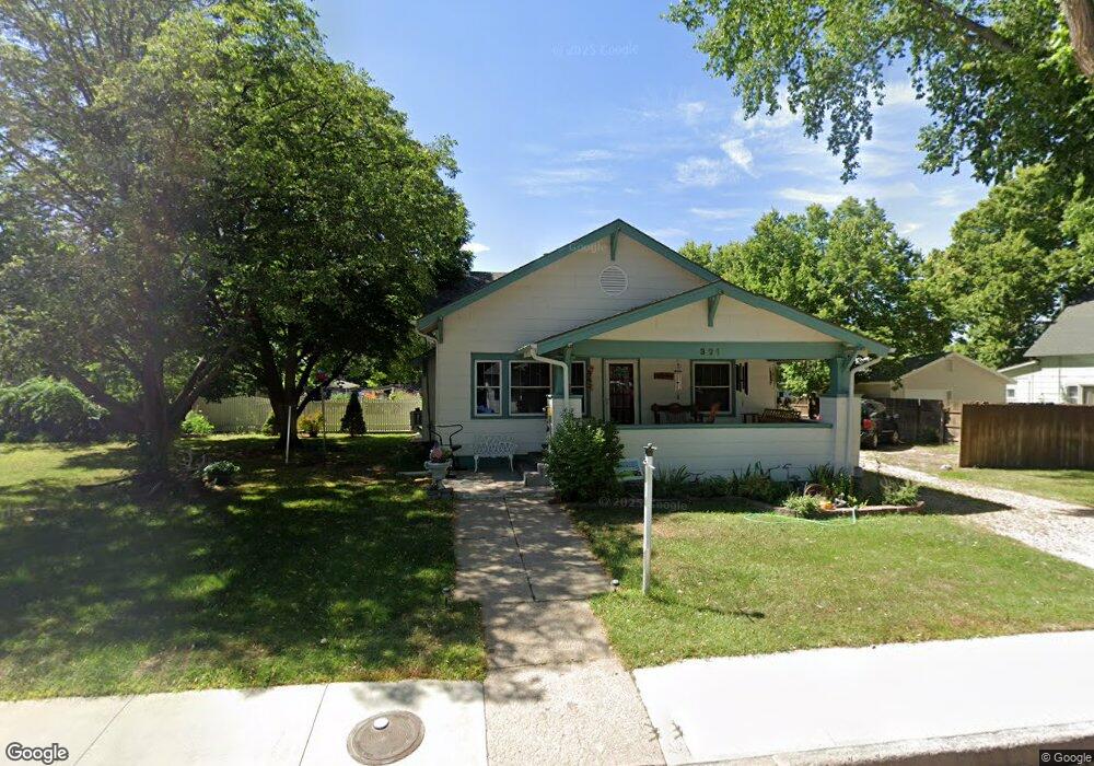
This home is located at 315 Franklin St, Wray, CO 80758 and is currently estimated at $152,536, approximately $118 per square foot. 315 Franklin St is a home located in Yuma County with nearby schools including Wray Elementary School, Buchanan Middle School, and Wray Junior/Senior High School.
Ownership History
Date
Name
Owned For
Owner Type
Purchase Details
Closed on
Feb 17, 2012
Sold by
Hales Shawn
Bought by
Juranek Stephen
Current Estimated Value
Purchase Details
Closed on
May 19, 2005
Sold by
Tombaugh Aileen D
Bought by
Hales Shawn
Home Financials for this Owner
Home Financials are based on the most recent Mortgage that was taken out on this home.
Original Mortgage
$34,000
Interest Rate
5.83%
Mortgage Type
Purchase Money Mortgage
Create a Home Valuation Report for This Property
The Home Valuation Report is an in-depth analysis detailing your home's value as well as a comparison with similar homes in the area
Purchase History
| Date | Buyer | Sale Price | Title Company |
|---|---|---|---|
| Juranek Stephen | $45,000 | None Available | |
| Hales Shawn | $42,500 | None Available |
Source: Public Records
Mortgage History
| Date | Status | Borrower | Loan Amount |
|---|---|---|---|
| Previous Owner | Hales Shawn | $34,000 |
Source: Public Records
Tax History
| Year | Tax Paid | Tax Assessment Tax Assessment Total Assessment is a certain percentage of the fair market value that is determined by local assessors to be the total taxable value of land and additions on the property. | Land | Improvement |
|---|---|---|---|---|
| 2024 | $254 | $2,660 | $0 | $0 |
| 2023 | $254 | $7,539 | $939 | $6,600 |
| 2022 | $241 | $5,327 | $939 | $4,388 |
| 2021 | $466 | $5,328 | $776 | $4,552 |
| 2020 | $432 | $4,944 | $776 | $4,168 |
| 2019 | $441 | $4,944 | $776 | $4,168 |
| 2018 | $405 | $4,040 | $0 | $0 |
| 2017 | $350 | $3,930 | $0 | $0 |
| 2016 | $337 | $3,790 | $0 | $0 |
| 2015 | $301 | $3,790 | $0 | $0 |
| 2014 | $301 | $3,790 | $0 | $0 |
| 2013 | $301 | $4,060 | $0 | $0 |
Source: Public Records
Map
Nearby Homes
- 549 Emerson St
- 18124 U S Highway 385
- 410 Clay St Unit 9
- 731 W 9th St
- 820 Grant St Unit D
- 820 Grant St Unit H
- 820 Grant St Unit G
- 734 W 8th St
- G4 Grant St Unit G4
- 440 Blake St
- 831 Dexter St
- 924 Grant St
- TBD Dexter St Unit Lot B
- 30342 Us Highway 34
- 303 E 3rd St
- 338 Elm St
- TBD Wray Industrial Park Unit Block 1, Lot 1
- TBD Wray Industrial Park Unit Block 4
- Lot 36-37 Arlyn Way
- Lot 38-39 Arlyn Way
Your Personal Tour Guide
Ask me questions while you tour the home.