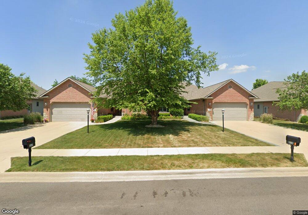
315 Garnet Dr Unit 135B Morton, IL 61550
Estimated Value: $371,524 - $421,000
2
Beds
1
Bath
1,879
Sq Ft
$215/Sq Ft
Est. Value
About This Home
This home is located at 315 Garnet Dr Unit 135B, Morton, IL 61550 and is currently estimated at $403,881, approximately $214 per square foot. 315 Garnet Dr Unit 135B is a home located in Tazewell County with nearby schools including Morton High School, Blessed Sacrament School, and Bethel Lutheran School.
Ownership History
Date
Name
Owned For
Owner Type
Purchase Details
Closed on
Jan 16, 2023
Sold by
Aupperle Kenneth W and Aupperle Carol A
Bought by
James A Hooker Living Trust and Anita S Hooker Living Trust
Current Estimated Value
Purchase Details
Closed on
Jun 11, 2021
Sold by
Aupperle Kenneth W
Bought by
Aupperle Kenneth W and Reecy Mark A
Purchase Details
Closed on
Aug 7, 2012
Sold by
Pearson Katelyn A
Bought by
Lindstrom Carol A
Purchase Details
Closed on
Sep 24, 2008
Sold by
K Eigsti Llc
Bought by
Lindstrom Carol A
Create a Home Valuation Report for This Property
The Home Valuation Report is an in-depth analysis detailing your home's value as well as a comparison with similar homes in the area
Home Values in the Area
Average Home Value in this Area
Purchase History
| Date | Buyer | Sale Price | Title Company |
|---|---|---|---|
| James A Hooker Living Trust | $395,000 | Hometown Title | |
| Aupperle Kenneth W | -- | None Listed On Document | |
| Aupperle Kenneth W | -- | Attorney | |
| Lindstrom Carol A | -- | None Available | |
| Lindstrom Carol A | $256,000 | First Community Title Svcs |
Source: Public Records
Tax History
| Year | Tax Paid | Tax Assessment Tax Assessment Total Assessment is a certain percentage of the fair market value that is determined by local assessors to be the total taxable value of land and additions on the property. | Land | Improvement |
|---|---|---|---|---|
| 2024 | $6,775 | $124,380 | $17,210 | $107,170 |
| 2023 | $6,775 | $98,380 | $16,030 | $82,350 |
| 2022 | $6,514 | $90,350 | $14,720 | $75,630 |
| 2021 | $6,711 | $86,870 | $14,150 | $72,720 |
| 2020 | $6,505 | $86,010 | $14,010 | $72,000 |
| 2019 | $6,488 | $86,010 | $14,010 | $72,000 |
| 2018 | $6,369 | $86,010 | $14,010 | $72,000 |
| 2017 | $6,205 | $85,160 | $13,870 | $71,290 |
| 2016 | $6,086 | $85,160 | $13,870 | $71,290 |
| 2015 | $5,875 | $0 | $0 | $0 |
| 2013 | $5,680 | $82,020 | $13,360 | $68,660 |
Source: Public Records
Map
Nearby Homes
- 71 Sapphire Point
- 31 Sapphire Point
- 26 Linden Ct
- 112 Caroline St
- 43 Lynnwood Ct
- 110 White Oak Dr Unit 110Whi
- 105 Willow Oak Dr Unit 105Wil
- 219 White Oak Dr Unit 219Whi
- 307 White Oak Dr Unit 307Whi
- 73 Hickory Ridge Dr
- 22623 Veterans Rd
- 106 Mulberry Dr Unit 108Mul
- 105 Hemlock Dr Unit 105Hem
- 10 Cherry Ln
- 29 Cherry Ln
- 116 Hickory Dr Unit 116Hic
- 108 Cottonwood Dr Unit 108Cot
- 111 Cottonwood Dr Unit 111Cot
- 120 Cottonwood Dr Unit 120Cot
- 307 Beverly Ave
- 317 Garnet Dr
- 311 Garnet Dr
- 309 Garnet Dr
- 319 Garnet Dr Unit 136B
- 700 Thornridge Dr
- 702 Thornridge Dr
- 321 Garnet Dr
- 307 Garnet Dr
- 708 Thornridge Dr
- 706 Thornridge Dr
- 312 Garnet Dr
- 314 Garnet Dr
- 310 Garnet Dr
- 305 Garnet Dr
- 308 Garnet Dr
- 323 Garnet Dr
- 318 Garnet Dr
- 306 Garnet Dr
- 608 Thornridge Dr
- 320 Garnet Dr