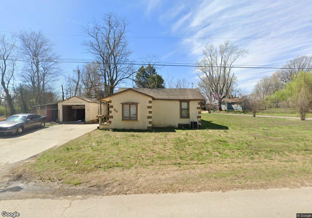
315 Lillian Dr Sikeston, MO 63801
Estimated Value: $78,000 - $108,234
3
Beds
1
Bath
1,203
Sq Ft
$77/Sq Ft
Est. Value
About This Home
This home is located at 315 Lillian Dr, Sikeston, MO 63801 and is currently estimated at $93,059, approximately $77 per square foot. 315 Lillian Dr is a home with nearby schools including Sikeston Senior High School, The Christian Academy, and Southeast Missouri Christian Academy.
Ownership History
Date
Name
Owned For
Owner Type
Purchase Details
Closed on
Jun 3, 2019
Sold by
Mcdowell Barry and Mcdowell Leeann
Bought by
Sprouse Management Llc
Current Estimated Value
Home Financials for this Owner
Home Financials are based on the most recent Mortgage that was taken out on this home.
Original Mortgage
$35,625
Outstanding Balance
$31,323
Interest Rate
4.1%
Mortgage Type
Future Advance Clause Open End Mortgage
Estimated Equity
$61,736
Purchase Details
Closed on
Jun 19, 2007
Sold by
Duetsche Bank National Trust Company
Bought by
Waters Steven and Waters Helen
Create a Home Valuation Report for This Property
The Home Valuation Report is an in-depth analysis detailing your home's value as well as a comparison with similar homes in the area
Home Values in the Area
Average Home Value in this Area
Purchase History
| Date | Buyer | Sale Price | Title Company |
|---|---|---|---|
| Sprouse Management Llc | -- | Semo Title Company | |
| Waters Steven | -- | -- |
Source: Public Records
Mortgage History
| Date | Status | Borrower | Loan Amount |
|---|---|---|---|
| Open | Sprouse Management Llc | $35,625 |
Source: Public Records
Tax History Compared to Growth
Tax History
| Year | Tax Paid | Tax Assessment Tax Assessment Total Assessment is a certain percentage of the fair market value that is determined by local assessors to be the total taxable value of land and additions on the property. | Land | Improvement |
|---|---|---|---|---|
| 2025 | $348 | $8,060 | $0 | $0 |
| 2024 | $348 | $7,310 | $0 | $0 |
| 2023 | $347 | $7,310 | $0 | $0 |
| 2022 | $349 | $7,060 | $0 | $0 |
| 2021 | $349 | $7,060 | $0 | $0 |
| 2020 | $312 | $6,810 | $0 | $0 |
| 2019 | -- | $6,810 | $0 | $0 |
| 2018 | -- | $6,810 | $0 | $0 |
| 2017 | -- | $6,810 | $0 | $0 |
| 2014 | -- | $6,810 | $0 | $0 |
| 2011 | -- | $6,780 | $0 | $0 |
Source: Public Records
Map
Nearby Homes