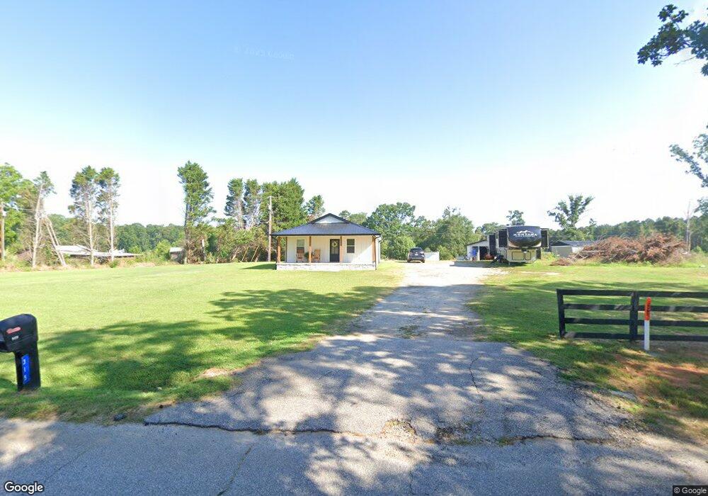
315 Mitchell Rd Williamston, SC 29697
Williamston-Pelzer NeighborhoodEstimated Value: $81,000 - $264,000
Studio
--
Bath
1,112
Sq Ft
$156/Sq Ft
Est. Value
About This Home
This home is located at 315 Mitchell Rd, Williamston, SC 29697 and is currently estimated at $173,551, approximately $156 per square foot. 315 Mitchell Rd is a home with nearby schools including Cedar Grove Elementary School, Palmetto Middle School, and Palmetto High School.
Ownership History
Date
Name
Owned For
Owner Type
Purchase Details
Closed on
Mar 21, 2022
Sold by
Cabaniss Dianne R
Bought by
Cabaniss Evan and Arndt Jessica
Current Estimated Value
Purchase Details
Closed on
Mar 16, 2022
Sold by
Cabaniss Dianne R
Bought by
Cabaniss Dianne R and Cabaniss Edward E
Purchase Details
Closed on
Oct 22, 2021
Sold by
Louis Jeffrey Craig and Estate Of Barbara Ann Lollis
Bought by
Cabaniss Diannae R and Cabaniss Edward E
Purchase Details
Closed on
Nov 7, 2005
Sold by
Lollis Barbara Ann Powell
Bought by
Lollis Barbara P and Lollis Barbara Ann Powell
Create a Home Valuation Report for This Property
The Home Valuation Report is an in-depth analysis detailing your home's value as well as a comparison with similar homes in the area
Home Values in the Area
Average Home Value in this Area
Purchase History
| Date | Buyer | Sale Price | Title Company |
|---|---|---|---|
| Cabaniss Evan | -- | None Listed On Document | |
| Cabaniss Dianne R | -- | None Listed On Document | |
| Cabaniss Diannae R | $35,000 | None Available | |
| Lollis Barbara P | -- | -- |
Source: Public Records
Tax History
| Year | Tax Paid | Tax Assessment Tax Assessment Total Assessment is a certain percentage of the fair market value that is determined by local assessors to be the total taxable value of land and additions on the property. | Land | Improvement |
|---|---|---|---|---|
| 2024 | $361 | $1,740 | $560 | $1,180 |
| 2023 | $336 | $1,740 | $560 | $1,180 |
| 2022 | $907 | $2,610 | $840 | $1,770 |
| 2021 | $0 | $1,650 | $510 | $1,140 |
| 2020 | $40 | $1,650 | $510 | $1,140 |
| 2019 | $40 | $1,650 | $510 | $1,140 |
| 2018 | $40 | $1,650 | $510 | $1,140 |
| 2017 | -- | $1,650 | $510 | $1,140 |
| 2016 | $40 | $1,540 | $310 | $1,230 |
| 2015 | $40 | $1,540 | $310 | $1,230 |
| 2014 | $40 | $1,540 | $310 | $1,230 |
Source: Public Records
Map
Nearby Homes
- 208 Big Woods Cir
- 00 Cromer Rd Unit 245 Cromer Road
- 315 Valley Oak Dr
- 322 Valley Oak Dr
- 324 Valley Oak Dr
- 124 Claridge Place
- 715 Oak Hill Ln
- 245 Cromer Rd
- 102 Lochenshire Place
- 109 Sheila Dr
- 303 Trail Ct
- 761 Oak Hill Ln
- 113 Loveland Dr
- 4355 Old Williamston Rd
- 1308 Breazeale Rd
- 4207 Old Williamston Rd
- 603 Pineland Meadows Rd
- 563 Willingham Rd
- 110A Willingham Rd
- 103 C-7-116
- 309 Mitchell Rd
- 321 Mitchell Rd
- 4804 Highway 29 N
- 4812 Highway 29 N
- 4812 U S 29
- 4900 Highway 29 N
- 1104 Breazeale Rd
- 00 Highway 29 N
- 2130 Cheddar Rd
- 2126 Cheddar Rd
- 2124 Cheddar Rd
- 2122 Cheddar Rd
- 2120 Cheddar Rd
- 1107 Breazeale Rd
- 281 Mitchell Rd
- 1114 Breazeale Rd
- 2118 Cheddar Rd Unit B
- 2118 Cheddar Rd
- 2119 Cheddar Rd
- 0 Big Woods Cir
Your Personal Tour Guide
Ask me questions while you tour the home.