Estimated Value: $87,092 - $216,000
2
Beds
--
Bath
2,768
Sq Ft
$53/Sq Ft
Est. Value
About This Home
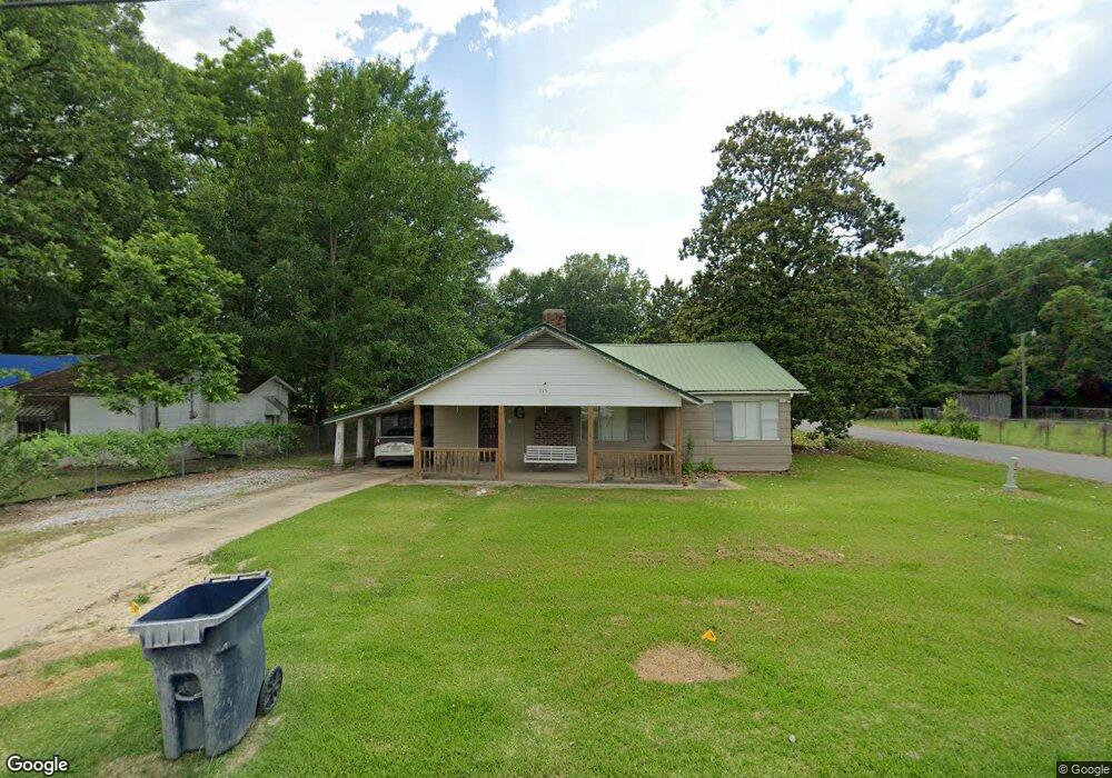
This home is located at 315 N McSweyn Place, Bruce, MS 38915 and is currently estimated at $147,364, approximately $53 per square foot. 315 N McSweyn Place is a home with nearby schools including Bruce Elementary School, Bruce Upper Elementary School, and Bruce High School.
Ownership History
Date
Name
Owned For
Owner Type
Purchase Details
Closed on
Feb 27, 2024
Sold by
Green Becky and Green Billy W
Bought by
Green Scott Aaron
Current Estimated Value
Home Financials for this Owner
Home Financials are based on the most recent Mortgage that was taken out on this home.
Original Mortgage
$44,000
Outstanding Balance
$43,134
Interest Rate
6.6%
Mortgage Type
New Conventional
Estimated Equity
$104,230
Create a Home Valuation Report for This Property
The Home Valuation Report is an in-depth analysis detailing your home's value as well as a comparison with similar homes in the area
Purchase History
| Date | Buyer | Sale Price | Title Company |
|---|---|---|---|
| Green Scott Aaron | -- | None Listed On Document | |
| Green Scott Aaron | -- | None Listed On Document |
Source: Public Records
Mortgage History
| Date | Status | Borrower | Loan Amount |
|---|---|---|---|
| Open | Green Scott Aaron | $44,000 | |
| Closed | Green Scott Aaron | $44,000 |
Source: Public Records
Tax History
| Year | Tax Paid | Tax Assessment Tax Assessment Total Assessment is a certain percentage of the fair market value that is determined by local assessors to be the total taxable value of land and additions on the property. | Land | Improvement |
|---|---|---|---|---|
| 2025 | $494 | $5,509 | $450 | $5,059 |
| 2024 | $1,050 | $8,264 | $675 | $7,589 |
| 2023 | $983 | $8,264 | $675 | $7,589 |
| 2022 | $885 | $7,262 | $675 | $6,587 |
| 2021 | $368 | $4,841 | $450 | $4,391 |
| 2020 | $361 | $4,841 | $450 | $4,391 |
| 2019 | $353 | $4,841 | $450 | $4,391 |
| 2018 | $326 | $4,488 | $450 | $4,038 |
| 2017 | $327 | $4,488 | $450 | $4,038 |
| 2016 | $327 | $4,488 | $450 | $4,038 |
| 2015 | $323 | $4,488 | $450 | $4,038 |
| 2014 | -- | $4,246 | $450 | $3,796 |
| 2013 | -- | $4,246 | $450 | $3,796 |
Source: Public Records
Map
Nearby Homes
- 109 E Spratlin St
- 232 E Calhoun St
- 119 S McSweyn Place
- 113 Woodson St
- 319 Rodgers Ave
- 115 W Johnson St
- 114 S Williams
- 0 Mississippi 9
- 00 Mississippi 9
- 105 Cr 257
- 26 Cr 272
- 209 N Pontotoc Rd
- 213 N Pontotoc Rd
- 410 W Calhoun St
- 01 Hwy 9
- 10 Cr 259
- 11 County Road 259
- 13 County Road 259c
- 137 Highway 9 N
- 181 Cr 221
- 313 N McSweyn Place
- 401 N McSweyn Place
- 401 N McSweyn Place
- 405 N McSweyn Place
- 313 E Clay St
- 301 E Clay St
- 400 N McSweyn Place
- 403 N McSweyn Place
- 303 N McSweyn Place
- 327 E Countiss St
- 404 N McSweyn Place
- 317 E Countiss St
- 306 N McSweyn Place
- 410 N McSweyn Place
- lot #10 E Countiss St
- lot #9 E Countiss St
- lot #8 E Countiss St
- 414 N McSweyn Place
- 328 E Countiss St
- 106 E Spratlin St
Your Personal Tour Guide
Ask me questions while you tour the home.