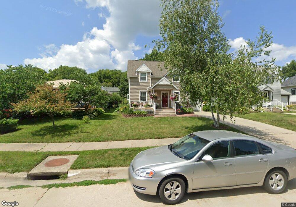
315 Pershing Ave Decorah, IA 52101
Estimated Value: $334,000 - $399,000
4
Beds
3
Baths
2,404
Sq Ft
$151/Sq Ft
Est. Value
About This Home
This home is located at 315 Pershing Ave, Decorah, IA 52101 and is currently estimated at $363,737, approximately $151 per square foot. 315 Pershing Ave is a home located in Winneshiek County with nearby schools including West Side Elementary School, Carrie Lee Elementary School, and John Cline Elementary School.
Ownership History
Date
Name
Owned For
Owner Type
Purchase Details
Closed on
Oct 1, 2024
Sold by
Eells Dominique N and Bockman Michael
Bought by
Bockman Michael and Bockman Dominique N
Current Estimated Value
Purchase Details
Closed on
Sep 22, 2021
Sold by
Espr015889 Pamela J Sanderson Estate
Bought by
Bockman Michael and Bockman Dominique
Home Financials for this Owner
Home Financials are based on the most recent Mortgage that was taken out on this home.
Original Mortgage
$112,000
Interest Rate
2.12%
Create a Home Valuation Report for This Property
The Home Valuation Report is an in-depth analysis detailing your home's value as well as a comparison with similar homes in the area
Home Values in the Area
Average Home Value in this Area
Purchase History
| Date | Buyer | Sale Price | Title Company |
|---|---|---|---|
| Bockman Michael | -- | None Listed On Document | |
| Bockman Michael | $140,000 | None Available |
Source: Public Records
Mortgage History
| Date | Status | Borrower | Loan Amount |
|---|---|---|---|
| Previous Owner | Bockman Michael | $112,000 |
Source: Public Records
Tax History
| Year | Tax Paid | Tax Assessment Tax Assessment Total Assessment is a certain percentage of the fair market value that is determined by local assessors to be the total taxable value of land and additions on the property. | Land | Improvement |
|---|---|---|---|---|
| 2025 | $5,638 | $350,100 | $25,770 | $324,330 |
| 2024 | $4,766 | $274,250 | $24,000 | $250,250 |
| 2023 | $4,774 | $274,250 | $24,000 | $250,250 |
| 2022 | $4,512 | $237,990 | $20,000 | $217,990 |
| 2021 | $4,320 | $232,540 | $20,000 | $212,540 |
| 2020 | $4,320 | $218,680 | $20,000 | $198,680 |
| 2019 | $4,204 | $218,680 | $0 | $0 |
| 2018 | $4,230 | $218,680 | $0 | $0 |
| 2017 | $4,128 | $205,270 | $0 | $0 |
| 2016 | $4,060 | $205,270 | $0 | $0 |
| 2015 | $3,874 | $196,350 | $0 | $0 |
| 2014 | $3,874 | $196,350 | $0 | $0 |
Source: Public Records
Map
Nearby Homes
- 405 Oak St
- 401 Williams St
- 608 Moen St
- 818 E Main St
- 310 E Broadway St
- 605 Day St
- 701 Winneshiek Ave
- 711 Winneshiek Ave
- 408 W Broadway St
- 803 Clearview Dr
- 0 Commerce Dr
- 111 N Mill St
- 602 Grove St
- 1112 S Mill St
- 911 Vernon St
- 1306 Skyline Dr
- 102 Center St
- Lot 7 BLK 1 Bruening Second Addition
- 215 High St
- 710 Serenity Ct
Your Personal Tour Guide
Ask me questions while you tour the home.