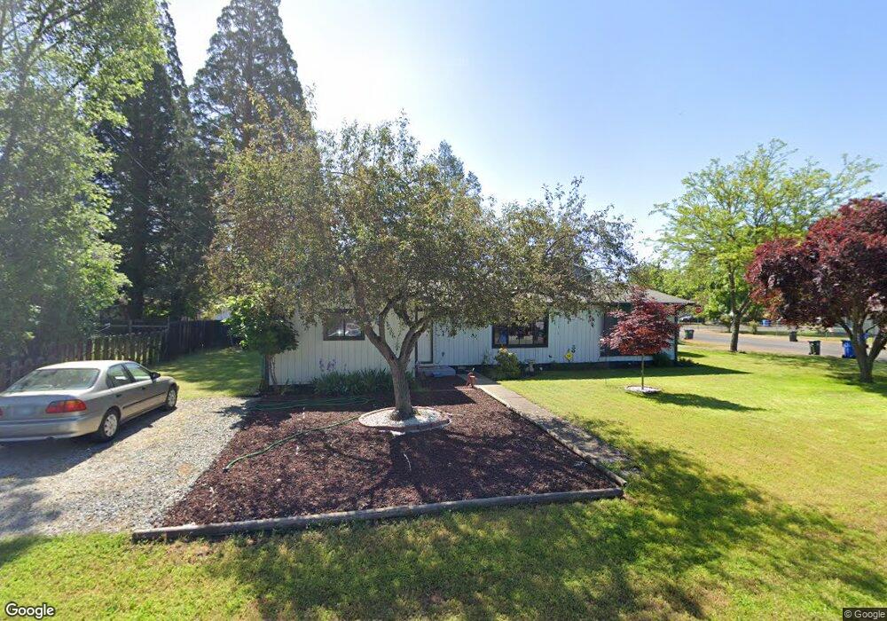
315 S Platt St Eagle Point, OR 97524
Estimated Value: $317,000 - $335,685
3
Beds
2
Baths
1,621
Sq Ft
$202/Sq Ft
Est. Value
About This Home
This home is located at 315 S Platt St, Eagle Point, OR 97524 and is currently estimated at $327,671, approximately $202 per square foot. 315 S Platt St is a home located in Jackson County with nearby schools including Eagle Point Middle School, White Mountain Middle School, and Eagle Point High School.
Ownership History
Date
Name
Owned For
Owner Type
Purchase Details
Closed on
Dec 24, 2025
Sold by
Sharp Lloyd Michael
Bought by
Sharp Karen Ann
Current Estimated Value
Purchase Details
Closed on
Dec 16, 2019
Sold by
Sharp Karen Ann
Bought by
Sharp Karen Ann and Sharp Lloyd Michael
Purchase Details
Closed on
Nov 21, 2014
Sold by
Sharp Lloyd Michael and Wilson Karen A
Bought by
Wilson Karen A
Purchase Details
Closed on
Oct 11, 2013
Sold by
Wilson Karen A
Bought by
Sharp Lloyd Michael
Purchase Details
Closed on
Mar 3, 2005
Sold by
Davis Lyle A
Bought by
Wilson Karen A
Create a Home Valuation Report for This Property
The Home Valuation Report is an in-depth analysis detailing your home's value as well as a comparison with similar homes in the area
Home Values in the Area
Average Home Value in this Area
Purchase History
| Date | Buyer | Sale Price | Title Company |
|---|---|---|---|
| Sharp Karen Ann | -- | None Listed On Document | |
| Sharp Karen Ann | -- | None Available | |
| Wilson Karen A | -- | None Available | |
| Sharp Lloyd Michael | -- | None Available | |
| Wilson Karen A | -- | -- |
Source: Public Records
Tax History
| Year | Tax Paid | Tax Assessment Tax Assessment Total Assessment is a certain percentage of the fair market value that is determined by local assessors to be the total taxable value of land and additions on the property. | Land | Improvement |
|---|---|---|---|---|
| 2026 | $2,308 | $169,610 | -- | -- |
| 2025 | $2,253 | $164,670 | $112,570 | $52,100 |
| 2024 | $2,253 | $159,880 | $109,290 | $50,590 |
| 2023 | $2,177 | $155,230 | $106,110 | $49,120 |
| 2022 | $2,118 | $155,230 | $106,110 | $49,120 |
| 2021 | $2,055 | $150,710 | $103,020 | $47,690 |
| 2020 | $2,183 | $146,330 | $100,030 | $46,300 |
| 2019 | $2,150 | $137,940 | $94,300 | $43,640 |
| 2018 | $2,109 | $133,930 | $91,560 | $42,370 |
| 2017 | $2,057 | $133,930 | $91,560 | $42,370 |
| 2016 | $2,017 | $126,250 | $86,310 | $39,940 |
| 2015 | $1,951 | $126,250 | $86,310 | $39,940 |
| 2014 | $1,861 | $119,010 | $81,360 | $37,650 |
Source: Public Records
Map
Nearby Homes
- 318 S Buchanan Ave
- 407 S Shasta Ave
- 620 S Royal Ave
- 522 Meadow Ln
- 650 Sarah Ln
- 621 S Shasta Ave
- 71 Tracy Ave Unit 71 & 73
- 133 Edith Cir
- 0 Crater Lake Hwy
- 837 S Royal Ave
- 421 Stevens Rd Unit 20
- 421 Stevens Rd Unit 14
- 421 Stevens Rd Unit 52
- 888 Arrowhead Trail
- 250 Tierra Cir
- 142 Onyx St
- 936 Arrowhead Trail
- 964 Pumpkin Ridge
- 997 Arrowhead Trail
- 995 Pumpkin Ridge
Your Personal Tour Guide
Ask me questions while you tour the home.