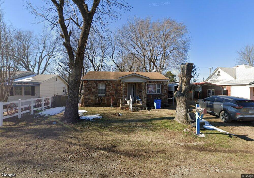
315 SE 1st St Checotah, OK 74426
Estimated Value: $53,473 - $111,000
2
Beds
1
Bath
728
Sq Ft
$126/Sq Ft
Est. Value
About This Home
This home is located at 315 SE 1st St, Checotah, OK 74426 and is currently estimated at $91,368, approximately $125 per square foot. 315 SE 1st St is a home located in McIntosh County with nearby schools including Marshall Elementary School, Checotah Intermediate Elementary School, and Checotah Middle School.
Ownership History
Date
Name
Owned For
Owner Type
Purchase Details
Closed on
Feb 2, 2005
Sold by
Cowan Michael Keith and Cowan Diane
Bought by
Lawhorn Rockey Allen and Lawhorn Lisa Gaye
Current Estimated Value
Home Financials for this Owner
Home Financials are based on the most recent Mortgage that was taken out on this home.
Original Mortgage
$18,605
Interest Rate
8%
Mortgage Type
Future Advance Clause Open End Mortgage
Create a Home Valuation Report for This Property
The Home Valuation Report is an in-depth analysis detailing your home's value as well as a comparison with similar homes in the area
Home Values in the Area
Average Home Value in this Area
Purchase History
| Date | Buyer | Sale Price | Title Company |
|---|---|---|---|
| Lawhorn Rockey Allen | -- | None Available |
Source: Public Records
Mortgage History
| Date | Status | Borrower | Loan Amount |
|---|---|---|---|
| Closed | Lawhorn Rockey Allen | $18,605 |
Source: Public Records
Tax History
| Year | Tax Paid | Tax Assessment Tax Assessment Total Assessment is a certain percentage of the fair market value that is determined by local assessors to be the total taxable value of land and additions on the property. | Land | Improvement |
|---|---|---|---|---|
| 2025 | $118 | $2,343 | $320 | $2,023 |
| 2024 | $110 | $2,343 | $310 | $2,033 |
| 2023 | $110 | $2,208 | $310 | $1,898 |
| 2022 | $98 | $2,144 | $310 | $1,834 |
| 2021 | $103 | $2,082 | $310 | $1,772 |
| 2020 | $159 | $2,736 | $202 | $2,534 |
| 2019 | $151 | $2,656 | $202 | $2,454 |
| 2018 | $143 | $2,579 | $202 | $2,377 |
| 2017 | $229 | $2,432 | $202 | $2,230 |
| 2016 | $246 | $2,552 | $197 | $2,355 |
| 2015 | $263 | $2,729 | $310 | $2,419 |
| 2014 | $263 | $2,729 | $310 | $2,419 |
Source: Public Records
Map
Nearby Homes
- 219 SE 1st St
- 514 SE Main St
- 0 South Ave Unit 2607526
- 0 South Ave Unit 2607528
- 0 South Ave Unit 2607533
- 0 South Ave Unit 2607513
- 0 South Ave Unit 2607492
- 0 South Ave Unit 2607521
- 0 South Ave Unit 2607508
- 0 South Ave Unit 2607485
- 0 South Ave Unit 2607518
- 0 South Ave Unit 2607530
- 0 South Ave Unit 2607500
- 0 South Ave Unit 2607532
- 220 E Audd Ave
- 722 SW 4th St
- 112580 New Texanna Rd
- 911 W Mcintosh Ave
- 402 N Broadway St
- 502 N Broadway St
- 313 SE 1st St
- 317 SE 1st St
- 314 SE 1st St
- 313 E Mcintosh Ave
- 305 E Mcintosh Ave
- 610 SE Main St
- 604 SE Main St
- 202 E Mcintosh Ave
- 701 SE 1st St
- 310 E South Ave
- 417410 Highway 150
- 306 E South Ave
- 302 E Mcintosh Ave
- 0 South Ave Unit 2008182
- 0 South Ave Unit 2103764
- 0 South Ave Unit 2204113
- 116501 S 4268 Rd
- 215 SE 1st St
- 508 SE Main St
- 225 E Chenault Ave
Your Personal Tour Guide
Ask me questions while you tour the home.