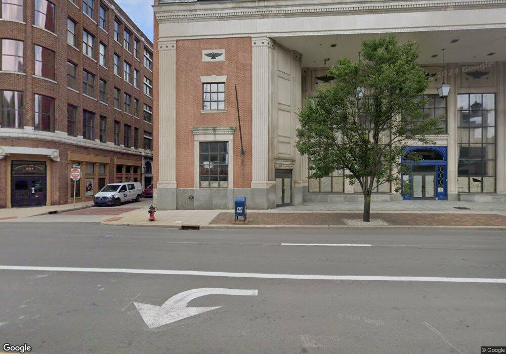
315 Tuscarawas St W Canton, OH 44702
Downtown Canton NeighborhoodEstimated Value: $636,661
--
Bed
20
Baths
55,926
Sq Ft
$11/Sq Ft
Est. Value
About This Home
This home is located at 315 Tuscarawas St W, Canton, OH 44702 and is currently estimated at $636,661, approximately $11 per square foot. 315 Tuscarawas St W is a home located in Stark County with nearby schools including Early Learning Center @ Schreiber, Gibbs Elementary School, and Clarendon Intermediate School.
Ownership History
Date
Name
Owned For
Owner Type
Purchase Details
Closed on
Jun 13, 2022
Sold by
Daily Shaughn T
Bought by
Red Oak Partners Llc
Current Estimated Value
Purchase Details
Closed on
Dec 28, 2018
Sold by
Liberty Commons Ltd
Bought by
Pjt Pointe West Llc
Purchase Details
Closed on
Oct 10, 2001
Sold by
Sun America Life Insurance Company
Bought by
Liberty Commons Ltd
Purchase Details
Closed on
Jul 13, 2000
Sold by
Real Estate Income Program 1987-1
Create a Home Valuation Report for This Property
The Home Valuation Report is an in-depth analysis detailing your home's value as well as a comparison with similar homes in the area
Home Values in the Area
Average Home Value in this Area
Purchase History
| Date | Buyer | Sale Price | Title Company |
|---|---|---|---|
| Red Oak Partners Llc | $247,720 | Beyke Joseph L | |
| Pjt Pointe West Llc | -- | None Available | |
| Liberty Commons Ltd | $300,000 | -- | |
| -- | -- | -- |
Source: Public Records
Tax History Compared to Growth
Tax History
| Year | Tax Paid | Tax Assessment Tax Assessment Total Assessment is a certain percentage of the fair market value that is determined by local assessors to be the total taxable value of land and additions on the property. | Land | Improvement |
|---|---|---|---|---|
| 2025 | $10,313 | $301,040 | $35,320 | $265,720 |
| 2024 | -- | $301,040 | $35,320 | $265,720 |
| 2023 | $23,801 | $273,670 | $32,100 | $241,570 |
| 2022 | $15,687 | $273,670 | $32,100 | $241,570 |
| 2021 | $20,848 | $273,670 | $32,100 | $241,570 |
| 2020 | $20,255 | $260,620 | $30,560 | $230,060 |
| 2019 | $19,912 | $260,640 | $30,560 | $230,080 |
| 2018 | $19,218 | $260,640 | $30,560 | $230,080 |
| 2017 | $18,829 | $219,800 | $18,520 | $201,280 |
| 2016 | $19,051 | $219,800 | $18,520 | $201,280 |
| 2015 | $19,143 | $219,800 | $18,520 | $201,280 |
| 2014 | $347 | $205,330 | $17,290 | $188,040 |
| 2013 | $9,930 | $205,330 | $17,290 | $188,040 |
Source: Public Records
Map
Nearby Homes
- 916 6th St NW
- 1024 3rd St NW
- 1015 4th St NW
- 722 High Ave NW
- 413 Newton Ave NW
- 905 High Ave NW
- 806 Troy Place NW
- 1005 Dewalt Ave NW
- 1007 Dewalt Ave NW
- 1221 9th St NW
- 0 3rd St SE Unit 5132035
- 1120 6th St NE
- 1405 8th St NW
- 1409 8th St NW
- 1224 Cleveland Ave NW
- 1023 Fulton Rd NW
- 1227 Worley Ave NW
- 1226 Logan Ave NW
- 1231 Worley Ave NW
- 935 Ridge Rd NW
- 401 Tuscarawas St W Unit 201
- 401 Tuscarawas St W
- 332 2nd St NW
- 111 Cleveland Ave SW
- 0 Cleveland Ave NW Unit 3470331
- 0 Cleveland Ave NW Unit 2441804
- 0 Cleveland Ave NW Unit 5071000
- 0 Cleveland Ave NW Unit 9150928
- 229 Cleveland Ave NW
- 320 3rd St NW
- 11445 Wm Penn
- 930 Sara
- 225 2nd St NW
- 400 Tuscarawas St W
- 400 Tuscarawas St W Unit 100
- 400 Tuscarawas St W Unit 400
- 400 Tuscarawas St W Unit 300
- 217 2nd St NW
- 217 2nd St NW
- 120 Court Ave NW