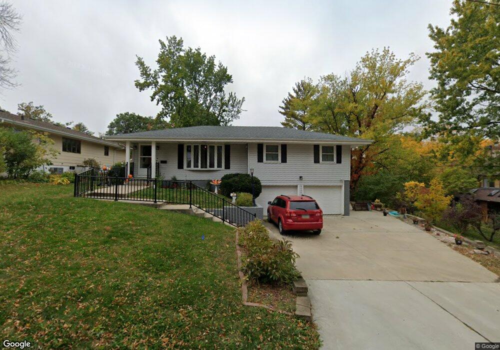
315 W 13th St S Newton, IA 50208
Estimated Value: $210,668 - $230,000
3
Beds
3
Baths
1,156
Sq Ft
$191/Sq Ft
Est. Value
About This Home
This home is located at 315 W 13th St S, Newton, IA 50208 and is currently estimated at $220,667, approximately $190 per square foot. 315 W 13th St S is a home located in Jasper County with nearby schools including Thomas Jefferson Elementary School, Woodrow Wilson Elementary School, and Berg Middle School.
Ownership History
Date
Name
Owned For
Owner Type
Purchase Details
Closed on
Nov 2, 2022
Sold by
Illingworth Donna Kay
Bought by
Farr Britney R
Current Estimated Value
Purchase Details
Closed on
Sep 9, 2020
Sold by
Charles Ronald W
Bought by
Engbers Britney R
Purchase Details
Closed on
Aug 28, 2020
Sold by
Farr Britney R and Farr James
Bought by
Illingworth Donna K
Purchase Details
Closed on
Feb 14, 2009
Sold by
Johnson William M and Johnson Sandra G
Bought by
Charles Ronald W
Create a Home Valuation Report for This Property
The Home Valuation Report is an in-depth analysis detailing your home's value as well as a comparison with similar homes in the area
Home Values in the Area
Average Home Value in this Area
Purchase History
| Date | Buyer | Sale Price | Title Company |
|---|---|---|---|
| Farr Britney R | -- | -- | |
| Engbers Britney R | $80,000 | None Available | |
| Illingworth Donna K | $138,500 | None Available | |
| Charles Ronald W | $125,000 | None Available |
Source: Public Records
Tax History Compared to Growth
Tax History
| Year | Tax Paid | Tax Assessment Tax Assessment Total Assessment is a certain percentage of the fair market value that is determined by local assessors to be the total taxable value of land and additions on the property. | Land | Improvement |
|---|---|---|---|---|
| 2025 | $3,398 | $198,480 | $35,340 | $163,140 |
| 2024 | $3,398 | $179,430 | $35,340 | $144,090 |
| 2023 | $3,380 | $179,430 | $35,340 | $144,090 |
| 2022 | $3,146 | $161,010 | $35,340 | $125,670 |
| 2021 | $3,398 | $150,340 | $35,340 | $115,000 |
| 2020 | $3,398 | $144,850 | $32,050 | $112,800 |
| 2019 | $3,014 | $124,810 | $0 | $0 |
| 2018 | $3,014 | $124,810 | $0 | $0 |
| 2017 | $3,016 | $124,810 | $0 | $0 |
| 2016 | $3,016 | $124,810 | $0 | $0 |
| 2015 | $2,944 | $124,810 | $0 | $0 |
| 2014 | $2,832 | $124,810 | $0 | $0 |
Source: Public Records
Map
Nearby Homes
- 237 W 12th St S
- 210 W 13th St S
- 8 Chancery Ct
- 1221 Monroe Dr
- 1431 Cardinal Ridge Dr
- 1100 1st Ave W
- 1000 1st Ave W
- 308 W 8th St S
- 726 W 9th St S
- 623 S 4th Ave W
- 304 W 11th St N
- 625 S 3rd Ave W
- 723 W 6th St S
- 1121 Woodland Dr
- 702 W 6th St S
- 303 W 5th St S
- 913 W 18th St S
- 429 1st Ave W
- 621 W 4th St S
- 6911-10 Highway F 48 W
- 1304 S 4th Ave W
- 1308 S 4th Ave W
- 1315 S 3rd Ave W
- 314 W 14th St S
- 1301 S 3rd Ave W
- 314 W 13th St S
- 316 W 13th St S
- 304 W 14th St S
- 1311 S 4th Ave W
- 1305 S 4th Ave W
- 318 W 13th St S
- 1300 S 3rd Ave W
- 1304 S 3rd Ave W
- 1327 S 4th Ave W
- 1301 S 4th Ave W
- 315 W 12th St S
- 300 W 13th St S
- 309 W 12th St S
- 403 W 12th St S
- 1316 S 3rd Ave W