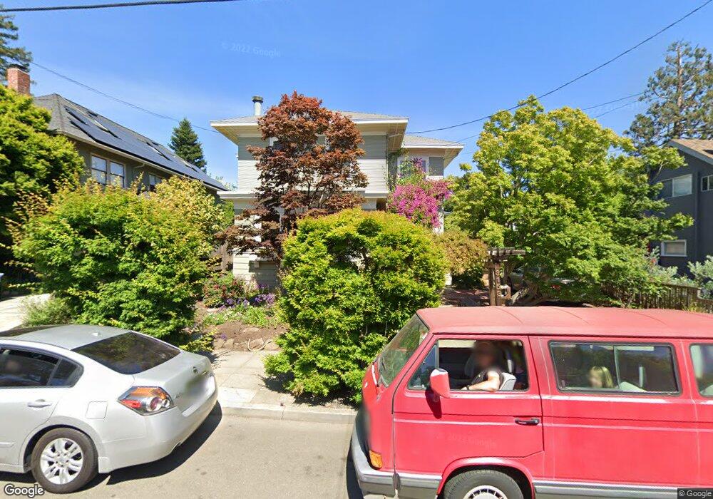
3153 Lewiston Ave Berkeley, CA 94705
Elmwood NeighborhoodEstimated Value: $2,830,000 - $3,525,000
5
Beds
4
Baths
3,228
Sq Ft
$980/Sq Ft
Est. Value
About This Home
This home is located at 3153 Lewiston Ave, Berkeley, CA 94705 and is currently estimated at $3,162,459, approximately $979 per square foot. 3153 Lewiston Ave is a home located in Alameda County with nearby schools including John Muir Elementary School, Emerson Elementary School, and Malcolm X Elementary School.
Ownership History
Date
Name
Owned For
Owner Type
Purchase Details
Closed on
Jul 20, 2015
Current Estimated Value
Purchase Details
Closed on
Jun 1, 1998
Sold by
Ettinger Anita
Home Financials for this Owner
Home Financials are based on the most recent Mortgage that was taken out on this home.
Original Mortgage
$227,000
Outstanding Balance
$45,650
Interest Rate
7.11%
Estimated Equity
$3,116,809
Create a Home Valuation Report for This Property
The Home Valuation Report is an in-depth analysis detailing your home's value as well as a comparison with similar homes in the area
Home Values in the Area
Average Home Value in this Area
Purchase History
| Date | Buyer | Sale Price | Title Company |
|---|---|---|---|
| -- | -- | None Available | |
| -- | $776,000 | Placer Title Company |
Source: Public Records
Mortgage History
| Date | Status | Borrower | Loan Amount |
|---|---|---|---|
| Open | -- | $227,000 |
Source: Public Records
Tax History
| Year | Tax Paid | Tax Assessment Tax Assessment Total Assessment is a certain percentage of the fair market value that is determined by local assessors to be the total taxable value of land and additions on the property. | Land | Improvement |
|---|---|---|---|---|
| 2025 | $21,784 | $1,232,015 | $371,704 | $867,311 |
| 2024 | $21,784 | $1,207,726 | $364,418 | $850,308 |
| 2023 | $21,267 | $1,190,911 | $357,273 | $833,638 |
| 2022 | $21,298 | $1,160,561 | $350,268 | $817,293 |
| 2021 | $21,321 | $1,137,668 | $343,400 | $801,268 |
| 2020 | $20,124 | $1,132,936 | $339,881 | $793,055 |
| 2019 | $19,252 | $1,110,727 | $333,218 | $777,509 |
| 2018 | $18,868 | $1,088,952 | $326,685 | $762,267 |
| 2017 | $18,227 | $1,067,604 | $320,281 | $747,323 |
| 2016 | $17,553 | $1,046,675 | $314,002 | $732,673 |
| 2015 | $17,305 | $1,030,954 | $309,286 | $721,668 |
| 2014 | $17,047 | $1,010,762 | $303,228 | $707,534 |
Source: Public Records
Map
Nearby Homes
- 2477 Prince St
- 6446 Colby St
- 2951 Linden Ave
- 5687 Miles Ave
- 5936 Broadway
- 204 El Camino Real
- 2243 Ashby Ave
- 629 66th St
- 1488 Alvarado Rd
- 2702 Dana St
- 2611 Piedmont Ave Unit 4
- 2319 Ward St
- 6320 Shattuck Ave
- 5668 Buena Vista Ave
- 2601 College Ave Unit 203
- 2601 College Ave Unit 208
- 2732 Parker St
- 0 Tunnel Rd
- 6555 Shattuck Ave
- 2110 Ashby Ave
- 3151 Lewiston Ave
- 3155 Lewiston Ave
- 2733 Alcatraz Ave
- 2733 Alcatraz Ave
- 2731 Alcatraz Ave
- 3143 Lewiston Ave
- 2737 Alcatraz Ave
- 2727 Alcatraz Ave
- 3139 Lewiston Ave
- 3148 Lewiston Ave
- 3152 Lewiston Ave
- 3142 Lewiston Ave
- 3154 Lewiston Ave
- 3134 Eton Ave
- 2747 Alcatraz Ave
- 3133 Lewiston Ave
- 3136 Eton Ave
- 3138 Lewiston Ave
- 3132 Eton Ave
- 3160 Lewiston Ave