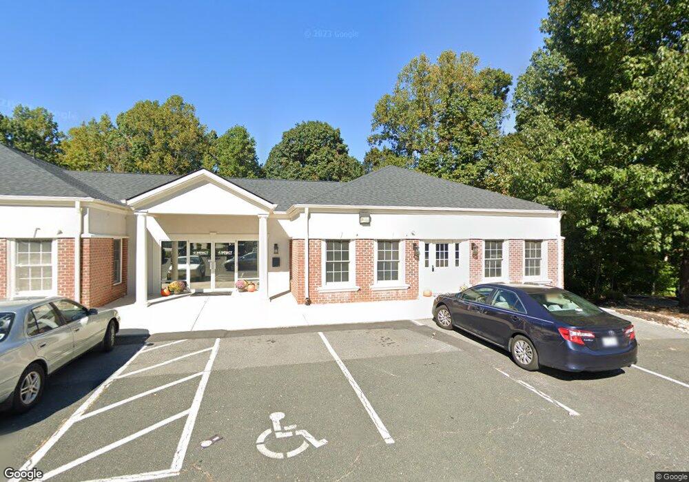
316 Brook Park Place Forest, VA 24551
--
Bed
--
Bath
10,080
Sq Ft
3.43
Acres
About This Home
This home is located at 316 Brook Park Place, Forest, VA 24551. 316 Brook Park Place is a home located in Bedford County with nearby schools including Thomas Jefferson Elementary School, Forest Middle School, and Jefferson Forest High School.
Ownership History
Date
Name
Owned For
Owner Type
Purchase Details
Closed on
Jan 28, 2019
Sold by
Anderson April Christa Jean and Anderson Mary Alecia Cherie
Bought by
S & S Properties Llc
Home Financials for this Owner
Home Financials are based on the most recent Mortgage that was taken out on this home.
Original Mortgage
$851,450
Outstanding Balance
$748,577
Interest Rate
4.5%
Mortgage Type
Credit Line Revolving
Purchase Details
Closed on
Jun 19, 2008
Sold by
Greenstone Properties Llc
Bought by
Jean Anderson April Christa and Anderson May Alecia
Create a Home Valuation Report for This Property
The Home Valuation Report is an in-depth analysis detailing your home's value as well as a comparison with similar homes in the area
Home Values in the Area
Average Home Value in this Area
Purchase History
| Date | Buyer | Sale Price | Title Company |
|---|---|---|---|
| S & S Properties Llc | $788,500 | Absolute Title & Settlement | |
| Jean Anderson April Christa | -- | None Available |
Source: Public Records
Mortgage History
| Date | Status | Borrower | Loan Amount |
|---|---|---|---|
| Open | S & S Properties Llc | $851,450 |
Source: Public Records
Tax History Compared to Growth
Tax History
| Year | Tax Paid | Tax Assessment Tax Assessment Total Assessment is a certain percentage of the fair market value that is determined by local assessors to be the total taxable value of land and additions on the property. | Land | Improvement |
|---|---|---|---|---|
| 2025 | $4,965 | $1,210,900 | $171,600 | $1,039,300 |
| 2024 | $4,965 | $1,210,900 | $171,600 | $1,039,300 |
| 2023 | $4,965 | $605,450 | $0 | $0 |
| 2022 | $3,835 | $383,450 | $0 | $0 |
| 2021 | $3,835 | $766,900 | $91,100 | $675,800 |
| 2020 | $3,835 | $766,900 | $91,100 | $675,800 |
| 2019 | $3,835 | $766,900 | $91,100 | $675,800 |
| 2018 | $4,086 | $785,800 | $112,000 | $673,800 |
| 2017 | $4,086 | $785,800 | $112,000 | $673,800 |
| 2016 | $4,086 | $785,800 | $112,000 | $673,800 |
| 2015 | $4,086 | $785,800 | $112,000 | $673,800 |
| 2014 | $4,151 | $798,200 | $112,000 | $686,200 |
Source: Public Records
Map
Nearby Homes
- 17513 Forest Rd
- 112 Forest Dale Dr
- 105 Simsbury Ln
- 206 Simsbury Ln
- 114 Bexley Dr
- 1245 Jefferson Oaks Ct Unit 69
- 114 Thornfield Dr
- 102 N Woodfin Ct
- 1055 Jefferson Oaks Ct Unit 3
- 0 Forest Rd
- 408 Robin Dr
- 1170 Mont View Ln
- 102 Springvale Dr
- 725 Wyndhurst Dr
- 202 Oak Knob Dr
- 106 Omega Ct
- 694 Wyndhurst Dr
- 1324 Cuddington Ln
- 202 Hounds Run
- 300 Robin Dr
- 317 Brook Park Place
- 311 Brook Park Place
- 307 Brook Park Place
- 314 Brook Park Place
- 304 Brook Park Place
- 0 Brook Park Place
- 207 Graves Dr
- 325 Brook Park Place
- 206 Enterprise Dr
- 2009 Enterprise Dr
- 302 Enterprise Dr
- 300 Enterprise Dr Unit B
- 203 Graves Dr
- 109 Graves Dr
- 111 Graves Dr
- 205 Graves Dr
- 306 Enterprise Dr
- 17421 Forest Rd
- 201 Graves Dr
- 211 Graves Dr