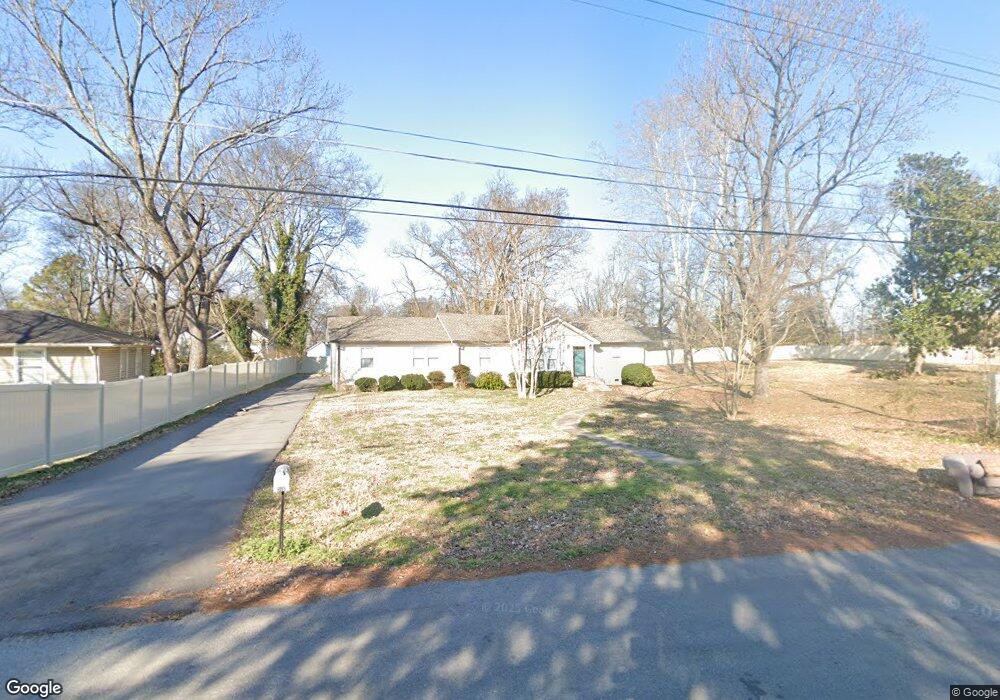
316 Farrar St Murfreesboro, TN 37129
Estimated Value: $250,000 - $345,000
--
Bed
1
Bath
1,683
Sq Ft
$180/Sq Ft
Est. Value
About This Home
This home is located at 316 Farrar St, Murfreesboro, TN 37129 and is currently estimated at $302,230, approximately $179 per square foot. 316 Farrar St is a home located in Rutherford County with nearby schools including Mitchell-Neilson Elementary, Siegel Middle School, and Siegel High School.
Ownership History
Date
Name
Owned For
Owner Type
Purchase Details
Closed on
Mar 4, 2021
Sold by
Moore Larry
Bought by
Sunset Tn Llc
Current Estimated Value
Purchase Details
Closed on
May 10, 2004
Sold by
Bank Of New York Trustee
Bought by
Larry Moore
Home Financials for this Owner
Home Financials are based on the most recent Mortgage that was taken out on this home.
Original Mortgage
$75,120
Interest Rate
5.54%
Purchase Details
Closed on
Feb 20, 2004
Sold by
Cummings Steven L
Bought by
Bank Of New York
Purchase Details
Closed on
Jan 3, 2001
Sold by
Cummings Regina L
Bought by
Cummings Steven L
Create a Home Valuation Report for This Property
The Home Valuation Report is an in-depth analysis detailing your home's value as well as a comparison with similar homes in the area
Home Values in the Area
Average Home Value in this Area
Purchase History
| Date | Buyer | Sale Price | Title Company |
|---|---|---|---|
| Sunset Tn Llc | -- | None Available | |
| Larry Moore | $93,900 | -- | |
| Bank Of New York | $118,842 | -- | |
| Cummings Steven L | -- | -- |
Source: Public Records
Mortgage History
| Date | Status | Borrower | Loan Amount |
|---|---|---|---|
| Previous Owner | Cummings Steven L | $75,120 |
Source: Public Records
Tax History Compared to Growth
Tax History
| Year | Tax Paid | Tax Assessment Tax Assessment Total Assessment is a certain percentage of the fair market value that is determined by local assessors to be the total taxable value of land and additions on the property. | Land | Improvement |
|---|---|---|---|---|
| 2025 | $1,633 | $57,700 | $13,750 | $43,950 |
| 2024 | $1,633 | $57,700 | $13,750 | $43,950 |
| 2023 | $1,083 | $57,700 | $13,750 | $43,950 |
| 2022 | $933 | $57,700 | $13,750 | $43,950 |
| 2021 | $860 | $38,750 | $8,750 | $30,000 |
| 2020 | $860 | $38,750 | $8,750 | $30,000 |
| 2019 | $860 | $38,750 | $8,750 | $30,000 |
| 2018 | $1,182 | $38,750 | $0 | $0 |
| 2017 | $1,088 | $28,000 | $0 | $0 |
| 2016 | $1,088 | $28,000 | $0 | $0 |
| 2015 | $1,088 | $28,000 | $0 | $0 |
| 2014 | $696 | $28,000 | $0 | $0 |
| 2013 | -- | $26,475 | $0 | $0 |
Source: Public Records
Map
Nearby Homes
- 301 Kingwood Dr
- 1107 Owen Layne Dr
- 1116 Owen Layne Dr
- 1019 N Maple St Unit 2D
- 608 Lynn St
- 1007 Grantland Ave
- 906 N Maple St
- 904 N Maple St
- 0 Lebanon Pike Unit RTC2818012
- 1620 Idlewood Dr
- 814 N Church St
- 0 Sulphur Springs Rd
- 1006 Jones Blvd
- 1120 White Blvd
- 717 N Church St
- 210 Grandview Dr
- 219 Ridgecrest Dr
- 623 Spencer Dr
- 1610 Jones Blvd
- 607 Staley St
- 310 Farrar St
- 311 W Clark Blvd
- 320 Farrar St
- 313 W Clark Blvd
- 215 W Clark Blvd
- 306 Farrar St
- 315 W Clark Blvd
- 311 Farrar St
- 1320 Poplar Ave
- 317 W Clark Blvd
- 1318 Poplar Ave
- 310 W Clark Blvd
- 312 W Clark Blvd
- 319 W Clark Blvd
- 314 W Clark Blvd
- 214 W Clark Blvd
- 320 W Clark Blvd
- 403 W Clark Blvd
- 324 W Clark Blvd
- 1321 Poplar Ave