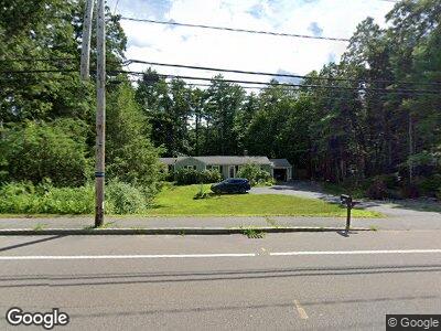
316 Hanover St Hanover, MA 02339
Estimated Value: $562,776 - $684,000
4
Beds
2
Baths
1,204
Sq Ft
$508/Sq Ft
Est. Value
About This Home
This home is located at 316 Hanover St, Hanover, MA 02339 and is currently estimated at $612,194, approximately $508 per square foot. 316 Hanover St is a home located in Plymouth County with nearby schools including Hanover High School, Cadence Academy Preschool - Hanover, and Cardinal Cushing Centers.
Ownership History
Date
Name
Owned For
Owner Type
Purchase Details
Closed on
Jul 23, 2004
Sold by
Foley Katherine A and Foley Padraig M
Bought by
Ellis Mark R
Current Estimated Value
Purchase Details
Closed on
Dec 15, 2000
Sold by
Wyman William R and Wyman Barbara A
Bought by
Foley Katherine A and Foley Padraig M
Create a Home Valuation Report for This Property
The Home Valuation Report is an in-depth analysis detailing your home's value as well as a comparison with similar homes in the area
Home Values in the Area
Average Home Value in this Area
Purchase History
| Date | Buyer | Sale Price | Title Company |
|---|---|---|---|
| Ellis Mark R | $377,900 | -- | |
| Ellis Mark R | $377,900 | -- | |
| Foley Katherine A | $203,000 | -- | |
| Foley Katherine A | $203,000 | -- |
Source: Public Records
Mortgage History
| Date | Status | Borrower | Loan Amount |
|---|---|---|---|
| Open | Ellis Mark R | $30,000 | |
| Open | Ellis Mark R | $68,600 | |
| Open | Ellis Mark R | $196,500 | |
| Closed | Wyman William R | $220,500 | |
| Closed | Wyman William R | $99,000 |
Source: Public Records
Tax History Compared to Growth
Tax History
| Year | Tax Paid | Tax Assessment Tax Assessment Total Assessment is a certain percentage of the fair market value that is determined by local assessors to be the total taxable value of land and additions on the property. | Land | Improvement |
|---|---|---|---|---|
| 2025 | $6,065 | $491,100 | $265,100 | $226,000 |
| 2024 | $6,306 | $491,100 | $265,100 | $226,000 |
| 2023 | $5,932 | $439,700 | $241,100 | $198,600 |
| 2022 | $5,980 | $392,100 | $229,000 | $163,100 |
| 2021 | $5,629 | $344,700 | $186,300 | $158,400 |
| 2020 | $5,728 | $351,200 | $197,200 | $154,000 |
| 2019 | $5,473 | $333,500 | $197,200 | $136,300 |
| 2018 | $5,333 | $327,600 | $197,200 | $130,400 |
| 2017 | $5,095 | $308,400 | $191,100 | $117,300 |
| 2016 | $4,908 | $291,100 | $173,800 | $117,300 |
| 2015 | $4,265 | $264,100 | $161,000 | $103,100 |
Source: Public Records
Map
Nearby Homes
- 7 Birchwood Rd
- 336 Broadway
- 186 Elm St
- 58 Oakland Ave
- 120 Broadway
- 115 Brook Bend Rd
- 80 Buttonwood Ln
- 101 Brook Bend Rd
- 362 Union St
- 89 River Rd
- 21 Te Berry Farm Rd
- 98 Spring Meadow Ln Unit 98
- 47 Deborah Rd
- 252 Myrtle St
- 38 Old Shipyard Ln
- 23 Roxanne Rd
- 10 Tiffany Rd
- 206 Circuit St
- 192 Plain St
- 24 Richard Dr
- 316 Hanover St
- 306 Hanover St
- 321 Hanover St
- 336 Hanover St
- 305 Hanover St
- 326 Hanover St
- 9 Tindale Way
- 329 Hanover St
- 313 Hanover St
- 346 Hanover St
- 337 Hanover St
- 299 Hanover St
- 23 Tindale Way
- 20 Tindale Way
- 35 Tindale Way
- 356 Hanover St
- 281 Hanover St
- 353 Hanover St
- 38 Tindale Way
- 16 Folly Hill Ln