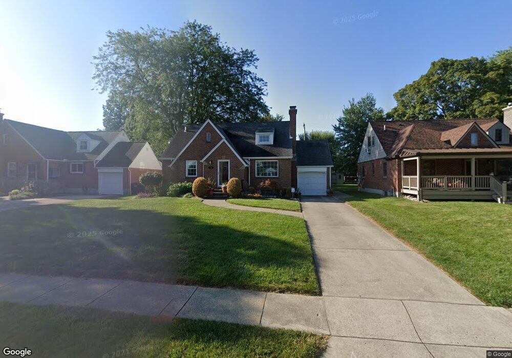
316 Lewiston Rd Dayton, OH 45429
Estimated Value: $234,000 - $316,000
2
Beds
1
Bath
1,248
Sq Ft
$218/Sq Ft
Est. Value
About This Home
This home is located at 316 Lewiston Rd, Dayton, OH 45429 and is currently estimated at $271,485, approximately $217 per square foot. 316 Lewiston Rd is a home located in Montgomery County with nearby schools including Orchard Park Elementary School, Van Buren Middle School, and Kettering Fairmont High School.
Ownership History
Date
Name
Owned For
Owner Type
Purchase Details
Closed on
Dec 2, 1999
Sold by
Newmark Homes Inc
Bought by
Hillard Donald R and Hillard Martha Darlene
Current Estimated Value
Home Financials for this Owner
Home Financials are based on the most recent Mortgage that was taken out on this home.
Original Mortgage
$147,950
Outstanding Balance
$51,917
Interest Rate
8.02%
Mortgage Type
Construction
Estimated Equity
$219,568
Purchase Details
Closed on
May 30, 1996
Sold by
Herman Ruth A
Bought by
Painter Ann M
Create a Home Valuation Report for This Property
The Home Valuation Report is an in-depth analysis detailing your home's value as well as a comparison with similar homes in the area
Home Values in the Area
Average Home Value in this Area
Purchase History
| Date | Buyer | Sale Price | Title Company |
|---|---|---|---|
| Hillard Donald R | $35,900 | Midwest Abstract Company | |
| Painter Ann M | $94,000 | -- |
Source: Public Records
Mortgage History
| Date | Status | Borrower | Loan Amount |
|---|---|---|---|
| Open | Hillard Donald R | $147,950 |
Source: Public Records
Tax History Compared to Growth
Tax History
| Year | Tax Paid | Tax Assessment Tax Assessment Total Assessment is a certain percentage of the fair market value that is determined by local assessors to be the total taxable value of land and additions on the property. | Land | Improvement |
|---|---|---|---|---|
| 2024 | $4,803 | $76,990 | $16,920 | $60,070 |
| 2023 | $4,803 | $76,990 | $16,920 | $60,070 |
| 2022 | $4,192 | $53,050 | $11,670 | $41,380 |
| 2021 | $3,879 | $53,050 | $11,670 | $41,380 |
| 2020 | $3,888 | $53,050 | $11,670 | $41,380 |
| 2019 | $3,681 | $44,340 | $13,530 | $30,810 |
| 2018 | $3,700 | $44,340 | $13,530 | $30,810 |
| 2017 | $3,410 | $44,340 | $13,530 | $30,810 |
| 2016 | $3,225 | $39,360 | $13,530 | $25,830 |
| 2015 | $3,082 | $39,360 | $13,530 | $25,830 |
| 2014 | $3,082 | $39,360 | $13,530 | $25,830 |
| 2012 | -- | $45,920 | $13,600 | $32,320 |
Source: Public Records
Map
Nearby Homes
- 309 Lewiston Rd
- 320 E Dorothy Ln
- 233 E Dorothy Ln
- 320 Brydon Rd
- 117 Cushing Ave
- 441 Cushing Ave
- 209 Brydon Rd
- 101 Blue Gate Cir Unit 1
- 235 Claranna Ave
- 587 Cottingwood Ct
- 3212 Lenox Dr
- 349 Orchard Dr
- 311 Parkdale St Unit 309
- 2701 Aerial Ave
- 2817 Royalston Ave
- 321 E Dorothy Ln
- 115 N Bromfield Rd
- 3073 Hillside Ave
- 709 E Dorothy Ln
- 651 Broad Blvd
- 320 Lewiston Rd
- 312 Lewiston Rd
- 324 Lewiston Rd
- 308 Lewiston Rd
- 325 Cushing Ave
- 321 Cushing Ave
- 333 Cushing Ave
- 317 Cushing Ave
- 337 Cushing Ave
- 328 Lewiston Rd
- 304 Lewiston Rd
- 313 Cushing Ave
- 317 Lewiston Rd
- 341 Cushing Ave
- 321 Lewiston Rd
- 313 Lewiston Rd
- 309 Cushing Ave
- 325 Lewiston Rd
- 300 Lewiston Rd
- 3060 Hathaway Rd