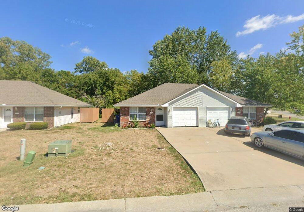
316 Lois Ln Grain Valley, MO 64029
Estimated Value: $287,000 - $338,000
4
Beds
2
Baths
1,848
Sq Ft
$168/Sq Ft
Est. Value
About This Home
This home is located at 316 Lois Ln, Grain Valley, MO 64029 and is currently estimated at $309,916, approximately $167 per square foot. 316 Lois Ln is a home with nearby schools including Grain Valley High School.
Ownership History
Date
Name
Owned For
Owner Type
Purchase Details
Closed on
Jan 2, 2013
Sold by
Calton Ila J
Bought by
C2 Grain Valley Llc
Current Estimated Value
Purchase Details
Closed on
Jun 29, 2004
Sold by
Dynamic Investments Inc
Bought by
Munzuris Kimberly A
Home Financials for this Owner
Home Financials are based on the most recent Mortgage that was taken out on this home.
Original Mortgage
$100,000
Interest Rate
6.32%
Mortgage Type
Purchase Money Mortgage
Purchase Details
Closed on
Jun 22, 2004
Sold by
Willis Delbert L and Willis Mary O
Bought by
Calton Ila J and The Ila J Calton Trust
Home Financials for this Owner
Home Financials are based on the most recent Mortgage that was taken out on this home.
Original Mortgage
$100,000
Interest Rate
6.32%
Mortgage Type
Purchase Money Mortgage
Purchase Details
Closed on
Jun 22, 2000
Sold by
Lafal Rick M and Lafal Sheila L
Bought by
Willis Delbert L and Willis Mary O
Home Financials for this Owner
Home Financials are based on the most recent Mortgage that was taken out on this home.
Original Mortgage
$126,350
Interest Rate
8.66%
Mortgage Type
Purchase Money Mortgage
Create a Home Valuation Report for This Property
The Home Valuation Report is an in-depth analysis detailing your home's value as well as a comparison with similar homes in the area
Home Values in the Area
Average Home Value in this Area
Purchase History
| Date | Buyer | Sale Price | Title Company |
|---|---|---|---|
| C2 Grain Valley Llc | -- | None Available | |
| Munzuris Kimberly A | -- | Stewart | |
| Calton Ila J | -- | Stewart | |
| Willis Delbert L | -- | Stewart Title |
Source: Public Records
Mortgage History
| Date | Status | Borrower | Loan Amount |
|---|---|---|---|
| Previous Owner | Munzuris Kimberly A | $100,000 | |
| Previous Owner | Willis Delbert L | $126,350 |
Source: Public Records
Tax History Compared to Growth
Tax History
| Year | Tax Paid | Tax Assessment Tax Assessment Total Assessment is a certain percentage of the fair market value that is determined by local assessors to be the total taxable value of land and additions on the property. | Land | Improvement |
|---|---|---|---|---|
| 2025 | $3,328 | $44,726 | $7,133 | $37,593 |
| 2024 | $3,204 | $40,405 | $6,899 | $33,506 |
| 2023 | $3,204 | $40,406 | $5,816 | $34,590 |
| 2022 | $3,066 | $33,820 | $4,057 | $29,763 |
| 2021 | $2,994 | $33,820 | $4,057 | $29,763 |
| 2020 | $2,666 | $29,705 | $4,057 | $25,648 |
| 2019 | $2,612 | $29,705 | $4,057 | $25,648 |
| 2018 | $1,414,005 | $25,218 | $3,196 | $22,022 |
| 2017 | $2,312 | $25,218 | $3,196 | $22,022 |
| 2016 | $2,312 | $24,586 | $4,066 | $20,520 |
| 2014 | -- | $21,850 | $4,276 | $17,574 |
Source: Public Records
Map
Nearby Homes
- 1024 Christie Ln
- 200 Cross Creek Ln
- 209 SW Cross Creek Dr
- 207 Pebblebrook St
- 725 SW Tisha Ln
- 636 SW Lakeview Dr
- 640 SW Crestview Dr
- 509 SW Joseph Ct
- 714 SW Brome Dr
- 1215 SW Lone Star Ct
- 506 SW Meadowood Dr
- 1418 SW Blue Branch Dr
- 401 S Minter Rd
- 1214 SW Windcrest Ct
- 518 South St
- 621 SW Tisha Ln
- 1219 SW Windcrest Ct
- 512 Broadway St
- 913 SW Abar Dr
- 1309 SW Graystone Cir
- 312 Lois Ln
- 930 SW Sandy Ln
- 0 Sandy Ln
- 30612 Duncan Rd
- 1002 SW Sandy Ln
- 308 Lois Ln
- 995 SW Sandy Ln
- 926 SW Sandy Ln
- 931 SW Sandy Ln
- 1001 SW Sandy Ln
- 304 Lois Ln
- 1001 Christie Ln
- 1003 Christie Ln
- 927 SW Sandy Ln
- 1006 Sandy Ln
- 922 SW Sandy Ln
- 1005 SW Sandy Ln
- 1005 Christie Ln
- 1010 SW Sandy Ln
- 923 SW Sandy Ln