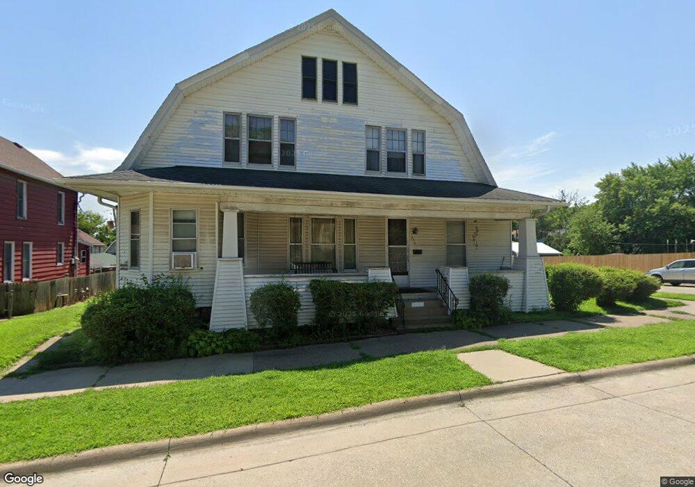
316 W 6th St Muscatine, IA 52761
Estimated Value: $128,000 - $184,000
3
Beds
3
Baths
2,322
Sq Ft
$69/Sq Ft
Est. Value
About This Home
This home is located at 316 W 6th St, Muscatine, IA 52761 and is currently estimated at $160,682, approximately $69 per square foot. 316 W 6th St is a home with nearby schools including Susan Clark Junior High School, Muscatine High School, and Saints Mary and Matthias Catholic School.
Ownership History
Date
Name
Owned For
Owner Type
Purchase Details
Closed on
Jul 30, 2016
Sold by
Tree Amigos Inc
Bought by
Dewitt Deon and Farris Laura
Current Estimated Value
Home Financials for this Owner
Home Financials are based on the most recent Mortgage that was taken out on this home.
Original Mortgage
$72,000
Interest Rate
6%
Mortgage Type
Seller Take Back
Purchase Details
Closed on
Sep 23, 2008
Sold by
Honeyman John A
Bought by
Honeyman James E
Create a Home Valuation Report for This Property
The Home Valuation Report is an in-depth analysis detailing your home's value as well as a comparison with similar homes in the area
Home Values in the Area
Average Home Value in this Area
Purchase History
| Date | Buyer | Sale Price | Title Company |
|---|---|---|---|
| Dewitt Deon | $72,000 | None Available | |
| Honeyman James E | -- | None Available |
Source: Public Records
Mortgage History
| Date | Status | Borrower | Loan Amount |
|---|---|---|---|
| Closed | Dewitt Deon | $72,000 |
Source: Public Records
Tax History Compared to Growth
Tax History
| Year | Tax Paid | Tax Assessment Tax Assessment Total Assessment is a certain percentage of the fair market value that is determined by local assessors to be the total taxable value of land and additions on the property. | Land | Improvement |
|---|---|---|---|---|
| 2025 | $1,758 | $146,300 | $20,440 | $125,860 |
| 2024 | $1,758 | $138,340 | $20,440 | $117,900 |
| 2023 | $2,054 | $137,588 | $20,405 | $117,183 |
| 2022 | $1,580 | $122,920 | $19,250 | $103,670 |
| 2021 | $1,580 | $105,430 | $19,250 | $86,180 |
| 2020 | $1,568 | $105,430 | $19,250 | $86,180 |
| 2019 | $1,694 | $102,620 | $0 | $0 |
| 2018 | $1,588 | $102,450 | $0 | $0 |
| 2017 | $1,588 | $102,450 | $0 | $0 |
| 2016 | $1,668 | $102,450 | $0 | $0 |
| 2015 | $1,668 | $98,880 | $0 | $0 |
| 2014 | $1,902 | $98,880 | $0 | $0 |
Source: Public Records
Map
Nearby Homes