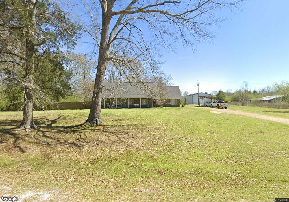
316 Woodrow Martin Rd Brandon, MS 39042
Estimated Value: $78,741 - $197,000
3
Beds
2
Baths
2,800
Sq Ft
$49/Sq Ft
Est. Value
About This Home
This home is located at 316 Woodrow Martin Rd, Brandon, MS 39042 and is currently estimated at $137,871, approximately $49 per square foot. 316 Woodrow Martin Rd is a home located in Rankin County with nearby schools including Puckett Elementary School and Puckett High School.
Ownership History
Date
Name
Owned For
Owner Type
Purchase Details
Closed on
Jul 30, 2015
Sold by
Harpe Vicki L and Harpe Kenneth
Bought by
Hales James Todd and Hales Brandy L
Current Estimated Value
Home Financials for this Owner
Home Financials are based on the most recent Mortgage that was taken out on this home.
Original Mortgage
$182,609
Interest Rate
4.11%
Mortgage Type
New Conventional
Purchase Details
Closed on
Jun 13, 2007
Sold by
Harpe Vicki L
Bought by
Hutson Mitcheal Brock
Create a Home Valuation Report for This Property
The Home Valuation Report is an in-depth analysis detailing your home's value as well as a comparison with similar homes in the area
Home Values in the Area
Average Home Value in this Area
Purchase History
| Date | Buyer | Sale Price | Title Company |
|---|---|---|---|
| Hales James Todd | -- | None Available | |
| Hutson Mitcheal Brock | -- | -- |
Source: Public Records
Mortgage History
| Date | Status | Borrower | Loan Amount |
|---|---|---|---|
| Closed | Hales James Todd | $182,609 |
Source: Public Records
Tax History Compared to Growth
Tax History
| Year | Tax Paid | Tax Assessment Tax Assessment Total Assessment is a certain percentage of the fair market value that is determined by local assessors to be the total taxable value of land and additions on the property. | Land | Improvement |
|---|---|---|---|---|
| 2024 | $278 | $2,821 | $0 | $0 |
| 2023 | $261 | $2,644 | $0 | $0 |
| 2022 | $258 | $2,648 | $0 | $0 |
| 2021 | $255 | $2,618 | $0 | $0 |
| 2020 | $256 | $2,625 | $0 | $0 |
| 2019 | $253 | $2,533 | $0 | $0 |
| 2018 | $249 | $2,533 | $0 | $0 |
| 2017 | $248 | $2,531 | $0 | $0 |
| 2016 | $716 | $7,693 | $0 | $0 |
| 2015 | $298 | $5,641 | $0 | $0 |
| 2014 | $287 | $5,653 | $0 | $0 |
| 2013 | $414 | $7,736 | $0 | $0 |
Source: Public Records
Map
Nearby Homes
- 873 Smith Co Road 142
- 6767 Mississippi 13
- 9472 Highway 13 S
- 1548 Mississippi 43
- 119 Ole Magnolia Dr
- 6156 Mississippi 18
- 9219 Mississippi 13
- 2406 Scr 563
- 252 Burnham Rd S
- 797 Scr 150a
- 0 Ashley Rd Unit 20288528
- 0 Ashley Rd Unit 4128192
- 0 Ashley Rd Unit 4128194
- 0 Ashley Rd Unit 11613506
- 396 Rankin-Ferguson Rd
- 0 Ms-18 Unit 4129530
- 0 Cooperville Rd
- 911 Smith Co Road 563
- Johns Shilow Rd
- 428 Walters Rd
- 316 Woodrow Martin Rd
- 305 Woodrow Martin Rd
- 376 Woodrow Martin Rd
- 377 Woodrow Martin Rd
- 225 Woodrow Martin Rd
- 389 Woodrow Martin Rd
- 2125 Scr 146
- 423 Woodrow Martin Rd
- 123 Means Ln
- 123 Scr 142 Ln
- 1925 Scr 146
- 3161 Beaver Trail
- 0000 Woodrow Martin Rd
- 0 Woodrow Martin Unit 1239353
- 375 Woodrow Martin Rd
- 25 Means Ln
- 25 Means Ln
- 1851 Scr 146
- 831 Scr 142
- 873 Scr 142