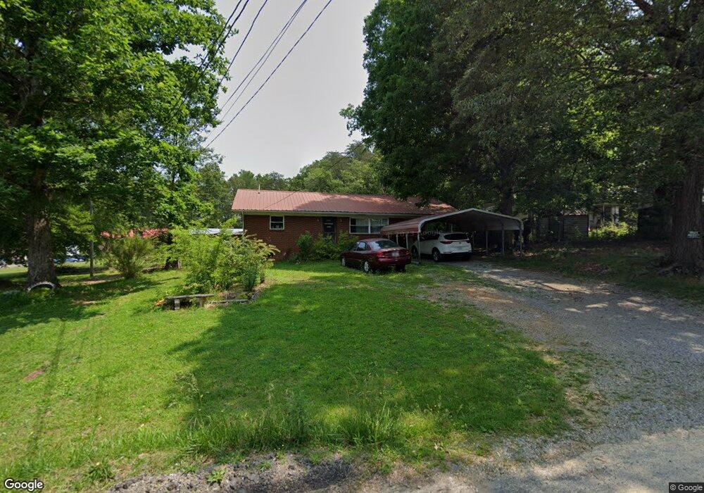
316 Woodson Rd Newport, TN 37821
Estimated Value: $123,016 - $177,000
--
Bed
1
Bath
952
Sq Ft
$155/Sq Ft
Est. Value
About This Home
This home is located at 316 Woodson Rd, Newport, TN 37821 and is currently estimated at $147,754, approximately $155 per square foot. 316 Woodson Rd is a home located in Cocke County with nearby schools including Northwest Elementary School, Cocke County High School, and Grace Christian School.
Ownership History
Date
Name
Owned For
Owner Type
Purchase Details
Closed on
Jul 17, 2023
Sold by
Crum Anthony S and Crum Tabitha
Bought by
Hutchinson Windle Mack and Hutchinson Ashley
Current Estimated Value
Purchase Details
Closed on
Jun 13, 2005
Sold by
Cureton Roy E
Bought by
Crum Anthony S
Home Financials for this Owner
Home Financials are based on the most recent Mortgage that was taken out on this home.
Original Mortgage
$71,250
Interest Rate
5.66%
Mortgage Type
Cash
Purchase Details
Closed on
Mar 29, 1999
Sold by
Angello Ross R
Bought by
Cureton Roy
Create a Home Valuation Report for This Property
The Home Valuation Report is an in-depth analysis detailing your home's value as well as a comparison with similar homes in the area
Home Values in the Area
Average Home Value in this Area
Purchase History
| Date | Buyer | Sale Price | Title Company |
|---|---|---|---|
| Hutchinson Windle Mack | $53,036 | Colonial Title | |
| Crum Anthony S | $75,000 | -- | |
| Cureton Roy | $30,000 | -- |
Source: Public Records
Mortgage History
| Date | Status | Borrower | Loan Amount |
|---|---|---|---|
| Previous Owner | Cureton Roy | $71,250 |
Source: Public Records
Tax History Compared to Growth
Tax History
| Year | Tax Paid | Tax Assessment Tax Assessment Total Assessment is a certain percentage of the fair market value that is determined by local assessors to be the total taxable value of land and additions on the property. | Land | Improvement |
|---|---|---|---|---|
| 2024 | $442 | $17,250 | $2,075 | $15,175 |
| 2023 | $442 | $17,250 | $2,075 | $15,175 |
| 2022 | $442 | $17,250 | $2,075 | $15,175 |
| 2021 | $551 | $17,250 | $2,075 | $15,175 |
| 2020 | $551 | $21,500 | $2,075 | $19,425 |
| 2019 | $524 | $18,500 | $2,075 | $16,425 |
| 2018 | $524 | $18,500 | $2,075 | $16,425 |
| 2017 | $537 | $18,500 | $2,075 | $16,425 |
| 2016 | $479 | $18,500 | $2,075 | $16,425 |
| 2015 | $539 | $18,500 | $2,075 | $16,425 |
| 2014 | $539 | $18,500 | $2,075 | $16,425 |
| 2013 | $539 | $22,475 | $2,650 | $19,825 |
Source: Public Records
Map
Nearby Homes
- 574 Banjo Way
- 573 Banjo Way
- 580 Jessica Way
- 584 Flatwoods Way
- 4317 River Chase Trail
- 0 Long Ave
- 499 Long Ave Unit LOT 16
- 0 Peaceful Ln
- 491 Justus St
- 613 North St
- 587 North St
- 384 Bridgefield Way
- 141 Hiola St
- 151 Clear Creek Rd
- 325 Whisper Way
- 0 Alpine Rd
- 640 N Cecil St
- 278 Harvest St
- 401 North St
- 300 Harvest St
- 598 Wells Dr
- 593 Bonanza Dr
- 320 Woodson Rd
- 594 Wells Dr
- 598 Bonanza Dr
- 591 Bonanza Dr
- 591 Bonanza Dr
- 592 Bonanza Dr
- 592 Bonanza Dr
- 588 Wells Dr
- 620 Wagon Rd
- 0 Battle Way Unit 605880
- 0 Battle Way Unit 247728
- 584 Wells Dr
- 583 Bonanza Dr
- 582 Bonanza Dr
- 589 Battle Rd
- 580 Bonanza Dr
- 576 Wells Dr
- 577 Bonanza Dr