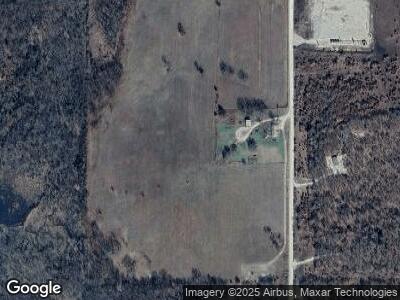
3160 Wade Rd Overbrook, OK 73453
Estimated Value: $214,882 - $247,000
3
Beds
2
Baths
1,280
Sq Ft
$180/Sq Ft
Est. Value
About This Home
This home is located at 3160 Wade Rd, Overbrook, OK 73453 and is currently estimated at $230,941, approximately $180 per square foot. 3160 Wade Rd is a home located in Love County with nearby schools including Turner High School.
Ownership History
Date
Name
Owned For
Owner Type
Purchase Details
Closed on
May 14, 2021
Sold by
Vernon Teresa Kay Eppler
Bought by
Vernon David Lee
Current Estimated Value
Home Financials for this Owner
Home Financials are based on the most recent Mortgage that was taken out on this home.
Original Mortgage
$42,000
Outstanding Balance
$38,355
Interest Rate
2.9%
Mortgage Type
New Conventional
Estimated Equity
$172,319
Purchase Details
Closed on
Dec 28, 2006
Sold by
Vernon Melvin E and Vernon Melvin
Bought by
Ponder Corey Eugene and Ponder Michele Marie
Home Financials for this Owner
Home Financials are based on the most recent Mortgage that was taken out on this home.
Original Mortgage
$103,728
Interest Rate
6.1%
Mortgage Type
Future Advance Clause Open End Mortgage
Create a Home Valuation Report for This Property
The Home Valuation Report is an in-depth analysis detailing your home's value as well as a comparison with similar homes in the area
Home Values in the Area
Average Home Value in this Area
Purchase History
| Date | Buyer | Sale Price | Title Company |
|---|---|---|---|
| Vernon David Lee | -- | None Available | |
| Ponder Corey Eugene | -- | None Available |
Source: Public Records
Mortgage History
| Date | Status | Borrower | Loan Amount |
|---|---|---|---|
| Open | Casillas Petroleum Corp | $42,000 | |
| Open | Vernon David Lee | $85,254 | |
| Closed | Vernon David Lee | $85,254 | |
| Closed | Ponder Corey Eugene | $103,728 |
Source: Public Records
Tax History Compared to Growth
Tax History
| Year | Tax Paid | Tax Assessment Tax Assessment Total Assessment is a certain percentage of the fair market value that is determined by local assessors to be the total taxable value of land and additions on the property. | Land | Improvement |
|---|---|---|---|---|
| 2024 | $514 | $7,903 | $1,024 | $6,879 |
| 2023 | $476 | $7,673 | $1,024 | $6,649 |
| 2022 | $460 | $7,450 | $1,085 | $6,365 |
| 2021 | $451 | $7,233 | $1,053 | $6,180 |
| 2020 | $439 | $7,022 | $1,022 | $6,000 |
| 2019 | $429 | $6,818 | $992 | $5,826 |
| 2018 | $418 | $6,619 | $929 | $5,690 |
| 2017 | $406 | $6,427 | $882 | $5,545 |
| 2016 | $395 | $6,238 | $940 | $5,298 |
| 2015 | $387 | $6,057 | $1,128 | $4,929 |
| 2014 | $398 | $5,882 | $1,138 | $4,744 |
Source: Public Records
Map
Nearby Homes
- 20 Oswalt Rd
- 29020 Oswalt Rd
- 0 Dogwood Unit 2511071
- 0 Rhonda Unit 2509774
- 8818 Clydesdale Ln
- 0 Anshultz Rd Unit 2517150
- 0 Anshultz Rd Unit 2434159
- 0 Anshultz Rd Unit 2434153
- 2173 State Highway 76
- 204 Bear Hollow Rd
- 3084 Anshultz Rd
- 0 Tuscon
- 0 Franks Unit 2510322
- 0 Cotton Blvd Unit 2444235
- 7412 Buck Skin Rd
- 0 Enid Place
- 0 Stockton Rd
- 0 N Diamondhead Dr
- 49 Diamondhead Dr
- 45 Abner Rd
