Estimated Value: $168,000 - $230,000
Studio
1
Bath
1,012
Sq Ft
$186/Sq Ft
Est. Value
About This Home
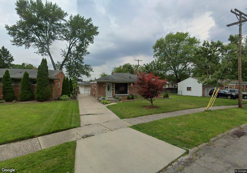
This home is located at 31651 Taylor St Unit Bldg-Unit, Wayne, MI 48184 and is currently estimated at $188,235, approximately $186 per square foot. 31651 Taylor St Unit Bldg-Unit is a home located in Wayne County with nearby schools including Taft-Galloway Elementary School, Benjamin Franklin Middle School, and Wayne Memorial High School.
Ownership History
Date
Name
Owned For
Owner Type
Purchase Details
Closed on
Jul 3, 2018
Sold by
Delly Property Llc
Bought by
Korie Stephen
Current Estimated Value
Purchase Details
Closed on
Sep 9, 2011
Sold by
Bank Of America N A
Bought by
Fannie Mae and Federal National Mortgage Association
Purchase Details
Closed on
Aug 17, 2011
Sold by
Stevens Michael C and Peters Lori L
Bought by
Bank Of America N A
Purchase Details
Closed on
Nov 29, 2000
Sold by
Paulino Everton J
Bought by
Peters Lori L
Purchase Details
Closed on
Sep 1, 2000
Sold by
Molotky Leigh M
Bought by
Everton J Paulino
Purchase Details
Closed on
Oct 19, 1998
Sold by
Patricia A and Patricia M
Bought by
Jpaulino Leigh Amolotky Everton
Create a Home Valuation Report for This Property
The Home Valuation Report is an in-depth analysis detailing your home's value as well as a comparison with similar homes in the area
Home Values in the Area
Average Home Value in this Area
Purchase History
| Date | Buyer | Sale Price | Title Company |
|---|---|---|---|
| Korie Stephen | $130,000 | None Available | |
| Korie Stephen | $130,000 | None Available | |
| Fannie Mae | -- | None Available | |
| Bank Of America N A | $153,061 | None Available | |
| Peters Lori L | $115,000 | -- | |
| Everton J Paulino | -- | -- | |
| Jpaulino Leigh Amolotky Everton | $94,900 | -- |
Source: Public Records
Tax History
| Year | Tax Paid | Tax Assessment Tax Assessment Total Assessment is a certain percentage of the fair market value that is determined by local assessors to be the total taxable value of land and additions on the property. | Land | Improvement |
|---|---|---|---|---|
| 2025 | $2,147 | $72,200 | $0 | $0 |
| 2024 | $2,094 | $67,100 | $0 | $0 |
| 2023 | $1,999 | $59,500 | $0 | $0 |
| 2022 | $2,293 | $52,700 | $0 | $0 |
| 2021 | $2,233 | $48,800 | $0 | $0 |
| 2020 | $2,732 | $44,000 | $0 | $0 |
| 2019 | $1,807 | $38,500 | $0 | $0 |
| 2018 | $1,830 | $31,800 | $0 | $0 |
| 2017 | $545 | $30,600 | $0 | $0 |
| 2016 | $2,125 | $28,400 | $0 | $0 |
| 2015 | $2,790 | $27,900 | $0 | $0 |
| 2013 | $3,100 | $31,700 | $0 | $0 |
| 2012 | -- | $34,300 | $7,700 | $26,600 |
Source: Public Records
Map
Nearby Homes
- 4523 Niagara St
- 31711 Annapolis St
- 4060 Winifred St
- 3933 Hayes St
- 3877 Niagara St
- 4815 Mildred St
- 4643 S Hubbard St
- 5157 Niagara St
- 32515 Annapolis St
- 32178 Carlisle Pkwy
- 4214 Cadillac Ave
- 3582 Swanson St
- 0 Swanson St
- 3512 Barry St
- 33180 Forest Park Dr Unit 21
- 32572 Woodbrook Dr
- 31665 Pine Valley Dr
- 31752 Pine Valley Dr
- 31627 Augusta Dr Unit 68
- 31649 Augusta Dr Unit 67
- 31651 Taylor St
- 31635 Taylor St
- 31719 Taft St
- 31731 Taft St
- 31629 Taylor St
- 31745 Taft St
- 4407 Gloria St
- 4421 Gloria St
- 31656 Taylor St
- 4423 Gloria St
- 31757 Taft St
- 31685 Taft St
- 4437 Gloria St
- 31610 Taylor St
- 31621 Taylor St
- 31669 Taft St
- 31615 Taylor St
- 4463 Gloria St
- 31601 Taylor St
- 31582 Taylor St
Your Personal Tour Guide
Ask me questions while you tour the home.