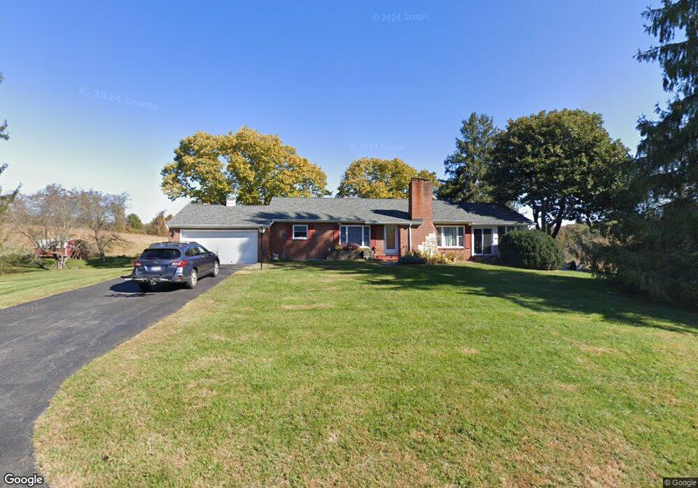
317 Byrd Dr Pulaski, VA 24301
Estimated Value: $217,000 - $281,000
3
Beds
3
Baths
2,438
Sq Ft
$104/Sq Ft
Est. Value
About This Home
This home is located at 317 Byrd Dr, Pulaski, VA 24301 and is currently estimated at $252,996, approximately $103 per square foot. 317 Byrd Dr is a home located in Pulaski County with nearby schools including Pulaski Elementary School, Pulaski County High School, and Mayflower Christian Academy.
Ownership History
Date
Name
Owned For
Owner Type
Purchase Details
Closed on
Aug 13, 2010
Sold by
Mccall Bruce B
Bought by
Shamanski Fay L
Current Estimated Value
Home Financials for this Owner
Home Financials are based on the most recent Mortgage that was taken out on this home.
Original Mortgage
$120,000
Outstanding Balance
$79,692
Interest Rate
4.63%
Mortgage Type
New Conventional
Estimated Equity
$173,304
Create a Home Valuation Report for This Property
The Home Valuation Report is an in-depth analysis detailing your home's value as well as a comparison with similar homes in the area
Home Values in the Area
Average Home Value in this Area
Purchase History
| Date | Buyer | Sale Price | Title Company |
|---|---|---|---|
| Shamanski Fay L | $155,000 | -- |
Source: Public Records
Mortgage History
| Date | Status | Borrower | Loan Amount |
|---|---|---|---|
| Open | Shamanski Fay L | $120,000 |
Source: Public Records
Tax History
| Year | Tax Paid | Tax Assessment Tax Assessment Total Assessment is a certain percentage of the fair market value that is determined by local assessors to be the total taxable value of land and additions on the property. | Land | Improvement |
|---|---|---|---|---|
| 2025 | $1,212 | $163,800 | $22,000 | $141,800 |
| 2024 | $1,212 | $163,800 | $22,000 | $141,800 |
| 2023 | $1,212 | $163,800 | $22,000 | $141,800 |
| 2022 | $1,212 | $163,800 | $22,000 | $141,800 |
| 2021 | $1,212 | $163,800 | $22,000 | $141,800 |
| 2020 | $1,120 | $145,400 | $20,000 | $125,400 |
| 2019 | $1,120 | $145,400 | $20,000 | $125,400 |
| 2018 | $1,120 | $145,400 | $20,000 | $125,400 |
| 2017 | $931 | $145,400 | $20,000 | $125,400 |
| 2016 | $931 | $145,400 | $20,000 | $125,400 |
| 2015 | $931 | $145,400 | $20,000 | $125,400 |
| 2014 | $1,020 | $172,900 | $25,000 | $147,900 |
| 2013 | $1,020 | $172,900 | $25,000 | $147,900 |
Source: Public Records
Map
Nearby Homes
- 1890 Alum Spring Rd
- 1924 Snider Ln
- 1950 Snider Ln
- 1965 Alum Spring Rd
- 4786 Millirons Ln
- 601 Orchard Rd
- 130 15th St NW
- 1219 Prospect Ave
- 102 12th St NW
- 140 13th St NW
- Randolph Ave
- 1407 Randolph Ave
- 1001 Forest Hill Dr
- 1027 Randolph Ave
- 745 Peppers Ferry Rd
- 1125 Peppers Ferry Rd
- 36 8th St NW
- 715 Franklin Ave
- 107 Ferry Ct
- 554 Monroe Ave
- 309 Byrd Dr
- 328 Byrd Dr
- 328 Byrd Dr
- 308 Byrd Dr
- 1705 Alum Spring Rd
- 1890 Snider Ln
- 1722 Alum Spring Rd
- 1524 Alum Spring Rd
- 1900 Snider Ln
- 1910 Snider Ln
- 1817 Alum Spring Rd
- 1709 Lowmoor Ave
- 1701 Lowmoor Ave
- 1501 Lowmoor Ave
- 1920 Snider Ln
- 112 Carriage Hill Dr
- 1933 Snider Ln
- 1704 Lowmoor Ave
- 1700 Lowmoor Ave
- 1800 Lowmoor Ave
Your Personal Tour Guide
Ask me questions while you tour the home.