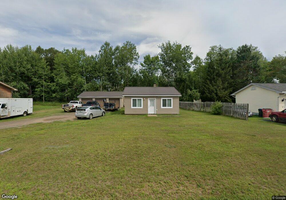
317 Goad Dr Wrenshall, MN 55797
Estimated Value: $128,000 - $166,000
1
Bed
1
Bath
576
Sq Ft
$247/Sq Ft
Est. Value
About This Home
This home is located at 317 Goad Dr, Wrenshall, MN 55797 and is currently estimated at $142,120, approximately $246 per square foot. 317 Goad Dr is a home located in Carlton County with nearby schools including Wrenshall Elementary School and Wrenshall Secondary School.
Ownership History
Date
Name
Owned For
Owner Type
Purchase Details
Closed on
Jun 1, 2021
Sold by
Bryce Robert J
Bought by
Conway Jacob W and Peterson Linda J
Current Estimated Value
Home Financials for this Owner
Home Financials are based on the most recent Mortgage that was taken out on this home.
Original Mortgage
$97,000
Outstanding Balance
$87,630
Interest Rate
2.9%
Mortgage Type
New Conventional
Estimated Equity
$54,490
Purchase Details
Closed on
Oct 28, 2005
Sold by
Carlson Robert J and Carlson Charlene A
Bought by
Bryce Robert J
Home Financials for this Owner
Home Financials are based on the most recent Mortgage that was taken out on this home.
Original Mortgage
$60,000
Interest Rate
5.8%
Mortgage Type
New Conventional
Create a Home Valuation Report for This Property
The Home Valuation Report is an in-depth analysis detailing your home's value as well as a comparison with similar homes in the area
Purchase History
| Date | Buyer | Sale Price | Title Company |
|---|---|---|---|
| Conway Jacob W | $100,000 | Misc Company | |
| Bryce Robert J | $60,000 | Carlton County Abstract & Ti | |
| Conway Jacob Jacob | $100,000 | -- |
Source: Public Records
Mortgage History
| Date | Status | Borrower | Loan Amount |
|---|---|---|---|
| Open | Conway Jacob W | $97,000 | |
| Previous Owner | Bryce Robert J | $60,000 | |
| Closed | Conway Jacob Jacob | $97,000 |
Source: Public Records
Tax History
| Year | Tax Paid | Tax Assessment Tax Assessment Total Assessment is a certain percentage of the fair market value that is determined by local assessors to be the total taxable value of land and additions on the property. | Land | Improvement |
|---|---|---|---|---|
| 2024 | $1,130 | $116,200 | $32,200 | $84,000 |
| 2023 | $1,242 | $115,100 | $32,200 | $82,900 |
| 2022 | $804 | $115,100 | $32,200 | $82,900 |
| 2021 | $1,274 | $68,600 | $25,400 | $43,200 |
| 2020 | $1,242 | $67,000 | $25,400 | $41,600 |
| 2019 | $1,078 | $59,500 | $25,400 | $34,100 |
| 2018 | $1,090 | $59,500 | $25,400 | $34,100 |
| 2017 | $730 | $58,000 | $22,900 | $35,100 |
| 2016 | $702 | $58,000 | $22,900 | $35,100 |
| 2015 | $724 | $33,000 | $13,000 | $20,000 |
| 2014 | -- | $33,000 | $13,000 | $20,000 |
| 2013 | -- | $33,000 | $13,000 | $20,000 |
Source: Public Records
Map
Nearby Homes
- Xxxx Wrenshall St
- 612 Wrenshall St
- 2336 Lac Labelle Rd
- 280 County Road 3
- 15 Vermillion St
- TBD Minnesota 210
- XXX Minnesota 45
- 52 Thomson Rd
- 1375 David Rd
- TBD County Road 103
- 1187 W Lawrence Rd
- 56 Helberg Rd
- 14 Michele Ln Unit 3
- 7 Hillside Rd
- 36 E Highway 61
- Lot 4, Unit A River Bend Dr
- Lot 1, Unit A River Bend Dr
- Lot 2, Unit B River Bend Dr
- Lot 1, Unit B River Bend Dr
- Lot 4, Unit B River Bend Dr
Your Personal Tour Guide
Ask me questions while you tour the home.