Estimated Value: $604,000 - $1,194,000
4
Beds
2
Baths
2,145
Sq Ft
$388/Sq Ft
Est. Value
About This Home
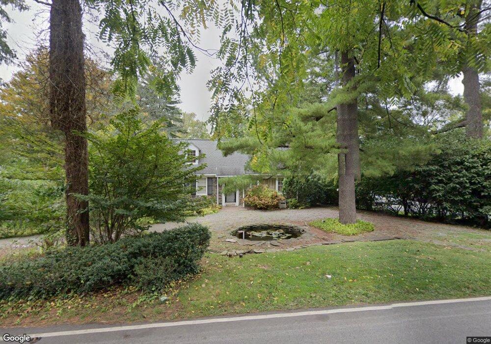
This home is located at 317 Matsonford Rd, Wayne, PA 19087 and is currently estimated at $831,873, approximately $387 per square foot. 317 Matsonford Rd is a home located in Montgomery County with nearby schools including Roberts Elementary School, Upper Merion Middle School, and Upper Merion High School.
Ownership History
Date
Name
Owned For
Owner Type
Purchase Details
Closed on
Feb 13, 2013
Sold by
Runyon Johanna and Runyon Robert M
Bought by
Runyon Johanna and Runyon Robert M
Current Estimated Value
Home Financials for this Owner
Home Financials are based on the most recent Mortgage that was taken out on this home.
Original Mortgage
$339,300
Outstanding Balance
$237,409
Interest Rate
3.43%
Mortgage Type
New Conventional
Estimated Equity
$594,464
Purchase Details
Closed on
Feb 27, 2004
Sold by
Lewis Warren D
Bought by
Runyon Robert M and Kalloch Johanna
Home Financials for this Owner
Home Financials are based on the most recent Mortgage that was taken out on this home.
Original Mortgage
$272,000
Interest Rate
5.67%
Purchase Details
Closed on
Jun 30, 2003
Sold by
Hurley Melissa M Ex and Kesel Isabel L Est
Bought by
Lewis Warren D
Create a Home Valuation Report for This Property
The Home Valuation Report is an in-depth analysis detailing your home's value as well as a comparison with similar homes in the area
Purchase History
| Date | Buyer | Sale Price | Title Company |
|---|---|---|---|
| Runyon Johanna | -- | None Available | |
| Runyon Robert M | $340,000 | -- | |
| Lewis Warren D | $270,000 | -- |
Source: Public Records
Mortgage History
| Date | Status | Borrower | Loan Amount |
|---|---|---|---|
| Open | Runyon Johanna | $339,300 | |
| Closed | Runyon Robert M | $272,000 |
Source: Public Records
Tax History
| Year | Tax Paid | Tax Assessment Tax Assessment Total Assessment is a certain percentage of the fair market value that is determined by local assessors to be the total taxable value of land and additions on the property. | Land | Improvement |
|---|---|---|---|---|
| 2025 | $6,318 | $205,000 | $103,310 | $101,690 |
| 2024 | $6,318 | $205,000 | $103,310 | $101,690 |
| 2023 | $6,094 | $205,000 | $103,310 | $101,690 |
| 2022 | $5,833 | $205,000 | $103,310 | $101,690 |
| 2021 | $5,652 | $205,000 | $103,310 | $101,690 |
| 2020 | $5,401 | $205,000 | $103,310 | $101,690 |
| 2019 | $5,309 | $205,000 | $103,310 | $101,690 |
Source: Public Records
Map
Nearby Homes
- 1236 Denbigh Ln
- 1241 Denbigh Ln
- 1266 Gulph Creek Dr
- 0 Matsonford Rd
- 1260-2 County Line Rd
- 711 County Line Rd Unit 1
- 1260 County Line Rd
- 1120 Grandview Terrace
- 117 Arden Rd
- 149 Timothy Cir Unit 29C
- 2 Arden Rd
- 4 Arden Rd
- Lot 1 Arden Rd
- Lot 3 Arden Rd
- 188 Arden Rd
- 230 Arden Rd
- 160 Lemonton Way Unit C
- 281 E Matsonford Rd
- 300 Valley Place
- 1721 Sherwood Cir
- 325 Matsonford Rd
- 309 Matsonford Rd
- 303 Tory Turn
- 335 Matsonford Rd
- 535 Candace Ln
- 301 Tory Turn Unit 52
- 341 Matsonford Rd
- 621 Griscom Dr
- 305 Tory Turn
- 349 W Matsonford Rd
- 349 Matsonford Rd
- 349 Matsonford Rd
- 529 Candace Ln
- 532 Candace Ln
- 285 W Matsonford Rd
- 307 Tory Turn
- 627 Griscom Dr
- 601 Matsons Ford Rd
- 601 Matsonford Rd
- 261 Matsonford Rd
Your Personal Tour Guide
Ask me questions while you tour the home.