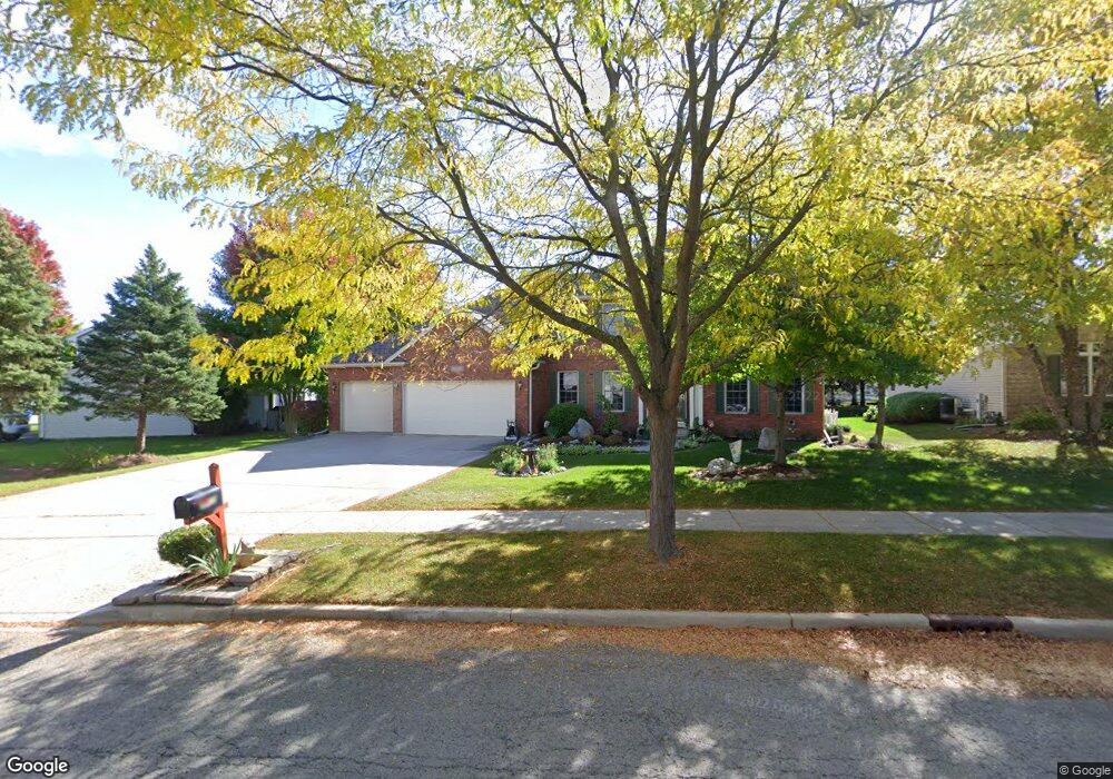
3170 Covered Bridge Ln Dekalb, IL 60115
Estimated Value: $391,000 - $427,000
4
Beds
3
Baths
2,416
Sq Ft
$171/Sq Ft
Est. Value
About This Home
This home is located at 3170 Covered Bridge Ln, Dekalb, IL 60115 and is currently estimated at $412,524, approximately $170 per square foot. 3170 Covered Bridge Ln is a home located in DeKalb County with nearby schools including Gwendolyn Brooks Elementary School, Clinton Rosette Middle School, and De Kalb High School.
Ownership History
Date
Name
Owned For
Owner Type
Purchase Details
Closed on
Dec 27, 2017
Sold by
Heilbrun Richard A
Bought by
Groesch David M
Current Estimated Value
Home Financials for this Owner
Home Financials are based on the most recent Mortgage that was taken out on this home.
Original Mortgage
$227,000
Outstanding Balance
$191,854
Interest Rate
4%
Mortgage Type
VA
Estimated Equity
$220,670
Purchase Details
Closed on
Aug 23, 2011
Sold by
Heilbrun Richard A
Bought by
Heilbrun Trust
Create a Home Valuation Report for This Property
The Home Valuation Report is an in-depth analysis detailing your home's value as well as a comparison with similar homes in the area
Home Values in the Area
Average Home Value in this Area
Purchase History
| Date | Buyer | Sale Price | Title Company |
|---|---|---|---|
| Groesch David M | $153,667 | None Available | |
| Heilbrun Trust | -- | -- |
Source: Public Records
Mortgage History
| Date | Status | Borrower | Loan Amount |
|---|---|---|---|
| Open | Groesch David M | $227,000 |
Source: Public Records
Tax History Compared to Growth
Tax History
| Year | Tax Paid | Tax Assessment Tax Assessment Total Assessment is a certain percentage of the fair market value that is determined by local assessors to be the total taxable value of land and additions on the property. | Land | Improvement |
|---|---|---|---|---|
| 2024 | $10,439 | $134,070 | $13,047 | $121,023 |
| 2023 | $10,439 | $116,898 | $11,376 | $105,522 |
| 2022 | $10,179 | $106,727 | $12,983 | $93,744 |
| 2021 | $10,413 | $100,100 | $12,177 | $87,923 |
| 2020 | $10,637 | $98,504 | $11,983 | $86,521 |
| 2019 | $10,401 | $94,633 | $11,512 | $83,121 |
| 2018 | $10,132 | $91,424 | $11,122 | $80,302 |
| 2017 | $9,576 | $87,882 | $10,691 | $77,191 |
| 2016 | $9,435 | $85,663 | $10,421 | $75,242 |
| 2015 | -- | $81,166 | $9,874 | $71,292 |
| 2014 | -- | $82,210 | $16,175 | $66,035 |
| 2013 | -- | $86,355 | $16,991 | $69,364 |
Source: Public Records
Map
Nearby Homes
- The Samuel Plan at Bridges of Rivermist
- The Wesley Plan at Bridges of Rivermist
- 3467 Roseman Ln
- 102 Quinlan Ave
- 151 Quinlan Ave
- 3323 Comstock Ave
- 3289 Comstock Ave
- 120 Stoney Creek Rd
- 3428 Comstock Ave
- 113 Andresen Ct
- 3051 Fairway Oaks Dr
- 10179 Rich Rd
- 338 Greenwood N
- 3229 Meadow Trail E
- 701 Blackstone Ct
- 2571 Lilac Ln
- 2820 N 1st St
- TBD Greenwood Acres Dr
- 301 River Dr
- 111 E Royal Dr
- 3160 Covered Bridge Ln
- 90 Tygert Ln
- 3150 Covered Bridge Ln
- 140 Tygert Ln
- 80 Tygert Ln
- 3165 Covered Bridge Ct
- 3140 Covered Bridge Ln
- 125 Tygert Ln
- 60 Tygert Ln
- 105 Tygert Ln
- 145 Tygert Ln
- 160 Tygert Ln
- 95 Tygert Ln
- 3130 Covered Bridge Ln
- 3163 Covered Bridge Ct
- 3131 N 1st St
- 165 Tygert Ln
- 85 Tygert Ln
- 50 Tygert Ln
- 3108 Covered Bridge Ln