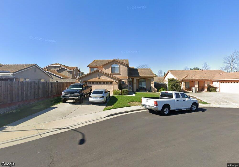
3170 King Edward Ct West Sacramento, CA 95691
Southport NeighborhoodEstimated Value: $630,532 - $676,000
4
Beds
3
Baths
2,330
Sq Ft
$279/Sq Ft
Est. Value
About This Home
This home is located at 3170 King Edward Ct, West Sacramento, CA 95691 and is currently estimated at $649,133, approximately $278 per square foot. 3170 King Edward Ct is a home located in Yolo County with nearby schools including Bridgeway Island Elementary School, River City High, and Our Lady Of Grace.
Ownership History
Date
Name
Owned For
Owner Type
Purchase Details
Closed on
Aug 20, 2001
Sold by
The Forecast Group Lp
Bought by
Randall Richard and Randall Maria
Current Estimated Value
Home Financials for this Owner
Home Financials are based on the most recent Mortgage that was taken out on this home.
Original Mortgage
$201,800
Outstanding Balance
$79,060
Interest Rate
7.21%
Estimated Equity
$570,073
Create a Home Valuation Report for This Property
The Home Valuation Report is an in-depth analysis detailing your home's value as well as a comparison with similar homes in the area
Home Values in the Area
Average Home Value in this Area
Purchase History
| Date | Buyer | Sale Price | Title Company |
|---|---|---|---|
| Randall Richard | $252,500 | Orange Coast Title Company |
Source: Public Records
Mortgage History
| Date | Status | Borrower | Loan Amount |
|---|---|---|---|
| Open | Randall Richard | $201,800 |
Source: Public Records
Tax History Compared to Growth
Tax History
| Year | Tax Paid | Tax Assessment Tax Assessment Total Assessment is a certain percentage of the fair market value that is determined by local assessors to be the total taxable value of land and additions on the property. | Land | Improvement |
|---|---|---|---|---|
| 2025 | $6,711 | $429,958 | $62,470 | $367,488 |
| 2023 | $6,711 | $413,265 | $60,046 | $353,219 |
| 2022 | $6,331 | $405,163 | $58,869 | $346,294 |
| 2021 | $6,270 | $397,219 | $57,715 | $339,504 |
| 2020 | $6,059 | $393,147 | $57,124 | $336,023 |
| 2019 | $5,987 | $385,439 | $56,004 | $329,435 |
| 2018 | $5,889 | $377,882 | $54,906 | $322,976 |
| 2017 | $5,825 | $370,474 | $53,830 | $316,644 |
| 2016 | $5,514 | $345,691 | $52,775 | $292,916 |
| 2015 | $4,899 | $314,614 | $51,983 | $262,631 |
| 2014 | $4,899 | $308,452 | $50,965 | $257,487 |
Source: Public Records
Map
Nearby Homes
- 3147 Grizzly Bay Rd
- 3226 Farallon Rd
- 3244 Ballena Bay Rd
- 3270 Rivermont St
- 2972 Violet Dr
- 3235 Santa Cruz Rd
- 3450 Seymour Ave
- 2961 Anacapa Island Ct
- 3255 Marshall Rd
- 2893 Pitzer Cir
- 3354 Jefferson Blvd
- 3424 Molokai Rd
- 3016 Canvasback Way
- 2893 Mergansers Ct
- 3125 Gladys Ave
- 3286 Owl Ct
- 3522 Pelican Ct
- 3515 Sparrow Ct
- 3580 Saint Lucia Place
- 3213 Longspur Ln
- 3160 King Edward Ct
- 3120 King Edward Rd
- 3163 Bacon Island St
- 3130 King Edward Rd
- 3155 Bacon Island St
- 3150 Andrus Island Ct
- 3145 Merrit Island Ct
- 3171 Bacon Island St
- 3090 King Edward Rd
- 3175 King Edward Ct
- 3165 King Edward Ct
- 3140 Andrus Island Ct
- 3115 King Edward Rd
- 3135 Merrit Island Ct
- 3105 King Edward Rd
- 3155 Andrus Island Ct
- 3080 King Edward Rd
- 3095 King Edward Rd
- 3135 King Edward Rd
- 3130 Andrus Island Ct