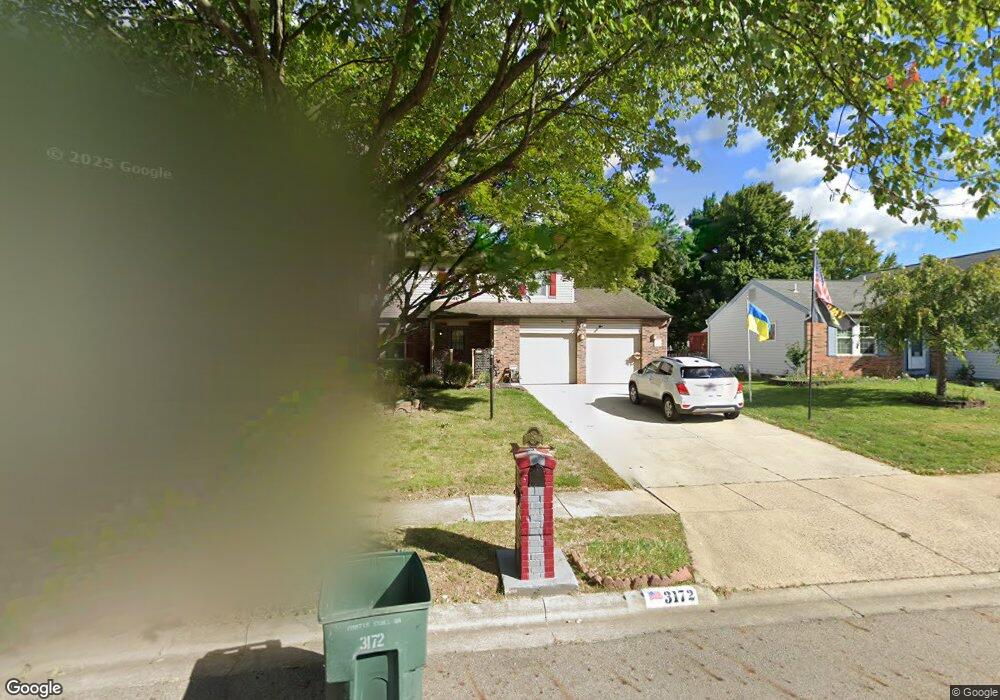
3172 Curtis Knoll Dr Dublin, OH 43017
Riverside NeighborhoodEstimated Value: $382,000 - $429,000
4
Beds
3
Baths
1,966
Sq Ft
$206/Sq Ft
Est. Value
About This Home
This home is located at 3172 Curtis Knoll Dr, Dublin, OH 43017 and is currently estimated at $405,913, approximately $206 per square foot. 3172 Curtis Knoll Dr is a home located in Franklin County with nearby schools including Thomas Elementary School, John Sells Middle School, and Dublin Coffman High School.
Ownership History
Date
Name
Owned For
Owner Type
Purchase Details
Closed on
Dec 21, 2015
Sold by
Brown John E and Brown Vernal A
Bought by
Brown John E and Brown Vernal A
Current Estimated Value
Home Financials for this Owner
Home Financials are based on the most recent Mortgage that was taken out on this home.
Original Mortgage
$160,115
Outstanding Balance
$127,170
Interest Rate
4%
Mortgage Type
VA
Estimated Equity
$278,743
Purchase Details
Closed on
Jan 20, 2005
Sold by
Brown John E and Brown Vernal A
Bought by
Brown John E and Brown Vernal A
Purchase Details
Closed on
Dec 3, 1985
Bought by
Brown John E
Create a Home Valuation Report for This Property
The Home Valuation Report is an in-depth analysis detailing your home's value as well as a comparison with similar homes in the area
Home Values in the Area
Average Home Value in this Area
Purchase History
| Date | Buyer | Sale Price | Title Company |
|---|---|---|---|
| Brown John E | -- | Liberty Title Co Llc | |
| Brown John E | -- | -- | |
| Brown John E | $87,700 | -- |
Source: Public Records
Mortgage History
| Date | Status | Borrower | Loan Amount |
|---|---|---|---|
| Open | Brown John E | $160,115 |
Source: Public Records
Tax History Compared to Growth
Tax History
| Year | Tax Paid | Tax Assessment Tax Assessment Total Assessment is a certain percentage of the fair market value that is determined by local assessors to be the total taxable value of land and additions on the property. | Land | Improvement |
|---|---|---|---|---|
| 2024 | $6,831 | $122,750 | $33,600 | $89,150 |
| 2023 | $6,773 | $122,745 | $33,600 | $89,145 |
| 2022 | $5,168 | $89,290 | $27,300 | $61,990 |
| 2021 | $5,252 | $89,290 | $27,300 | $61,990 |
| 2020 | $5,220 | $89,290 | $27,300 | $61,990 |
| 2019 | $4,387 | $68,670 | $21,000 | $47,670 |
| 2018 | $3,800 | $68,670 | $21,000 | $47,670 |
| 2017 | $4,050 | $68,670 | $21,000 | $47,670 |
| 2016 | $3,534 | $57,860 | $11,550 | $46,310 |
| 2015 | $3,376 | $57,860 | $11,550 | $46,310 |
| 2014 | $3,559 | $57,860 | $11,550 | $46,310 |
| 2013 | $1,807 | $57,855 | $11,550 | $46,305 |
Source: Public Records
Map
Nearby Homes
- 6040 Thatcher Dr
- 3087 Strathaven Ct
- 3263 Scioto Ridge Rd
- 2970 Black Kettle Trail
- 6241 Buck Ridge Rd
- 3185 Middleboro Way
- 5850 Meadowhurst Way
- 3107 Hamden Ct
- 5622 Riverside Dr
- 6354 Emberwood Rd
- 5753 Newgate Rd Unit 5753
- 2947 Talbrock Cir
- 5735 Newbank Cir Unit 303
- 6342 Bannister Dr
- 2951 Cranston Dr Unit 2953
- 3158 Kingsmead Trace Unit 3158
- 5672 Barry Trace Unit 5672
- 5657 Barry Trace
- 2960 Sawdust Ln Unit 2960
- 2946 Sawdust Ln
- 3164 Curtis Knoll Dr
- 3186 Curtis Knoll Dr
- 3156 Curtis Knoll Dr
- 3193 Ebonywood Ct
- 3194 Curtis Knoll Dr
- 3201 Ebonywood Ct
- 3151 Strathaven Ct
- 3148 Curtis Knoll Dr
- 3165 Curtis Knoll Dr
- 3209 Ebonywood Ct
- 6110 Castlebar Ln
- 6100 Castlebar Ln
- 3154 Strathaven Ct
- 3186 Ebonywood Ct
- 6078 Renfield Dr
- 3143 Strathaven Ct
- 3140 Curtis Knoll Dr
- 6118 Castlebar Ln
- 6081 Hildenboro Dr
- 6070 Thatcher Dr