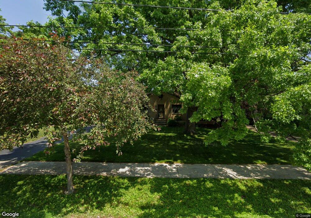
3173 Twin Circle Dr North Olmsted, OH 44070
Estimated Value: $257,000 - $263,000
3
Beds
1
Bath
1,564
Sq Ft
$167/Sq Ft
Est. Value
About This Home
This home is located at 3173 Twin Circle Dr, North Olmsted, OH 44070 and is currently estimated at $261,066, approximately $166 per square foot. 3173 Twin Circle Dr is a home located in Cuyahoga County with nearby schools including Maple Intermediate Elementary School, Pine Intermediate School, and North Olmsted Middle School.
Ownership History
Date
Name
Owned For
Owner Type
Purchase Details
Closed on
Jan 11, 2012
Sold by
Papp Joyce A
Bought by
Papp Mark
Current Estimated Value
Home Financials for this Owner
Home Financials are based on the most recent Mortgage that was taken out on this home.
Original Mortgage
$65,000
Interest Rate
3.93%
Mortgage Type
New Conventional
Purchase Details
Closed on
May 4, 2005
Sold by
Papp Thomas M and Papp Joyce A
Bought by
Papp Mark
Purchase Details
Closed on
Oct 10, 2002
Sold by
Papp Thomas M and Papp Joyce A
Bought by
Papp Thomas M and Papp Joyce A
Purchase Details
Closed on
Jan 1, 1975
Bought by
Papp Thomas M and Papp Joyce A
Create a Home Valuation Report for This Property
The Home Valuation Report is an in-depth analysis detailing your home's value as well as a comparison with similar homes in the area
Home Values in the Area
Average Home Value in this Area
Purchase History
| Date | Buyer | Sale Price | Title Company |
|---|---|---|---|
| Papp Mark | -- | Third Capital Title | |
| Papp Mark | -- | -- | |
| Papp Thomas M | -- | -- | |
| Papp Thomas M | -- | -- |
Source: Public Records
Mortgage History
| Date | Status | Borrower | Loan Amount |
|---|---|---|---|
| Closed | Papp Mark | $65,000 |
Source: Public Records
Tax History Compared to Growth
Tax History
| Year | Tax Paid | Tax Assessment Tax Assessment Total Assessment is a certain percentage of the fair market value that is determined by local assessors to be the total taxable value of land and additions on the property. | Land | Improvement |
|---|---|---|---|---|
| 2024 | $5,157 | $75,250 | $14,630 | $60,620 |
| 2023 | $5,297 | $64,860 | $12,780 | $52,080 |
| 2022 | $5,269 | $64,860 | $12,780 | $52,080 |
| 2021 | $4,769 | $64,860 | $12,780 | $52,080 |
| 2020 | $4,602 | $55,440 | $10,920 | $44,520 |
| 2019 | $4,478 | $158,400 | $31,200 | $127,200 |
| 2018 | $4,374 | $55,440 | $10,920 | $44,520 |
| 2017 | $4,277 | $48,060 | $9,910 | $38,150 |
| 2016 | $4,240 | $48,060 | $9,910 | $38,150 |
| 2015 | $4,206 | $48,060 | $9,910 | $38,150 |
| 2014 | $4,099 | $46,200 | $9,520 | $36,680 |
Source: Public Records
Map
Nearby Homes
- 3517 Walter Rd
- 25324 Hall Dr
- 25255 Maple Ridge Rd
- 23993 Fairlawn Dr
- 25360 Hall Dr
- 25400 Maple Ridge Rd
- 3463 Clague Rd
- 25077 Doe Dr
- 23413 Clifford Dr
- 25148 Tara Lynn Dr
- 24152 Hedgewood Ave
- 2563 Columbia Rd
- 23547 Quail Hollow
- 22976 Maple Ridge Rd Unit B 105
- 22958 Maple Ridge Rd Unit 101A
- 22958 Maple Ridge Rd Unit 202
- 22958 Maple Ridge Rd Unit 209B
- 3139 W 230th St
- 22968 Maple Ridge Rd Unit 103
- 25716 Westwood Rd
- 3187 Twin Circle Dr
- 3159 Twin Circle Dr
- 24299 Ambour Dr
- 3201 Twin Circle Dr
- 24300 Ambour Dr
- 3145 Twin Circle Dr
- 24289 Ambour Dr
- 3186 Twin Circle Dr
- 3215 Twin Circle Dr
- 3200 Twin Circle Dr
- 3133 Twin Circle Dr
- 24286 Ambour Dr
- 3146 Twin Circle Dr
- 24279 Ambour Dr
- 3132 Twin Circle Dr
- 3216 Twin Circle Dr
- 3229 Twin Circle Dr
- 24276 Ambour Dr
- 24403 Twin Circle Dr
- 24404 Twin Circle Dr