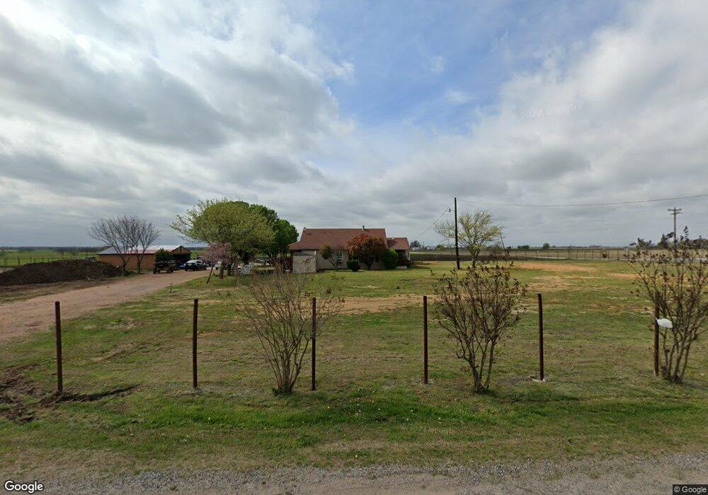
3177 Berend Rd Pilot Point, TX 76258
Estimated Value: $279,312 - $395,000
Studio
--
Bath
1,128
Sq Ft
$284/Sq Ft
Est. Value
About This Home
This home is located at 3177 Berend Rd, Pilot Point, TX 76258 and is currently estimated at $320,078, approximately $283 per square foot. 3177 Berend Rd is a home located in Denton County with nearby schools including Pilot Point Early Childhood Center, Pilot Point Elementary School, and Pilot Point Middle School.
Ownership History
Date
Name
Owned For
Owner Type
Purchase Details
Closed on
Feb 8, 2017
Sold by
Hartsock Lajuana and Hartsock L
Bought by
Steadman Hunter
Current Estimated Value
Home Financials for this Owner
Home Financials are based on the most recent Mortgage that was taken out on this home.
Original Mortgage
$123,966
Outstanding Balance
$102,982
Interest Rate
4.32%
Mortgage Type
New Conventional
Estimated Equity
$217,096
Create a Home Valuation Report for This Property
The Home Valuation Report is an in-depth analysis detailing your home's value as well as a comparison with similar homes in the area
Home Values in the Area
Average Home Value in this Area
Purchase History
| Date | Buyer | Sale Price | Title Company |
|---|---|---|---|
| Steadman Hunter | -- | None Available |
Source: Public Records
Mortgage History
| Date | Status | Borrower | Loan Amount |
|---|---|---|---|
| Open | Steadman Hunter | $123,966 |
Source: Public Records
Tax History
| Year | Tax Paid | Tax Assessment Tax Assessment Total Assessment is a certain percentage of the fair market value that is determined by local assessors to be the total taxable value of land and additions on the property. | Land | Improvement |
|---|---|---|---|---|
| 2025 | $2,817 | $237,000 | $119,710 | $117,290 |
| 2024 | $2,817 | $231,999 | $74,200 | $157,799 |
| 2023 | $2,966 | $244,000 | $69,036 | $174,964 |
| 2022 | $3,409 | $238,496 | $58,631 | $179,865 |
| 2021 | $2,379 | $164,801 | $22,113 | $142,688 |
| 2020 | $2,385 | $159,659 | $22,113 | $137,546 |
| 2019 | $1,316 | $82,474 | $11,057 | $71,417 |
| 2018 | $2,464 | $153,274 | $19,295 | $133,979 |
| 2017 | $1,955 | $120,784 | $19,295 | $118,188 |
| 2016 | $1,777 | $109,804 | $19,295 | $95,097 |
| 2015 | $286 | $99,822 | $19,295 | $80,527 |
| 2013 | -- | $95,267 | $19,295 | $75,972 |
Source: Public Records
Map
Nearby Homes
- 831 Baker Rd
- TBD E Baker Rd
- G-0073 Baker Rd
- TBD Baker Rd
- TBD Baker Rd Unit Lot 2
- TBD Lot 1 Baker Rd
- 2200 Twin Creeks Ct
- 15962 Fritcher Rd
- 16531 Fm 455 E
- 16954 Fm 455
- 40 Acres Fm 455
- 13357 Fm 1385
- 13265 Fm 1385
- 20240 Willow Glade Cir
- TBD Buck Creek Rd
- 20175 Willow Glade Cir
- 3128 Arthurdale St
- 12520 455 E
- 0 Buck Creek Rd
- 12517 Farm To Market Road 1385
- 4249 Berend Rd
- 4189 Berend Rd
- 4299 Berend Rd
- 137 Emerald Glenn Ln
- 4335 Berend Rd
- 167 Emerald Glenn Ln
- 164 Emerald Glenn Ln
- 4423 Berend Rd
- 4387 Berend Rd
- 4477 Berend Rd
- 250 Emerald Glenn Ln
- 4515 Berend Rd
- 95 Ruby Glenn Ln
- 352 Emerald Glenn Ln
- 4537 Berend Rd
- 394 Emerald Glenn Ln
- 1763 Maier Rd
- 13600 Pelzel Rd
- 1727 Maier Rd
- 13484 Pelzel Rd
Your Personal Tour Guide
Ask me questions while you tour the home.