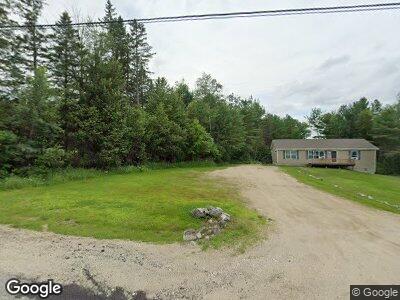
318 Bryant Rd Buckfield, ME 04220
Estimated Value: $249,000 - $400,000
--
Bed
--
Bath
--
Sq Ft
1.4
Acres
About This Home
This home is located at 318 Bryant Rd, Buckfield, ME 04220 and is currently estimated at $315,449. 318 Bryant Rd is a home with nearby schools including Hartford-Sumner Elementary School and Buckfield Junior/Senior High School.
Ownership History
Date
Name
Owned For
Owner Type
Purchase Details
Closed on
Dec 14, 2021
Sold by
Warren Barbara H and Warren Roland E
Bought by
Warren David C
Current Estimated Value
Purchase Details
Closed on
Nov 13, 2017
Sold by
Truman Corp
Bought by
Warren David C
Home Financials for this Owner
Home Financials are based on the most recent Mortgage that was taken out on this home.
Original Mortgage
$173,603
Interest Rate
3.83%
Mortgage Type
Unknown
Purchase Details
Closed on
Aug 1, 2017
Sold by
Warren David C
Bought by
Warren David C
Create a Home Valuation Report for This Property
The Home Valuation Report is an in-depth analysis detailing your home's value as well as a comparison with similar homes in the area
Home Values in the Area
Average Home Value in this Area
Purchase History
| Date | Buyer | Sale Price | Title Company |
|---|---|---|---|
| Warren David C | -- | None Available | |
| Warren David C | -- | -- | |
| Warren David C | -- | -- |
Source: Public Records
Mortgage History
| Date | Status | Borrower | Loan Amount |
|---|---|---|---|
| Open | Warren David C | $67,000 | |
| Previous Owner | Warren David C | $170,440 | |
| Previous Owner | Warren David C | $173,603 |
Source: Public Records
Tax History Compared to Growth
Tax History
| Year | Tax Paid | Tax Assessment Tax Assessment Total Assessment is a certain percentage of the fair market value that is determined by local assessors to be the total taxable value of land and additions on the property. | Land | Improvement |
|---|---|---|---|---|
| 2024 | $4,090 | $320,800 | $35,600 | $285,200 |
| 2023 | $3,231 | $123,800 | $30,200 | $93,600 |
| 2022 | $3,495 | $123,800 | $30,200 | $93,600 |
| 2021 | $2,321 | $123,800 | $30,200 | $93,600 |
| 2020 | $2,699 | $123,800 | $30,200 | $93,600 |
| 2019 | $2,985 | $123,800 | $30,200 | $93,600 |
| 2018 | $2,938 | $123,800 | $30,200 | $93,600 |
| 2017 | $912 | $40,800 | $30,200 | $10,600 |
| 2016 | $878 | $40,800 | $30,200 | $10,600 |
| 2015 | $849 | $40,800 | $30,200 | $10,600 |
| 2014 | $838 | $40,800 | $30,200 | $10,600 |
| 2013 | $869 | $40,800 | $30,200 | $10,600 |
Source: Public Records
Map
Nearby Homes
- 52 Swan Pond Rd
- 0 Caboose Ln Unit 1601449
- 169 Sam Annis Rd
- 0 Auburn Rd Unit 1621703
- 28-1 Auburn Rd
- Lot 21 Auburn Rd
- Lot21&22 Auburn Rd
- Map28Lot1 Auburn Rd
- 5 Ranch Rd
- Lot# Hebron St
- 567 General Turner Hill Rd
- Lot 5 Memory Ln
- 252 General Turner Hill Rd
- 3 Gabriel's Way
- 1 Long Meadow Estates
- 271 Plains Rd
- 150 Plains Rd
- 22 Shire Ln
- 222 Pleasant Pond Rd
- 173 Darnit Rd
- 318 Bryant Rd
- 328 Bryant Rd
- 309 Bryant Rd
- 306 Bryant Rd
- 337 Bryant Rd
- 346 Bryant Rd
- 291 Bryant Rd
- 275 Bryant Rd
- 270 Bryant Rd
- 239 Bryant Rd
- 381 Bryant Rd
- 285 E Buckfield Rd
- 329 E Buckfield Rd
- 0 Gammon Rd
- LOT 2 Gammon
- 314 E Buckfield Rd
- 336 E Buckfield Rd
- 369 E Buckfield Rd
- 358 E Buckfield Rd
- 225 Bryant Rd