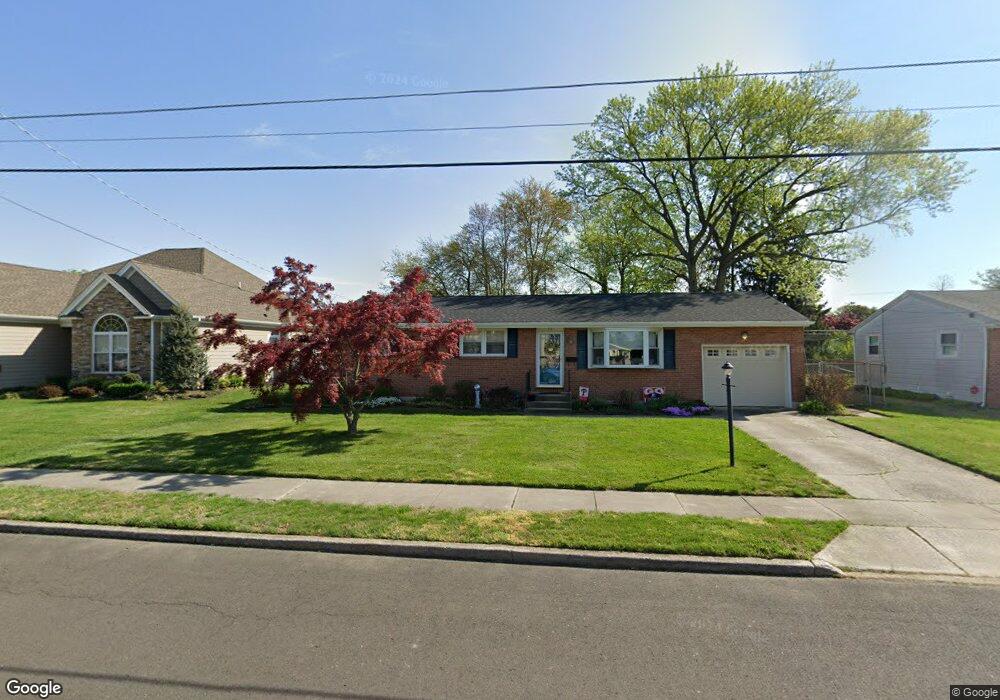
318 Carson Ave Gibbstown, NJ 08027
Greenwich Township NeighborhoodEstimated Value: $271,485 - $355,000
--
Bed
--
Bath
1,504
Sq Ft
$215/Sq Ft
Est. Value
About This Home
This home is located at 318 Carson Ave, Gibbstown, NJ 08027 and is currently estimated at $323,121, approximately $214 per square foot. 318 Carson Ave is a home located in Gloucester County with nearby schools including Nehaunsey Middle School and Guardian Angels Regional School.
Ownership History
Date
Name
Owned For
Owner Type
Purchase Details
Closed on
Oct 14, 2005
Sold by
Helder Lisa and Makel Lisa
Bought by
Pasquini Diane
Current Estimated Value
Home Financials for this Owner
Home Financials are based on the most recent Mortgage that was taken out on this home.
Original Mortgage
$96,144
Interest Rate
5.72%
Mortgage Type
Purchase Money Mortgage
Purchase Details
Closed on
Dec 17, 2001
Sold by
Stocksdale Lillian A and Stocksdale Irene E
Bought by
Pasquini John A and Pasquini Diane
Purchase Details
Closed on
May 16, 1997
Sold by
Stocksdale Irene E and Stocksdale Caroline G
Bought by
Stocksdale Irene E and Stocksdale Lillian A
Create a Home Valuation Report for This Property
The Home Valuation Report is an in-depth analysis detailing your home's value as well as a comparison with similar homes in the area
Home Values in the Area
Average Home Value in this Area
Purchase History
| Date | Buyer | Sale Price | Title Company |
|---|---|---|---|
| Pasquini Diane | $107,000 | Homestead Title Agency | |
| Pasquini John A | $92,500 | Fidelity National Title Ins | |
| Stocksdale Irene E | -- | -- |
Source: Public Records
Mortgage History
| Date | Status | Borrower | Loan Amount |
|---|---|---|---|
| Closed | Pasquini Diane | $96,144 |
Source: Public Records
Tax History Compared to Growth
Tax History
| Year | Tax Paid | Tax Assessment Tax Assessment Total Assessment is a certain percentage of the fair market value that is determined by local assessors to be the total taxable value of land and additions on the property. | Land | Improvement |
|---|---|---|---|---|
| 2025 | $5,681 | $165,000 | $36,500 | $128,500 |
| 2024 | $5,382 | $165,000 | $36,500 | $128,500 |
| 2023 | $5,382 | $165,000 | $36,500 | $128,500 |
| 2022 | $5,386 | $165,000 | $36,500 | $128,500 |
| 2021 | $4,982 | $165,000 | $36,500 | $128,500 |
| 2020 | $5,404 | $165,000 | $36,500 | $128,500 |
| 2019 | $5,407 | $165,000 | $36,500 | $128,500 |
| 2018 | $5,254 | $165,000 | $36,500 | $128,500 |
| 2017 | $5,127 | $165,000 | $36,500 | $128,500 |
| 2016 | $5,070 | $165,000 | $36,500 | $128,500 |
| 2015 | $4,907 | $165,000 | $36,500 | $128,500 |
| 2014 | $4,696 | $165,000 | $36,500 | $128,500 |
Source: Public Records
Map
Nearby Homes
- 836 E Broad St
- 330 Croce Ave
- 219 Vanneman Blvd
- 0 S Democrat Rd Unit NJGL2065008
- 344 W Washington St
- 335 W Buck St
- 0 Swedesboro Ave Unit NJGL2061592
- L18 20 W Broad St
- 255 Elizabeth Ave
- 269 W Broad St
- 1043 Penn Line Rd
- 1224 Heddon Ave
- 1214 Walter Ave
- 227 W Buck St
- 100 Giammarino Ave
- 342 Democrat Rd
- 140 142 W Jefferson St
- 1534 Pine St
- 122 W Washington St
- 1519 Pine St
- 324 Carson Ave
- 312 Carson Ave
- 85 Harmony Rd
- 93 Harmony Rd
- 330 Carson Ave
- 1511 Memorial Ave
- 77 Harmony Rd
- 317 Carson Ave
- 323 Carson Ave
- 311 Carson Ave
- 1515 Memorial Ave
- 69 Harmony Rd
- 336 Carson Ave
- 329 Carson Ave
- 1497 Memorial Ave
- 61 Harmony Rd
- 335 Carson Ave
- 1500 Memorial Ave
- 342 Carson Ave
- 104 Harmony Rd