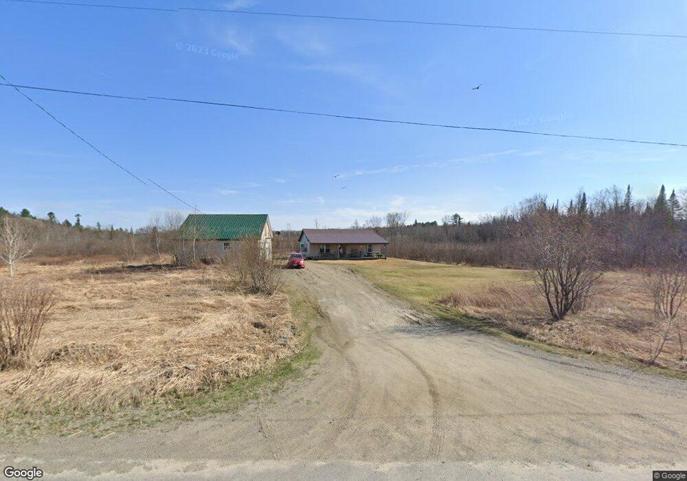
318 Wood Rd Cornville, ME 04976
Estimated Value: $173,000 - $235,157
2
Beds
1
Bath
1,064
Sq Ft
$192/Sq Ft
Est. Value
About This Home
This home is located at 318 Wood Rd, Cornville, ME 04976 and is currently estimated at $204,079, approximately $191 per square foot. 318 Wood Rd is a home located in Somerset County.
Ownership History
Date
Name
Owned For
Owner Type
Purchase Details
Closed on
Feb 19, 2026
Sold by
Macmichael James
Bought by
Macmichael Robert D
Current Estimated Value
Purchase Details
Closed on
Nov 7, 2025
Sold by
Macmichael Ann S and Macmichael James
Bought by
Macmichael James
Home Financials for this Owner
Home Financials are based on the most recent Mortgage that was taken out on this home.
Original Mortgage
$118,350
Interest Rate
6.17%
Mortgage Type
VA
Purchase Details
Closed on
Apr 28, 2020
Sold by
Macmichael Ann S
Bought by
Macmichael Ann S and Macmichael James
Purchase Details
Closed on
Dec 18, 2012
Sold by
Cooke Jason A
Bought by
Macmichael Ann S
Create a Home Valuation Report for This Property
The Home Valuation Report is an in-depth analysis detailing your home's value as well as a comparison with similar homes in the area
Purchase History
| Date | Buyer | Sale Price | Title Company |
|---|---|---|---|
| Macmichael Robert D | -- | -- | |
| Macmichael James | -- | -- | |
| Macmichael Ann S | -- | None Available | |
| Macmichael Ann S | -- | None Available | |
| Macmichael Ann S | -- | -- | |
| Macmichael Ann S | -- | -- | |
| Macmichael Ann S | -- | -- |
Source: Public Records
Mortgage History
| Date | Status | Borrower | Loan Amount |
|---|---|---|---|
| Previous Owner | Macmichael James | $118,350 |
Source: Public Records
Tax History
| Year | Tax Paid | Tax Assessment Tax Assessment Total Assessment is a certain percentage of the fair market value that is determined by local assessors to be the total taxable value of land and additions on the property. | Land | Improvement |
|---|---|---|---|---|
| 2025 | $1,713 | $161,620 | $51,400 | $110,220 |
| 2024 | $1,713 | $161,620 | $51,400 | $110,220 |
| 2023 | $1,629 | $112,360 | $35,600 | $76,760 |
| 2022 | $1,629 | $112,360 | $35,600 | $76,760 |
| 2021 | $1,629 | $112,360 | $35,600 | $76,760 |
| 2020 | $1,629 | $112,360 | $35,600 | $76,760 |
| 2019 | $1,447 | $89,310 | $27,390 | $61,920 |
| 2018 | $1,340 | $89,310 | $27,390 | $61,920 |
| 2017 | $1,358 | $79,900 | $32,100 | $47,800 |
| 2016 | $1,358 | $79,900 | $32,100 | $47,800 |
| 2015 | $1,358 | $79,900 | $32,100 | $47,800 |
| 2013 | $1,358 | $79,900 | $32,100 | $47,800 |
Source: Public Records
Map
Nearby Homes
- 167 Lower Mills Rd
- M9 L29 Beckwith Rd
- M9 L29 N Beckwith Rd
- M9 L29 S Beckwith Rd
- M40 L13-6 Mallard Rd
- 7 & 9 Crane Ln
- 16 Salmon Rd
- 58 Naomi Ave
- 22 Deer Hill Estates
- 21 Naomi Ave
- 1012 Lakewood Rd
- 17 Green Rd
- 28 Messina Dr
- 1266 W Ridge Rd
- 176 W Ridge Rd
- 538 Malbons Mills Rd
- 1631 Lakewood Rd
- 24 Fickett Ln
- 72 Fire Lane 12 Unit 72
- M1 L9-1 Off Ames Rd
- 288 Wood Rd
- M11 L50 Molunkus Rd
- 896 Beckwith Rd
- 818 Beckwith Rd
- 266 Wood Rd
- 202 Lower Mills Rd
- 197 Lower Mills Rd
- 741 Molunkus Rd
- 758 Molunkus Rd
- 181 Lower Mills Rd
- 750 Molunkus Rd
- 184 Lower Mills Rd
- 910 Molunkus Rd
- 723 Molunkus Rd
- 920 Molunkus Rd
- 5840 Molunkus Rd
- 163 Lower Mills Rd
- 930 Molunkus Rd
- 151 Lower Mills Rd
- 157 Lower Mills Rd
Your Personal Tour Guide
Ask me questions while you tour the home.