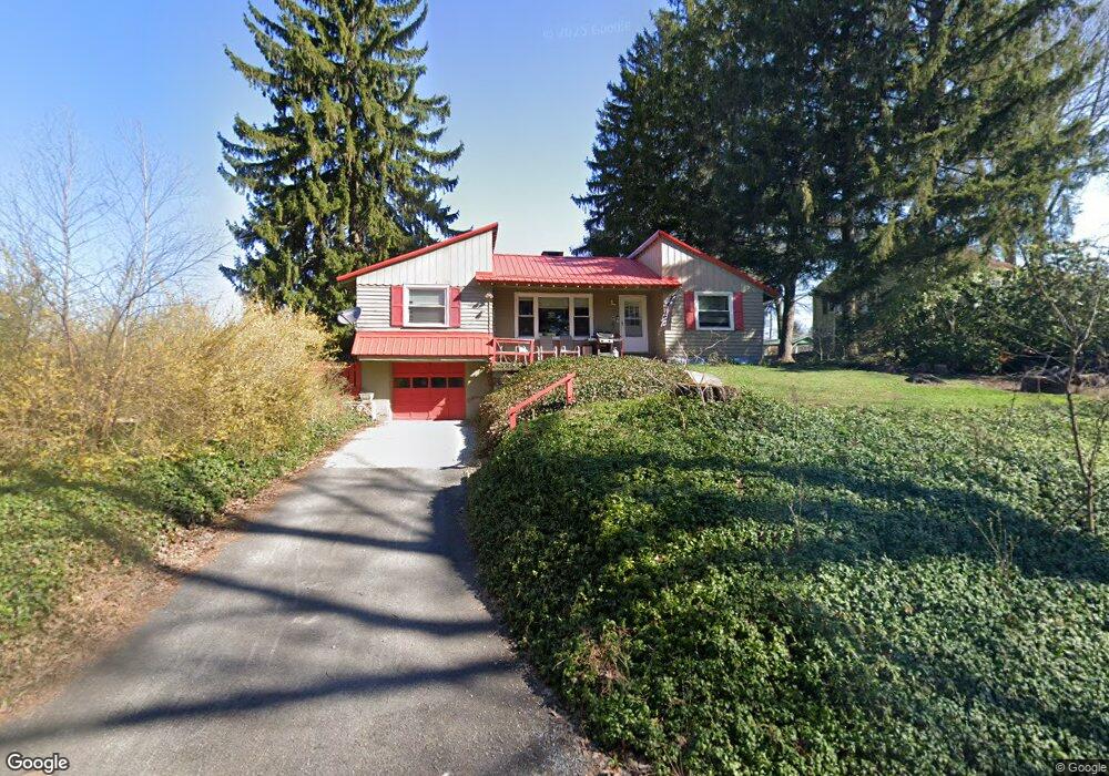
319 Brookside Way Johnstown, PA 15904
Estimated Value: $77,000 - $182,000
--
Bed
--
Bath
--
Sq Ft
0.34
Acres
About This Home
This home is located at 319 Brookside Way, Johnstown, PA 15904 and is currently estimated at $119,187. 319 Brookside Way is a home with nearby schools including Richland Elementary School, Richland High School, and Genesis Christian Academy.
Ownership History
Date
Name
Owned For
Owner Type
Purchase Details
Closed on
Sep 5, 2017
Sold by
Blough Joel T and Blough Mary C
Bought by
Gorden Boyd
Current Estimated Value
Home Financials for this Owner
Home Financials are based on the most recent Mortgage that was taken out on this home.
Original Mortgage
$55,182
Outstanding Balance
$46,651
Interest Rate
4.37%
Mortgage Type
FHA
Estimated Equity
$72,536
Purchase Details
Closed on
Jan 18, 2005
Bought by
Blough Joel T and Blough Mary C
Create a Home Valuation Report for This Property
The Home Valuation Report is an in-depth analysis detailing your home's value as well as a comparison with similar homes in the area
Home Values in the Area
Average Home Value in this Area
Purchase History
| Date | Buyer | Sale Price | Title Company |
|---|---|---|---|
| Gorden Boyd | $56,200 | None Available | |
| Blough Joel T | -- | -- |
Source: Public Records
Mortgage History
| Date | Status | Borrower | Loan Amount |
|---|---|---|---|
| Open | Gorden Boyd | $55,182 |
Source: Public Records
Tax History Compared to Growth
Tax History
| Year | Tax Paid | Tax Assessment Tax Assessment Total Assessment is a certain percentage of the fair market value that is determined by local assessors to be the total taxable value of land and additions on the property. | Land | Improvement |
|---|---|---|---|---|
| 2025 | $618 | $12,740 | $3,140 | $9,600 |
| 2024 | $1,312 | $12,740 | $3,140 | $9,600 |
| 2023 | $1,280 | $12,740 | $3,140 | $9,600 |
| 2022 | $1,261 | $12,740 | $3,140 | $9,600 |
| 2021 | $1,292 | $12,740 | $3,140 | $9,600 |
| 2020 | $1,276 | $12,740 | $3,140 | $9,600 |
| 2019 | $1,254 | $12,740 | $3,140 | $9,600 |
| 2018 | $1,242 | $12,740 | $3,140 | $9,600 |
| 2017 | $1,248 | $12,740 | $3,140 | $9,600 |
| 2016 | $440 | $12,740 | $3,140 | $9,600 |
| 2015 | $376 | $12,740 | $3,140 | $9,600 |
| 2014 | $376 | $12,740 | $3,140 | $9,600 |
Source: Public Records
Map
Nearby Homes
- 607 Belmont St
- 217 Coldren St
- 124 Rosewood St
- 613 Demuth St
- 213 Dravis St
- 733 Demuth St
- 130 Kiawa St
- 147 Luna Ln
- 0 Bushwack & Platt Unit 96036183
- 0 Stonybrook Lane Lot
- 921 Old Scalp Ave
- 404 Walters Ave
- 137 Brandle St
- 707 Luray Ave
- 157 Lohr Place
- 110 Oakland Ave
- 144-145 Western Ave
- 412 Kenneth Ave
- 394 Ohio St
- 1643 Florida Ave
- 318 White Oak Ln
- 323 Brookside Way
- 315 Brookside Way
- 326 White Oak Ln
- 316 White Oak Ln
- 345 Teaberry Ln
- 328 White Oak Ln
- 348 Teaberry Ln
- 323 White Oak Ln
- 347 Teaberry Ln
- 346 Teaberry Ln
- 341 Teaberry Ln
- 330 White Oak Ln
- 325 White Oak Ln
- 344 Teaberry Ln
- 327 White Oak Ln
- 332 White Oak Ln
- 339 Teaberry Ln
- 342 Teaberry Ln
- 334 White Oak Ln