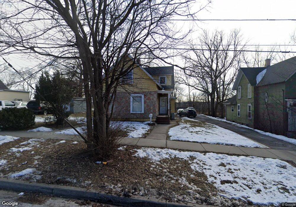
319 Dwight St Elgin, IL 60120
Southeast Elgin NeighborhoodEstimated Value: $197,000 - $288,000
About This Home
This home is located at 319 Dwight St, Elgin, IL 60120 and is currently estimated at $248,974, approximately $158 per square foot. 319 Dwight St is a home located in Kane County with nearby schools including Huff Elementary School, Kenyon Woods Middle School, and South Elgin High School.
Ownership History
We collect this data history from publicly available records. To have your information removed, we recommend requesting removal directly through your county’s website.
Purchase Details
Home Financials for this Owner
Home Financials are based on the most recent Mortgage that was taken out on this home.Home Values in the Area
Average Home Value in this Area
Purchase History
We collect this data history from publicly available records. To have your information removed, we recommend requesting removal directly through your county’s website.
| Date | Buyer | Sale Price | Title Company |
|---|---|---|---|
| $75,000 | Intercounty Title Company | ||
| $46,000 | Intercounty Title Company |
Mortgage History
We collect this data history from publicly available records. To have your information removed, we recommend requesting removal directly through your county’s website.
| Date | Status | Borrower | Loan Amount |
|---|---|---|---|
| Closed | $74,650 |
Tax History
We collect this data history from publicly available records. To have your information removed, we recommend requesting removal directly through your county’s website.
| Year | Tax Paid | Tax Assessment Tax Assessment Total Assessment is a certain percentage of the fair market value that is determined by local assessors to be the total taxable value of land and additions on the property. | Land | Improvement |
|---|---|---|---|---|
| 2024 | $5,147 | $64,312 | $12,209 | $52,103 |
| 2023 | $4,953 | $58,101 | $11,030 | $47,071 |
| 2022 | $4,255 | $49,076 | $10,057 | $39,019 |
| 2021 | $4,094 | $45,883 | $9,403 | $36,480 |
| 2020 | $3,995 | $43,803 | $8,977 | $34,826 |
| 2019 | $3,897 | $41,725 | $8,551 | $33,174 |
| 2018 | $3,886 | $39,308 | $8,056 | $31,252 |
| 2017 | $3,822 | $37,160 | $7,616 | $29,544 |
| 2016 | $3,677 | $34,475 | $7,066 | $27,409 |
| 2015 | -- | $31,600 | $6,477 | $25,123 |
| 2014 | -- | $31,210 | $6,397 | $24,813 |
| 2013 | -- | $32,034 | $6,566 | $25,468 |
Map
- 648 S Liberty St
- Lot 3 Russell St
- 415 Russell St
- 953 Elizabeth St
- 555 S Liberty St
- 870 Lavoie Ave
- 255 Bartlett Place
- 433 Arlington Ave
- 513 Cookane Ave
- 1609 Deer Pointe Dr
- 1603 Deer Pointe Dr
- 483 Barrett St
- 700 Villa St
- 286 Villa St
- 1563 Deer Pointe Dr
- 907 Houston Ave
- 217 Michigan St
- 153 Dawson Dr
- 515 Oak St
- 161 S Grove Ave
Ask me questions while you tour the home.