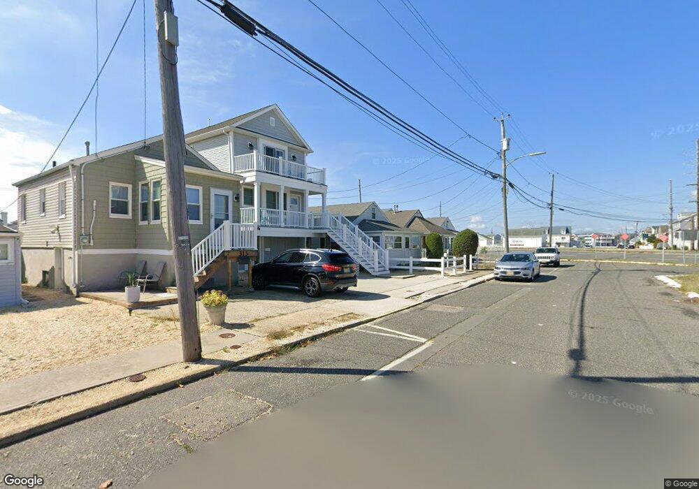
319 Hiering Ave Seaside Heights, NJ 08751
Estimated Value: $428,740 - $849,000
2
Beds
1
Bath
680
Sq Ft
$893/Sq Ft
Est. Value
About This Home
This home is located at 319 Hiering Ave, Seaside Heights, NJ 08751 and is currently estimated at $607,435, approximately $893 per square foot. 319 Hiering Ave is a home located in Ocean County with nearby schools including Hugh J. Boyd Jr. Elementary School, Central Regional Middle School, and Central Regional High School.
Ownership History
Date
Name
Owned For
Owner Type
Purchase Details
Closed on
Aug 28, 2009
Sold by
Lagrossa Stephen D and Lagrossa Marguerite J
Bought by
Woodrow Michael
Current Estimated Value
Home Financials for this Owner
Home Financials are based on the most recent Mortgage that was taken out on this home.
Original Mortgage
$197,600
Outstanding Balance
$129,819
Interest Rate
5.28%
Mortgage Type
New Conventional
Estimated Equity
$477,616
Purchase Details
Closed on
Aug 7, 2001
Sold by
Federal Home Loan Mortgage Corporation
Bought by
Lagrossa Stephen and Lagrossa La Grossa
Home Financials for this Owner
Home Financials are based on the most recent Mortgage that was taken out on this home.
Original Mortgage
$76,400
Interest Rate
7.1%
Purchase Details
Closed on
Feb 11, 1999
Sold by
Erlewein Joseph and Erlewein Kathy
Bought by
Rowbotham Ronald
Home Financials for this Owner
Home Financials are based on the most recent Mortgage that was taken out on this home.
Original Mortgage
$71,250
Interest Rate
6.78%
Mortgage Type
Purchase Money Mortgage
Create a Home Valuation Report for This Property
The Home Valuation Report is an in-depth analysis detailing your home's value as well as a comparison with similar homes in the area
Home Values in the Area
Average Home Value in this Area
Purchase History
| Date | Buyer | Sale Price | Title Company |
|---|---|---|---|
| Woodrow Michael | $247,000 | None Available | |
| Lagrossa Stephen | $84,900 | -- | |
| Lagrossa Stephen | $84,900 | -- | |
| Rowbotham Ronald | $75,000 | Chicago Title Insurance Co |
Source: Public Records
Mortgage History
| Date | Status | Borrower | Loan Amount |
|---|---|---|---|
| Open | Woodrow Michael | $197,600 | |
| Previous Owner | Lagrossa Stephen | $76,400 | |
| Previous Owner | Rowbotham Ronald | $71,250 |
Source: Public Records
Tax History Compared to Growth
Tax History
| Year | Tax Paid | Tax Assessment Tax Assessment Total Assessment is a certain percentage of the fair market value that is determined by local assessors to be the total taxable value of land and additions on the property. | Land | Improvement |
|---|---|---|---|---|
| 2025 | $4,673 | $496,500 | $389,400 | $107,100 |
| 2024 | $4,337 | $164,900 | $100,500 | $64,400 |
| 2023 | $4,124 | $164,900 | $100,500 | $64,400 |
| 2022 | $4,124 | $164,900 | $100,500 | $64,400 |
| 2021 | $3,991 | $164,900 | $100,500 | $64,400 |
| 2020 | $4,004 | $164,900 | $100,500 | $64,400 |
| 2019 | $3,883 | $164,900 | $100,500 | $64,400 |
| 2018 | $3,781 | $164,900 | $100,500 | $64,400 |
| 2017 | $3,710 | $164,900 | $100,500 | $64,400 |
| 2016 | $3,648 | $164,900 | $100,500 | $64,400 |
| 2015 | $3,521 | $164,900 | $100,500 | $64,400 |
| 2014 | $3,224 | $164,900 | $100,500 | $64,400 |
Source: Public Records
Map
Nearby Homes
- 323 Hiering Ave
- 241 Hiering Ave
- 245 Sampson Ave
- 1400 Bay Blvd Unit 1.03 pending
- 1400 Bay Blvd Unit 1.04 pending
- 1400 Bay Blvd Unit 1.02 Pending
- 1501 Central
- 263 Kearney Ave
- 132 Sampson Ave Unit 2
- 1639 Bay Blvd
- 437 Hiering Ave
- 229 Kearney Ave Unit 2
- 211 Kearney Ave
- 1653 Bay Blvd
- 118 Sampson Ave
- 447 Tunney Ave
- 1515 Boulevard Unit 4
- 1515 Boulevard Unit 13
- 228 Hancock Ave
- 1601 Boulevard Unit B7
- 317 Hiering Ave
- 321 Hiering Ave
- 313 Hiering Ave
- 311 Hiering Ave
- 311 Hiering Ave Unit SUMMER RENTAL
- 316 Sampson Ave
- 309 Hiering Ave
- 309 Hiering Ave Unit B
- 309 Hiering Ave Unit A
- 314 Sampson Ave
- 318 Sampson Ave
- 320 Sampson Ave
- 312 Sampson Ave
- 312 Sampson Ave Unit B
- 312 Sampson Ave Unit A
- 1510R Bay Blvd Unit 1
- 1510R Bay Blvd
- 1510 Bay Blvd
- 1510 Bay Blvd Unit Lower
- 1510 Bay Blvd Unit R