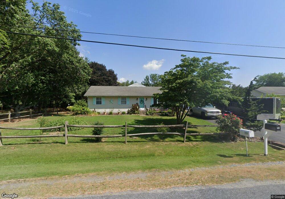
319 Longfellow Dr Chestertown, MD 21620
Kingstown NeighborhoodEstimated Value: $396,967 - $511,000
--
Bed
2
Baths
2,256
Sq Ft
$193/Sq Ft
Est. Value
About This Home
This home is located at 319 Longfellow Dr, Chestertown, MD 21620 and is currently estimated at $436,492, approximately $193 per square foot. 319 Longfellow Dr is a home located in Queen Anne's County with nearby schools including Church Hill Elementary School, Sudlersville Middle School, and Queen Anne's County High School.
Ownership History
Date
Name
Owned For
Owner Type
Purchase Details
Closed on
Apr 1, 2009
Sold by
Thompson Debra A
Bought by
Hampton Debra A
Current Estimated Value
Purchase Details
Closed on
Jun 30, 2004
Sold by
Clark Frank Vincent and Clark Karen
Bought by
Thompson Debra A
Purchase Details
Closed on
Dec 18, 2003
Sold by
Secretary Of Veterans Affairs
Bought by
Clark Frank Vincent and Clark Karen
Purchase Details
Closed on
Oct 22, 2003
Sold by
Horney Casey Wade
Bought by
Secretary Of Veterans Affairs
Purchase Details
Closed on
Mar 28, 2001
Sold by
Pinder Gary A and Pinder Renita E
Bought by
Horney Casey Wade
Create a Home Valuation Report for This Property
The Home Valuation Report is an in-depth analysis detailing your home's value as well as a comparison with similar homes in the area
Home Values in the Area
Average Home Value in this Area
Purchase History
| Date | Buyer | Sale Price | Title Company |
|---|---|---|---|
| Hampton Debra A | -- | -- | |
| Thompson Debra A | $230,000 | -- | |
| Clark Frank Vincent | $142,500 | -- | |
| Secretary Of Veterans Affairs | $130,433 | -- | |
| Horney Casey Wade | $135,000 | -- |
Source: Public Records
Mortgage History
| Date | Status | Borrower | Loan Amount |
|---|---|---|---|
| Closed | Clark Frank Vincent | -- |
Source: Public Records
Tax History Compared to Growth
Tax History
| Year | Tax Paid | Tax Assessment Tax Assessment Total Assessment is a certain percentage of the fair market value that is determined by local assessors to be the total taxable value of land and additions on the property. | Land | Improvement |
|---|---|---|---|---|
| 2025 | $3,128 | $365,800 | $76,000 | $289,800 |
| 2024 | $2,967 | $336,100 | $0 | $0 |
| 2023 | $2,812 | $306,400 | $0 | $0 |
| 2022 | $2,667 | $276,700 | $56,000 | $220,700 |
| 2021 | $2,478 | $264,500 | $0 | $0 |
| 2020 | $2,478 | $252,300 | $0 | $0 |
| 2019 | $2,363 | $240,100 | $56,000 | $184,100 |
| 2018 | $2,124 | $240,100 | $56,000 | $184,100 |
| 2017 | $2,363 | $240,100 | $0 | $0 |
| 2016 | -- | $307,800 | $0 | $0 |
| 2015 | $934 | $274,267 | $0 | $0 |
| 2014 | $934 | $240,733 | $0 | $0 |
Source: Public Records
Map
Nearby Homes
- 213 Central Dr
- 222 Dutchess Rd
- 109 Wilton Rd
- 492 Pear Tree Point Rd
- 26933 Mallard Rd
- 0 East St
- 101 Birch Run Rd
- 303 E Campus Ave
- 204 Rolling Rd
- 411 Greenwood Ave
- 105 High St
- 206 Valley Rd
- 228 S Water St
- 206 S Water St
- 200 Washington Ave
- 0 Elm St Unit MDKE2003590
- 206 Cannon St
- 304 Hadaway Dr
- 349 & 351 High St
- 222 Mount Vernon Ave
- 323 Longfellow Dr
- 315 Longfellow Dr
- 310 Longfellow Dr
- 124 Justin Buch Dr
- 312 Longfellow Dr
- 308 Longfellow Dr
- 329 Longfellow Dr
- 320 Longfellow Dr
- 305 Longfellow Dr
- 304 Longfellow Dr
- 324 Longfellow Dr
- 123 Woodstock Rd
- 120 Justin Buch Dr
- 127 Woodstock Rd
- 119 Woodstock Rd
- 131 Woodstock Rd
- 335 Longfellow Dr
- 328 Longfellow Dr
- 102 Iris Rd
- 115 Woodstock Rd