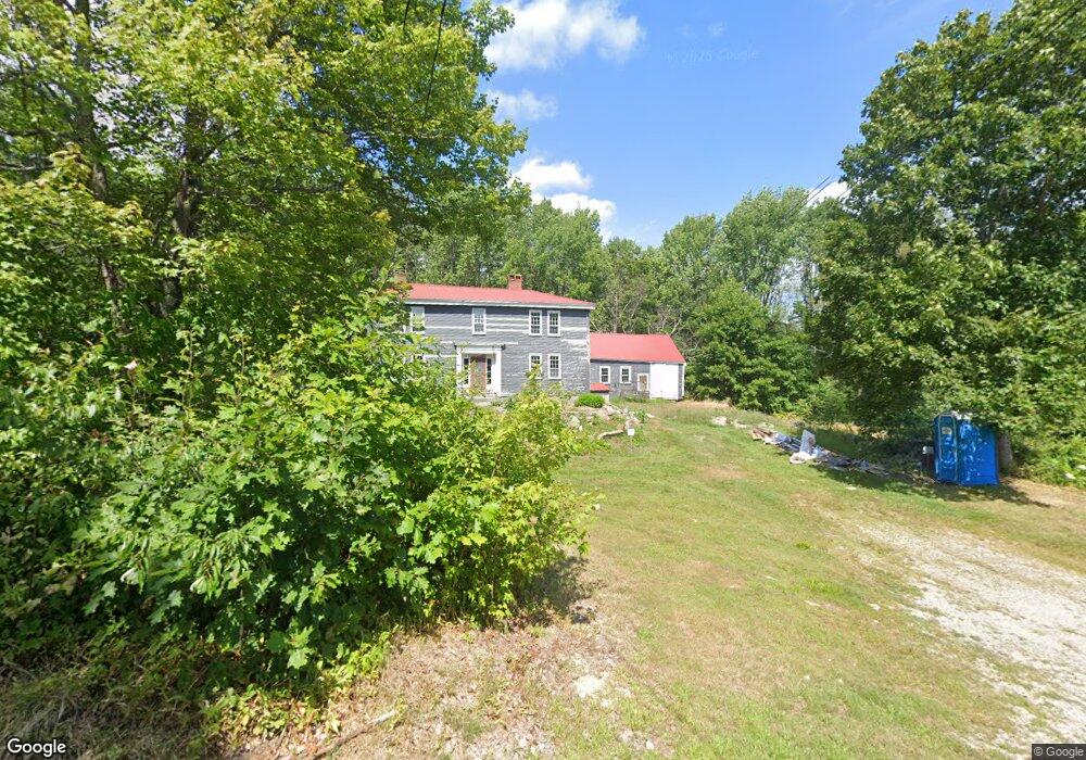
319 Maplecrest Rd Parsonsfield, ME 04047
Estimated Value: $291,976 - $409,000
Studio
--
Bath
1,174
Sq Ft
$302/Sq Ft
Est. Value
About This Home
This home is located at 319 Maplecrest Rd, Parsonsfield, ME 04047 and is currently estimated at $354,744, approximately $302 per square foot. 319 Maplecrest Rd is a home with nearby schools including Ossipee Valley Christian School.
Ownership History
Date
Name
Owned For
Owner Type
Purchase Details
Closed on
May 2, 2025
Sold by
Walker Richard J and Walker Tara
Bought by
The Walker Geherty House
Current Estimated Value
Purchase Details
Closed on
Mar 7, 2025
Sold by
T U & W Of Nanci K W and Walker
Bought by
Walker Richard J and Walker Tara
Create a Home Valuation Report for This Property
The Home Valuation Report is an in-depth analysis detailing your home's value as well as a comparison with similar homes in the area
Home Values in the Area
Average Home Value in this Area
Purchase History
| Date | Buyer | Sale Price | Title Company |
|---|---|---|---|
| The Walker Geherty House | -- | None Available | |
| The Walker Geherty House | -- | None Available | |
| The Walker Geherty House | -- | None Available | |
| Walker Richard J | -- | None Available | |
| Walker Richard J | -- | None Available | |
| The Walker Geherty House | -- | None Available | |
| The Walker Geherty House | -- | None Available | |
| Walker Richard J | -- | None Available | |
| The Walker Geherty House | -- | None Available |
Source: Public Records
Tax History
| Year | Tax Paid | Tax Assessment Tax Assessment Total Assessment is a certain percentage of the fair market value that is determined by local assessors to be the total taxable value of land and additions on the property. | Land | Improvement |
|---|---|---|---|---|
| 2025 | $2,640 | $156,207 | $66,600 | $89,607 |
| 2024 | $2,624 | $156,207 | $66,600 | $89,607 |
| 2023 | $2,531 | $156,207 | $66,600 | $89,607 |
| 2022 | $2,421 | $156,207 | $66,600 | $89,607 |
| 2021 | $2,413 | $156,207 | $66,600 | $89,607 |
| 2020 | $2,367 | $156,207 | $66,600 | $89,607 |
| 2019 | $2,327 | $156,207 | $66,600 | $89,607 |
| 2017 | $3,084 | $207,000 | $66,600 | $140,400 |
| 2016 | $3,084 | $207,000 | $66,600 | $140,400 |
| 2015 | $3,105 | $207,000 | $66,600 | $140,400 |
| 2013 | $3,022 | $207,000 | $66,600 | $140,400 |
Source: Public Records
Map
Nearby Homes
- 27 Nocturne Rd
- 424 Maplecrest Rd
- 178 Maplecrest Rd
- R13/038 Weeks Rd
- 27 Lynn Dr
- 1186 Middle
- 1783 North Rd
- 00 North Rd
- 00 North Rd Unit Lot 3
- 00 North Rd Unit Lot 2
- 00 North Rd Unit Lot 1
- 1882 North Rd
- 11 Penny Ln
- Lot 1 Moulton Hill Rd
- 231 South Rd
- 35 Mudgett Rd
- TBD Sokokis Trail N
- 528 Maplewood Rd
- 154 Staples Rd
- 14 Hunter Dr
- 333 Maplecrest Rd
- 596 Maplecrest Rd
- 48 Maplecrest Rd
- Lot #4 Maplecrest Rd
- R13-2,3,4, Maplecrest Rd
- 349 Maplecrest Rd
- 282 Maplecrest Rd
- 363 Maplecrest Rd
- 255 Maplecrest Rd
- 32 Dearborn Rd
- 233 Maplecrest Rd
- 207 Maplecrest Rd
- 205 Maplecrest Rd
- 423 Maplecrest Rd
- 171 Maplecrest Rd
- 167 Maplecrest Rd
- 494 Maplecrest Rd
- 155 Maplecrest Rd
- 150 Maplecrest Rd
- 484 Maplecrest Rd
Your Personal Tour Guide
Ask me questions while you tour the home.