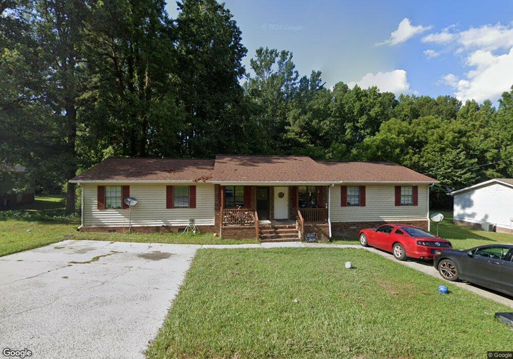
319 Mill Trace Dalton, GA 30721
Estimated Value: $228,000 - $285,000
Studio
2
Baths
1,960
Sq Ft
$134/Sq Ft
Est. Value
About This Home
This home is located at 319 Mill Trace, Dalton, GA 30721 and is currently estimated at $262,547, approximately $133 per square foot. 319 Mill Trace is a home located in Whitfield County with nearby schools including Pleasant Grove Elementary School, New Hope Middle School, and Northwest Whitfield County High School.
Ownership History
Date
Name
Owned For
Owner Type
Purchase Details
Closed on
Jan 9, 2020
Sold by
Cherryton Llc
Bought by
Wb Properties Llc
Current Estimated Value
Home Financials for this Owner
Home Financials are based on the most recent Mortgage that was taken out on this home.
Original Mortgage
$130,000
Outstanding Balance
$100,572
Interest Rate
3.73%
Mortgage Type
Commercial
Estimated Equity
$161,975
Purchase Details
Closed on
Oct 31, 2000
Sold by
Bisson James H and Bisson Susan W
Bought by
Cherryton Llc
Purchase Details
Closed on
May 1, 1991
Bought by
Bisson James H and Bisson Susan W
Create a Home Valuation Report for This Property
The Home Valuation Report is an in-depth analysis detailing your home's value as well as a comparison with similar homes in the area
Purchase History
| Date | Buyer | Sale Price | Title Company |
|---|---|---|---|
| Wb Properties Llc | $130,000 | -- | |
| Cherryton Llc | -- | -- | |
| Bisson James H | $75,000 | -- |
Source: Public Records
Mortgage History
| Date | Status | Borrower | Loan Amount |
|---|---|---|---|
| Open | Wb Properties Llc | $130,000 |
Source: Public Records
Tax History
| Year | Tax Paid | Tax Assessment Tax Assessment Total Assessment is a certain percentage of the fair market value that is determined by local assessors to be the total taxable value of land and additions on the property. | Land | Improvement |
|---|---|---|---|---|
| 2025 | $2,149 | $98,473 | $12,000 | $86,473 |
| 2024 | $2,149 | $98,473 | $12,000 | $86,473 |
| 2023 | $1,785 | $96,592 | $8,000 | $88,592 |
| 2022 | $1,915 | $64,929 | $5,250 | $59,679 |
| 2021 | $1,141 | $38,670 | $5,250 | $33,420 |
| 2020 | $1,180 | $38,670 | $5,250 | $33,420 |
| 2019 | $1,199 | $38,670 | $5,250 | $33,420 |
| 2018 | $1,218 | $38,670 | $5,250 | $33,420 |
| 2017 | $1,219 | $38,670 | $5,250 | $33,420 |
| 2016 | $1,081 | $35,646 | $5,250 | $30,396 |
| 2014 | $1,104 | $41,010 | $5,250 | $35,760 |
| 2013 | -- | $41,010 | $5,250 | $35,760 |
Source: Public Records
Map
Nearby Homes
- 107 Driftwood Ln
- 101 Forrest Park Rd
- 522 Westbrook Rd
- 2502 E Hillview Dr
- 112 Albertson Dr
- 503 Moore Dr
- 132 Andros Loop
- 140 Andros Dr
- 150 W Acklin Ln
- 142 Andros Dr
- 141 Andros Dr
- 144 Andros Dr
- 143 Andros Dr
- 116 W Acklin Ln
- 145 Andros Dr
- 186 Andros Dr
- 193 Andros Drives
- 114 Andros Loop
- 202 Andros Dr
- 122 Andros Loop
- 321 Mill Trace
- 321 Mill Trace Unit 321A
- 322 Mill Trace
- 320 Mill Trace
- 313 Mill Trace
- 318 Mill Trace
- 323 Mill Trace Unit 323A
- 316 Mill Trace
- 324 Mill Trace
- 312 Mill Trace
- 325 Mill Trace
- 314 Mill Trace
- 367 Haig Mill Rd NW
- 302 Ricky Dr
- 326 Mill Trace
- 326 Mill Trace Unit 326A
- 327 Mill Trace
- 365 Haig Mill Rd NW
- 204 Royal Oak Dr
- 329 Mill Trace
Your Personal Tour Guide
Ask me questions while you tour the home.