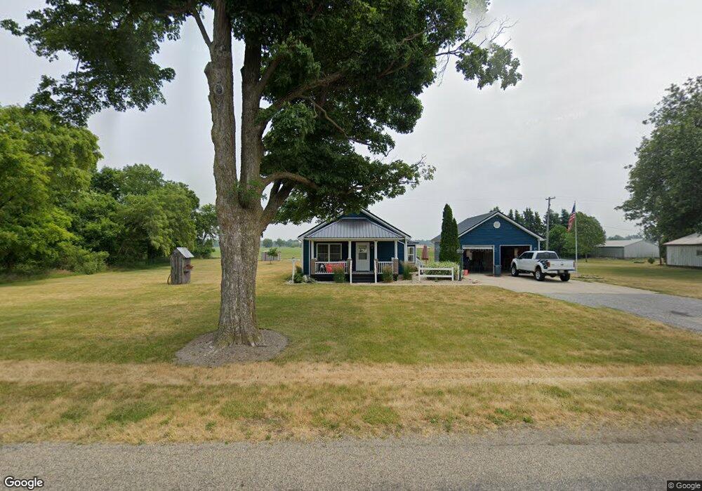
319 S Parham Rd Bronson, MI 49028
Estimated Value: $183,000 - $295,000
3
Beds
2
Baths
2,496
Sq Ft
$91/Sq Ft
Est. Value
About This Home
This home is located at 319 S Parham Rd, Bronson, MI 49028 and is currently estimated at $227,324, approximately $91 per square foot. 319 S Parham Rd is a home located in Branch County with nearby schools including Anderson Elementary School, Ryan Elementary School, and Bronson Junior/Senior High School.
Ownership History
Date
Name
Owned For
Owner Type
Purchase Details
Closed on
Jun 4, 2025
Sold by
Hayes Kathleen
Bought by
Barve Jesse Lee-Lawrence
Current Estimated Value
Purchase Details
Closed on
Dec 15, 2023
Sold by
Hayes Kathleen
Bought by
Hayes Kathleen and Barve Jesse
Purchase Details
Closed on
Jul 24, 2023
Sold by
Hayes Robert
Bought by
Hayes Kathleen
Purchase Details
Closed on
Jul 17, 2017
Sold by
Brooks Edward William
Bought by
Hayes Robert A
Purchase Details
Closed on
Nov 11, 2002
Sold by
Wheaton Deborah A
Bought by
Wheaton Raymond S
Purchase Details
Closed on
Sep 26, 2002
Sold by
Runyon Stephen L and Runyon Nancy
Bought by
Wheaton Raymond S
Create a Home Valuation Report for This Property
The Home Valuation Report is an in-depth analysis detailing your home's value as well as a comparison with similar homes in the area
Purchase History
| Date | Buyer | Sale Price | Title Company |
|---|---|---|---|
| Barve Jesse Lee-Lawrence | -- | None Listed On Document | |
| Hayes Kathleen | -- | None Listed On Document | |
| Hayes Kathleen | -- | None Listed On Document | |
| Hayes Robert A | $113,000 | None Available | |
| Wheaton Raymond S | -- | -- | |
| Wheaton Raymond S | $11,000 | -- |
Source: Public Records
Tax History
| Year | Tax Paid | Tax Assessment Tax Assessment Total Assessment is a certain percentage of the fair market value that is determined by local assessors to be the total taxable value of land and additions on the property. | Land | Improvement |
|---|---|---|---|---|
| 2025 | $2,883 | $91,300 | $0 | $0 |
| 2024 | $6 | $88,600 | $0 | $0 |
| 2023 | $628 | $73,400 | $0 | $0 |
| 2022 | $628 | $77,300 | $0 | $0 |
| 2020 | -- | $70,200 | $0 | $0 |
| 2019 | -- | $62,100 | $0 | $0 |
| 2018 | -- | $53,100 | $0 | $0 |
| 2017 | -- | $54,300 | $0 | $0 |
| 2016 | -- | $53,000 | $0 | $0 |
| 2015 | -- | $48,100 | $0 | $0 |
| 2014 | -- | $40,600 | $0 | $0 |
| 2013 | -- | $46,200 | $0 | $0 |
Source: Public Records
Map
Nearby Homes
- 317 S Parham Rd
- 351 Roosevelt St
- 234 N Lincoln St
- 150 Washington St
- 225 N Lincoln St
- 644 S Matteson St
- 325 N Lincoln St
- 224 S Ruggles St
- 220 N Douglas St
- 410 Franklin St
- 769 Kosmerick Rd
- 0 Bawden Rd
- 368 Cranson Rd
- 141 S Snow Prairie Rd
- 130 Osborn Rd
- 1015 Brink Rd
- 1051 Brink Rd
- 0 Rierson Rd
- 0 Gilead Shores Dr Unit 26003688
- 719 Gilead Shores Dr
Your Personal Tour Guide
Ask me questions while you tour the home.