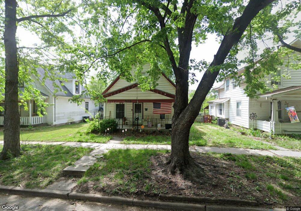
319 SW Orchard St Topeka, KS 66606
Greater Auburndale NeighborhoodEstimated Value: $107,000 - $125,000
3
Beds
1
Bath
1,045
Sq Ft
$114/Sq Ft
Est. Value
About This Home
This home is located at 319 SW Orchard St, Topeka, KS 66606 and is currently estimated at $119,462, approximately $114 per square foot. 319 SW Orchard St is a home located in Shawnee County with nearby schools including Rosenwald Elementary School, Martin Park Elementary School, and Meadows Elementary School.
Ownership History
Date
Name
Owned For
Owner Type
Purchase Details
Closed on
Feb 29, 2012
Sold by
Hussey Pritchard Sheri
Bought by
Pritchard David G
Current Estimated Value
Purchase Details
Closed on
Nov 15, 2006
Sold by
Pritchard David G and Hussey Pritchard Sheri
Bought by
Pritchard David G and Hussey Pritchard Sheri
Home Financials for this Owner
Home Financials are based on the most recent Mortgage that was taken out on this home.
Original Mortgage
$56,500
Outstanding Balance
$33,341
Interest Rate
6.26%
Mortgage Type
New Conventional
Estimated Equity
$86,121
Purchase Details
Closed on
Oct 30, 2006
Sold by
Edwards Renee and Pflaum Donna
Bought by
Pritchard David G
Home Financials for this Owner
Home Financials are based on the most recent Mortgage that was taken out on this home.
Original Mortgage
$56,500
Outstanding Balance
$33,341
Interest Rate
6.26%
Mortgage Type
New Conventional
Estimated Equity
$86,121
Create a Home Valuation Report for This Property
The Home Valuation Report is an in-depth analysis detailing your home's value as well as a comparison with similar homes in the area
Home Values in the Area
Average Home Value in this Area
Purchase History
| Date | Buyer | Sale Price | Title Company |
|---|---|---|---|
| Pritchard David G | -- | None Available | |
| Pritchard David G | -- | Multiple | |
| Pritchard David G | -- | Columbuab Title Of Topeka |
Source: Public Records
Mortgage History
| Date | Status | Borrower | Loan Amount |
|---|---|---|---|
| Open | Pritchard David G | $56,500 | |
| Closed | Pritchard David G | $56,500 |
Source: Public Records
Tax History Compared to Growth
Tax History
| Year | Tax Paid | Tax Assessment Tax Assessment Total Assessment is a certain percentage of the fair market value that is determined by local assessors to be the total taxable value of land and additions on the property. | Land | Improvement |
|---|---|---|---|---|
| 2025 | $1,512 | $11,650 | -- | -- |
| 2023 | $1,512 | $10,571 | $0 | $0 |
| 2022 | $1,329 | $9,192 | $0 | $0 |
| 2021 | $1,233 | $7,993 | $0 | $0 |
| 2020 | $1,159 | $7,612 | $0 | $0 |
| 2019 | $1,142 | $7,462 | $0 | $0 |
| 2018 | $1,109 | $7,245 | $0 | $0 |
| 2017 | $1,112 | $7,245 | $0 | $0 |
| 2014 | $1,171 | $7,544 | $0 | $0 |
Source: Public Records
Map
Nearby Homes
- 200 SW Orchard St
- 208 SW MacVicar Ave
- 700 SW Roosevelt St
- 2235 SW Kenilworth Ct
- 348 SW Jewell Ave
- 626 SW Medford Ave
- 1830 SW Willow Ave
- 719 SW Jewell Ave
- 734 SW Lindenwood Ave
- 618 SW Randolph Ave
- 808 SW Lindenwood Ave
- 614 SW Webster Ave
- 0000 SW Elmwood Ave Unit Lots 5,6 Laurel Park
- 801 SW Wayne Ave
- 2330 SW Hazelton Ct
- 312 SW Elmwood Ave
- 3005 SW 6th Ave Unit 6th
- 2204 SW Kensington Ct
- 923 SW High Ave
- 2012 SW 10th Ave
- 321 SW Orchard St
- 317 SW Orchard St
- 323 SW Orchard St
- 315 SW Orchard St
- 335 SW Orchard St
- 2414 SW 3rd St
- 311 SW Orchard St
- 307 SW Orchard St
- 320 SW Orchard St
- 318 SW Orchard St
- 314 SW Orchard St
- 312 SW Orchard St
- 334 SW Orchard St
- 303 SW Orchard St
- 401 SW Orchard St
- 310 SW Orchard St
- 336 SW Orchard St
- 2415 SW 3rd St
- 2419 SW Duane St
- 301 SW Orchard St