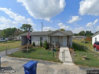
3197 B Ave Columbus, OH 43207
Far South NeighborhoodEstimated Value: $168,000 - $190,000
2
Beds
1
Bath
1,083
Sq Ft
$167/Sq Ft
Est. Value
About This Home
This home is located at 3197 B Ave, Columbus, OH 43207 and is currently estimated at $181,307, approximately $167 per square foot. 3197 B Ave is a home located in Franklin County with nearby schools including Parsons Elementary School, Buckeye Middle School, and Marion-Franklin High School.
Ownership History
Date
Name
Owned For
Owner Type
Purchase Details
Closed on
Nov 30, 2018
Sold by
Mcclung Vickie L and Mcclung Donald Haven
Bought by
Mcclung Vickie L
Current Estimated Value
Purchase Details
Closed on
Apr 16, 2009
Sold by
Mcclung Donald H and Mcclung Vickie L
Bought by
Mcclung Donald H and Mcclung Vickie L
Purchase Details
Closed on
Jul 9, 1985
Bought by
Mcclung Donald H
Purchase Details
Closed on
Dec 1, 1983
Create a Home Valuation Report for This Property
The Home Valuation Report is an in-depth analysis detailing your home's value as well as a comparison with similar homes in the area
Home Values in the Area
Average Home Value in this Area
Purchase History
| Date | Buyer | Sale Price | Title Company |
|---|---|---|---|
| Mcclung Vickie L | -- | None Available | |
| Mcclung Donald H | -- | Attorney | |
| Mcclung Donald H | -- | -- | |
| -- | -- | -- |
Source: Public Records
Mortgage History
| Date | Status | Borrower | Loan Amount |
|---|---|---|---|
| Open | Mcclung Donald H | $50,000 | |
| Closed | Mcclung Donald H | $49,533 | |
| Closed | Mcclung Donald H | $54,791 | |
| Closed | Mcclung Donald H | $61,600 | |
| Closed | Mcclung Donald H | $52,000 | |
| Closed | Mcclung Donald H | $50,000 | |
| Closed | Mcclung Donald H | $40,000 |
Source: Public Records
Tax History Compared to Growth
Tax History
| Year | Tax Paid | Tax Assessment Tax Assessment Total Assessment is a certain percentage of the fair market value that is determined by local assessors to be the total taxable value of land and additions on the property. | Land | Improvement |
|---|---|---|---|---|
| 2024 | $2,418 | $53,870 | $11,690 | $42,180 |
| 2023 | $2,387 | $53,865 | $11,690 | $42,175 |
| 2022 | $1,044 | $20,130 | $6,440 | $13,690 |
| 2021 | $1,046 | $20,130 | $6,440 | $13,690 |
| 2020 | $1,047 | $20,130 | $6,440 | $13,690 |
| 2019 | $1,019 | $16,800 | $5,600 | $11,200 |
| 2018 | $565 | $16,800 | $5,600 | $11,200 |
| 2017 | $488 | $16,800 | $5,600 | $11,200 |
| 2016 | $707 | $19,430 | $1,120 | $18,310 |
| 2015 | $642 | $19,430 | $1,120 | $18,310 |
| 2014 | $644 | $19,430 | $1,120 | $18,310 |
| 2013 | $348 | $20,440 | $1,190 | $19,250 |
Source: Public Records
Map
Nearby Homes
- 3197 E Ave
- 1633-1635 E Greenway Ave
- 3161 Lewis Rd
- 0 F Ave Unit 224036459
- 3128 Parsons Ave
- 3070 Parsons Ave
- 623 Colton Rd
- 780 Basswood Rd
- 245 Marilla Rd
- 273 E Alcott Rd
- 2852 Thorndale Ave
- 82 Schryver Rd
- 370 Chatterly Ln
- 358 Chatterly Ln
- 0 Thorndale Ave
- 78 Phelps Rd
- 0 Parsons Ave Unit 225012522
- 2811 Dolby Dr
- 2806 Claude Dr
- 1118 Maplewood Rd