Estimated Value: $740,227
--
Bed
2
Baths
6,000
Sq Ft
$123/Sq Ft
Est. Value
About This Home
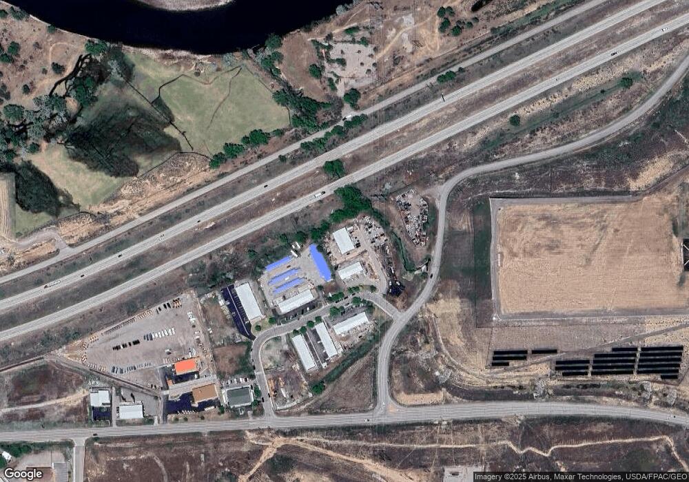
This home is located at 3198 Baron Ln, Rifle, CO 81650 and is currently estimated at $740,227, approximately $123 per square foot. 3198 Baron Ln is a home located in Garfield County with nearby schools including Highland Elementary School, Rifle Middle School, and Rifle High School.
Ownership History
Date
Name
Owned For
Owner Type
Purchase Details
Closed on
Mar 14, 2018
Sold by
Baron Lane West Llc
Bought by
Pba Associates Llc
Current Estimated Value
Purchase Details
Closed on
Aug 14, 2012
Sold by
Baron Lane Llc
Bought by
Baron Lane West Llc
Purchase Details
Closed on
Jul 28, 2006
Sold by
Levinson Dan and Levinson Lynne
Bought by
Baron Lane Llc
Purchase Details
Closed on
Sep 27, 2005
Sold by
Empty Enterprises Llc
Bought by
Levinson Dan and Levinson Lynne
Create a Home Valuation Report for This Property
The Home Valuation Report is an in-depth analysis detailing your home's value as well as a comparison with similar homes in the area
Home Values in the Area
Average Home Value in this Area
Purchase History
| Date | Buyer | Sale Price | Title Company |
|---|---|---|---|
| Pba Associates Llc | $480,000 | Commonwealth Title | |
| Baron Lane West Llc | -- | None Available | |
| Baron Lane Llc | -- | None Available | |
| Levinson Dan | $1,100,000 | -- |
Source: Public Records
Tax History Compared to Growth
Tax History
| Year | Tax Paid | Tax Assessment Tax Assessment Total Assessment is a certain percentage of the fair market value that is determined by local assessors to be the total taxable value of land and additions on the property. | Land | Improvement |
|---|---|---|---|---|
| 2024 | -- | $161,350 | $98,340 | $63,010 |
| 2023 | $10,645 | $161,350 | $98,340 | $63,010 |
| 2022 | $10,345 | $146,120 | $54,430 | $91,690 |
| 2021 | $11,566 | $146,120 | $54,430 | $91,690 |
| 2020 | $10,307 | $142,450 | $54,430 | $88,020 |
| 2019 | $9,748 | $142,450 | $54,430 | $88,020 |
| 2018 | $6,771 | $96,710 | $69,000 | $27,710 |
| 2017 | $6,111 | $96,710 | $69,000 | $27,710 |
| 2016 | $6,354 | $114,060 | $80,500 | $33,560 |
| 2015 | $5,867 | $114,060 | $80,500 | $33,560 |
| 2014 | -- | $119,220 | $89,240 | $29,980 |
Source: Public Records
Map
Nearby Homes
- 2135 Airport Rd
- 1797 County Road 346
- Tbd Blacktail Dr
- TBD Cty Rd 319 ''Cmc West Parcel''
- 27653 Highway 6 Unit 310
- 756 Airport Rd
- 756 Airport Rd Unit 9 AC
- TBD Cty Rd 346 ''Moose Pasture''
- TBD Cty Rd 352 ''Adj Airport Nw''
- 1626 Dogwood Dr
- 1553 E 12th St
- 1108 Hickory Dr
- 1546 E 12th St
- 83 Native Springs Dr
- 1401 E Spruce Ct
- 545 County Road 352
- 530 Birch Ct
- 1433 Jays Ave
- 203 Native Springs Dr
- 1458 E 12th St
- 3160 Baron Ln
- 3186 Baron Ln
- 3158 Baron Ln Unit D
- 3158 Baron Ln
- 3158 Baron Ln Unit s A thru F
- 3158 Baron Ln Unit s D, E & F
- 3158 Baron Ln Unit C
- 3161 Baron Ln
- 3161 Baron Ln Unit Parcel 11, Units A t
- 3161 Baron Ln Unit D
- 3125 Baron Ln
- TBD Baron Ln Unit Lot 9
- TBD Baron Ln Unit Lot 10
- 3136 Baron Ln Unit B
- 3136 Baron Ln Unit A
- 3136 Baron Ln
- 3136 Baron Ln Unit F
- 3136 Baron Ln Unit E, F
- 3136 Baron Ln Unit B
- 3147 Baron Ln
