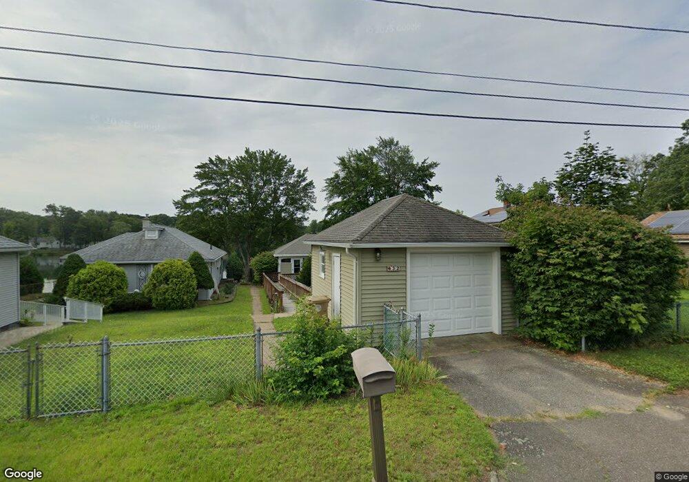
32 Beachside Dr Ludlow, MA 01056
Estimated Value: $321,000 - $360,000
2
Beds
1
Bath
1,008
Sq Ft
$334/Sq Ft
Est. Value
About This Home
This home is located at 32 Beachside Dr, Ludlow, MA 01056 and is currently estimated at $336,186, approximately $333 per square foot. 32 Beachside Dr is a home located in Hampden County with nearby schools including East Street Elementary School, Chapin Street Elementary School, and Paul R. Baird Middle School.
Ownership History
Date
Name
Owned For
Owner Type
Purchase Details
Closed on
Oct 12, 2017
Sold by
Lapanne Jean F Est and Wilkinson
Bought by
Simard Christine A and Simard Timothy J
Current Estimated Value
Home Financials for this Owner
Home Financials are based on the most recent Mortgage that was taken out on this home.
Original Mortgage
$164,000
Outstanding Balance
$136,325
Interest Rate
3.82%
Mortgage Type
New Conventional
Estimated Equity
$199,861
Purchase Details
Closed on
Apr 20, 1999
Sold by
Almeida Elizabeth E
Bought by
Lapanne Thomas A and Lapanne Jean F
Home Financials for this Owner
Home Financials are based on the most recent Mortgage that was taken out on this home.
Original Mortgage
$85,000
Interest Rate
7.04%
Mortgage Type
Purchase Money Mortgage
Create a Home Valuation Report for This Property
The Home Valuation Report is an in-depth analysis detailing your home's value as well as a comparison with similar homes in the area
Home Values in the Area
Average Home Value in this Area
Purchase History
| Date | Buyer | Sale Price | Title Company |
|---|---|---|---|
| Simard Christine A | $182,360 | -- | |
| Simard Christine A | $182,360 | -- | |
| Lapanne Thomas A | $125,300 | -- | |
| Lapanne Thomas A | $125,300 | -- |
Source: Public Records
Mortgage History
| Date | Status | Borrower | Loan Amount |
|---|---|---|---|
| Open | Simard Christine A | $164,000 | |
| Closed | Simard Christine A | $164,000 | |
| Previous Owner | Lapanne Thomas A | $85,000 |
Source: Public Records
Tax History
| Year | Tax Paid | Tax Assessment Tax Assessment Total Assessment is a certain percentage of the fair market value that is determined by local assessors to be the total taxable value of land and additions on the property. | Land | Improvement |
|---|---|---|---|---|
| 2025 | $4,537 | $261,500 | $110,100 | $151,400 |
| 2024 | $4,421 | $244,400 | $110,100 | $134,300 |
| 2023 | $4,066 | $208,400 | $91,600 | $116,800 |
| 2022 | $3,928 | $196,500 | $91,600 | $104,900 |
| 2021 | $3,980 | $188,800 | $91,600 | $97,200 |
| 2020 | $3,817 | $185,100 | $90,200 | $94,900 |
| 2019 | $3,554 | $179,300 | $89,300 | $90,000 |
| 2018 | $3,350 | $176,200 | $89,300 | $86,900 |
| 2017 | $3,300 | $178,100 | $90,900 | $87,200 |
| 2016 | $3,118 | $172,000 | $89,100 | $82,900 |
| 2015 | $2,931 | $169,500 | $88,200 | $81,300 |
Source: Public Records
Map
Nearby Homes
- 84 Chapin Greene Dr
- 70 Sroka Ln
- 517 Ideal Ln Unit 401
- 676 Chapin St
- 102 Swan Ave
- 259 Prospect St
- 665 Center St Unit 706
- 98 Fuller St Unit 32
- 37 Waters Edge Unit 37
- 162 Highland Ave
- 0 Fuller St Unit 73409741
- 31 Greenwich St
- 350 West Ave Unit 5
- '0' Rood St
- 59 Prospect St
- 63 Oak St
- 374 East St
- 287 East St
- 57 Belmont St
- 39 Rogers Ave
- 42 Beachside Dr
- 28 Beachside Dr
- 22 Beachside Dr
- 54 Beachside Dr
- 27 Beachside Dr
- 56 Beachside Dr
- 20 Beachside Dr
- 542 Center St
- 47 Beachside Dr
- 55 Beachside Dr
- 19 Beachside Dr
- 58 Beachside Dr
- 546 1/2 Center St
- 556 Center St
- 597 Chapin St
- 9 Beachside Dr
- 605 Chapin St
- 61 Beachside Dr
- 607 Chapin St
- 60 Beachside Dr
Your Personal Tour Guide
Ask me questions while you tour the home.