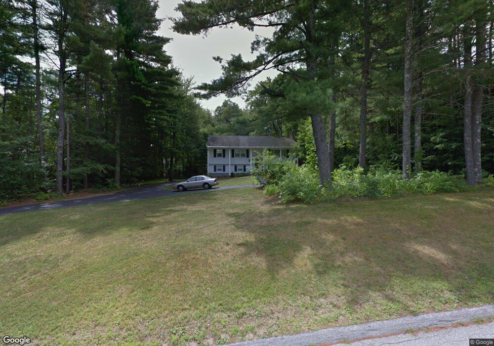
32 Briar Rd Bedford, NH 03110
Bedford NeighborhoodEstimated Value: $506,000 - $581,000
3
Beds
2
Baths
1,222
Sq Ft
$441/Sq Ft
Est. Value
About This Home
This home is located at 32 Briar Rd, Bedford, NH 03110 and is currently estimated at $538,584, approximately $440 per square foot. 32 Briar Rd is a home located in Hillsborough County with nearby schools including Mckelvie Intermediate School, Ross A. Lurgio Middle School, and Bedford High School.
Ownership History
Date
Name
Owned For
Owner Type
Purchase Details
Closed on
Sep 17, 2013
Sold by
Watson Bristow P and Watson Jane R
Bought by
Jane and Bristow T
Current Estimated Value
Purchase Details
Closed on
Sep 8, 2006
Sold by
Abdi Hashir V and Abdi Julie L
Bought by
Watson Bristow P and Watson Jane R
Home Financials for this Owner
Home Financials are based on the most recent Mortgage that was taken out on this home.
Original Mortgage
$248,000
Interest Rate
6.79%
Mortgage Type
Purchase Money Mortgage
Purchase Details
Closed on
Jun 21, 1999
Sold by
Kaplan Joseph T and Kaplan Kaoru E
Bought by
Abdi Hashir V and Abdi Julie L
Home Financials for this Owner
Home Financials are based on the most recent Mortgage that was taken out on this home.
Original Mortgage
$147,250
Interest Rate
6.99%
Create a Home Valuation Report for This Property
The Home Valuation Report is an in-depth analysis detailing your home's value as well as a comparison with similar homes in the area
Home Values in the Area
Average Home Value in this Area
Purchase History
| Date | Buyer | Sale Price | Title Company |
|---|---|---|---|
| Jane | -- | -- | |
| Watson Bristow P | $310,000 | -- | |
| Abdi Hashir V | $159,900 | -- |
Source: Public Records
Mortgage History
| Date | Status | Borrower | Loan Amount |
|---|---|---|---|
| Previous Owner | Abdi Hashir V | $248,000 | |
| Previous Owner | Abdi Hashir V | $50,000 | |
| Previous Owner | Abdi Hashir V | $147,250 |
Source: Public Records
Tax History Compared to Growth
Tax History
| Year | Tax Paid | Tax Assessment Tax Assessment Total Assessment is a certain percentage of the fair market value that is determined by local assessors to be the total taxable value of land and additions on the property. | Land | Improvement |
|---|---|---|---|---|
| 2024 | $7,080 | $447,800 | $236,500 | $211,300 |
| 2023 | $6,627 | $447,800 | $236,500 | $211,300 |
| 2022 | $6,141 | $348,900 | $175,100 | $173,800 |
| 2021 | $5,980 | $348,900 | $175,100 | $173,800 |
| 2020 | $5,852 | $292,300 | $134,600 | $157,700 |
| 2019 | $5,539 | $292,300 | $134,600 | $157,700 |
| 2018 | $5,461 | $267,700 | $134,600 | $133,100 |
| 2017 | $5,062 | $267,700 | $134,600 | $133,100 |
| 2016 | $5,123 | $229,000 | $107,600 | $121,400 |
| 2015 | $5,212 | $229,000 | $107,600 | $121,400 |
| 2014 | $5,153 | $229,000 | $107,600 | $121,400 |
| 2013 | $5,077 | $229,000 | $107,600 | $121,400 |
Source: Public Records
Map
Nearby Homes
- 3 Westview Rd Unit Lot 3 - The Saffron
- 4 Westview Rd Unit Lot 4 - Hannah Floor
- 32 Wellesley Dr
- 10 Roosevelt Dr
- 60 Riddle Dr
- 17-4-28 Boiling Kettle Way
- 17-4-28 Boiling Kettle Way Unit 28
- 7 Hamilton Way
- 217 N Amherst Rd
- 4 Jenkins Rd Unit Lot 31-4 - The Hann
- 44-9 Olympus Way
- 20 Ledgewood Rd
- 52 Hardy Rd
- 155 Wallace Rd
- 150 Wallace Rd
- 258 N Amherst Rd Unit 34
- 74 Settlers Ct
- 38 Christmas Tree Cir
- 38 Old Farm Rd
- 7 Shepherd Hill Rd