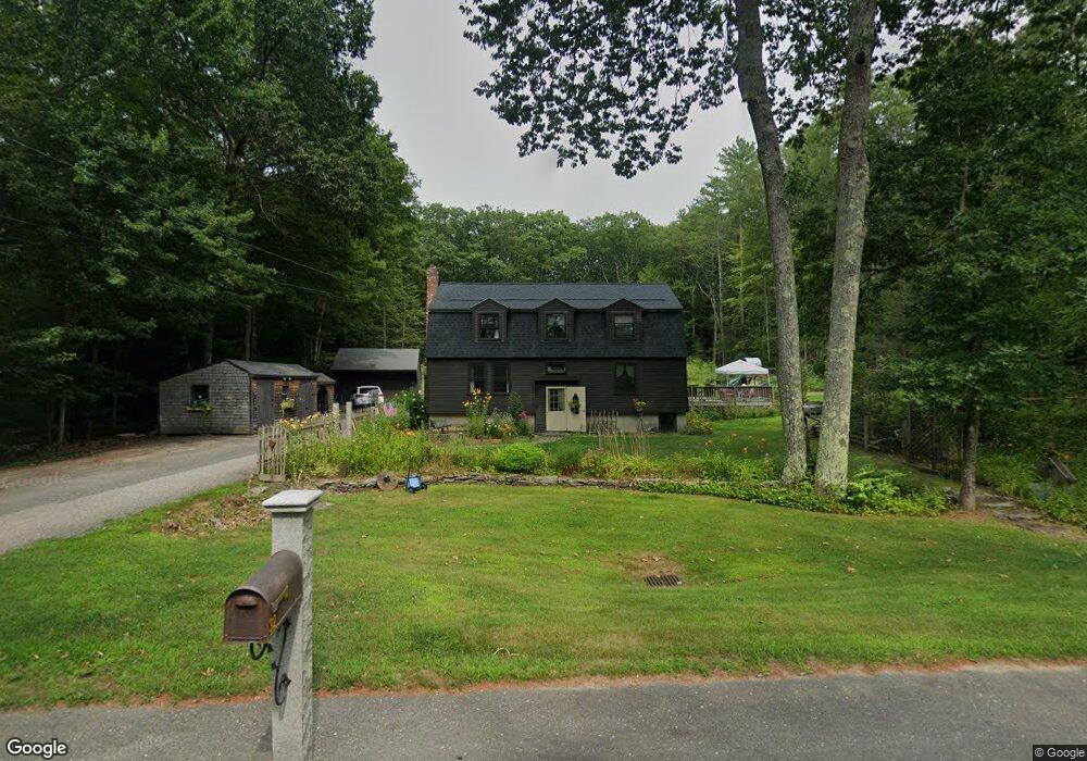
32 Burnshirt Rd Hubbardston, MA 01452
Estimated Value: $369,000 - $614,000
4
Beds
2
Baths
1,684
Sq Ft
$284/Sq Ft
Est. Value
About This Home
This home is located at 32 Burnshirt Rd, Hubbardston, MA 01452 and is currently estimated at $477,849, approximately $283 per square foot. 32 Burnshirt Rd is a home located in Worcester County with nearby schools including Quabbin Regional Middle School and Quabbin Regional High School.
Create a Home Valuation Report for This Property
The Home Valuation Report is an in-depth analysis detailing your home's value as well as a comparison with similar homes in the area
Home Values in the Area
Average Home Value in this Area
Tax History Compared to Growth
Tax History
| Year | Tax Paid | Tax Assessment Tax Assessment Total Assessment is a certain percentage of the fair market value that is determined by local assessors to be the total taxable value of land and additions on the property. | Land | Improvement |
|---|---|---|---|---|
| 2025 | $4,361 | $373,400 | $38,800 | $334,600 |
| 2024 | $4,421 | $375,000 | $36,400 | $338,600 |
| 2023 | $3,715 | $285,100 | $31,900 | $253,200 |
| 2022 | $3,991 | $285,100 | $31,900 | $253,200 |
| 2021 | $4,009 | $270,700 | $31,900 | $238,800 |
| 2020 | $3,947 | $266,300 | $31,900 | $234,400 |
| 2019 | $3,899 | $256,200 | $46,500 | $209,700 |
| 2018 | $583 | $246,000 | $46,500 | $199,500 |
| 2017 | $3,747 | $246,000 | $46,500 | $199,500 |
| 2016 | $3,225 | $202,800 | $46,500 | $156,300 |
| 2015 | $3,270 | $219,200 | $46,500 | $172,700 |
| 2014 | $3,183 | $219,200 | $46,500 | $172,700 |
Source: Public Records
Map
Nearby Homes
- 30 Burnshirt Rd
- 34 Burnshirt Rd
- 1 Burnshirt Rd
- 1 Thompson Rd
- 36 Williamsville Templeton Rd
- 36 Burnshirt Rd
- 7 Thompson Rd
- 7 Thompson Rd
- 38 Burnshirt Rd
- 35 Burnshirt Rd
- 35 Burnshirt Rd Unit 35A
- 35 Burnshirt Rd
- 2 Thompson Rd
- 4 Thompson Rd
- 6 Thompson Rd
- 9 Thompson Rd
- 8 Thompson Rd
- 14 Grove St
- 10 Thompson Rd
- 19 Burnshirt Rd