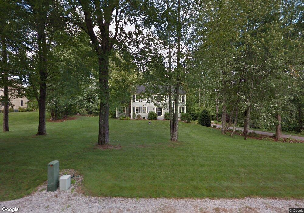
32 Christmas Tree Cir Bedford, NH 03110
Bedford NeighborhoodEstimated Value: $900,000 - $946,000
4
Beds
4
Baths
3,166
Sq Ft
$291/Sq Ft
Est. Value
About This Home
This home is located at 32 Christmas Tree Cir, Bedford, NH 03110 and is currently estimated at $920,967, approximately $290 per square foot. 32 Christmas Tree Cir is a home located in Hillsborough County with nearby schools including Mckelvie Intermediate School, Ross A. Lurgio Middle School, and Bedford High School.
Ownership History
Date
Name
Owned For
Owner Type
Purchase Details
Closed on
Mar 11, 2022
Sold by
Edwards Colleen and Edwards Bryan D
Bought by
Edwards Ft 2022
Current Estimated Value
Purchase Details
Closed on
Jul 16, 1998
Sold by
Kelley Stephen J and Kelley Elizabeth
Bought by
Edwards Colleen and Edwards Bryan D
Create a Home Valuation Report for This Property
The Home Valuation Report is an in-depth analysis detailing your home's value as well as a comparison with similar homes in the area
Home Values in the Area
Average Home Value in this Area
Purchase History
| Date | Buyer | Sale Price | Title Company |
|---|---|---|---|
| Edwards Ft 2022 | -- | None Available | |
| Edwards Colleen | $210,900 | -- |
Source: Public Records
Mortgage History
| Date | Status | Borrower | Loan Amount |
|---|---|---|---|
| Previous Owner | Edwards Colleen | $268,000 | |
| Previous Owner | Edwards Colleen | $280,000 | |
| Previous Owner | Edwards Colleen | $298,000 | |
| Previous Owner | Edwards Colleen | $310,000 |
Source: Public Records
Tax History Compared to Growth
Tax History
| Year | Tax Paid | Tax Assessment Tax Assessment Total Assessment is a certain percentage of the fair market value that is determined by local assessors to be the total taxable value of land and additions on the property. | Land | Improvement |
|---|---|---|---|---|
| 2024 | $12,934 | $818,100 | $271,500 | $546,600 |
| 2023 | $12,108 | $818,100 | $271,500 | $546,600 |
| 2022 | $10,996 | $624,800 | $201,300 | $423,500 |
| 2021 | $10,709 | $624,800 | $201,300 | $423,500 |
| 2020 | $10,062 | $502,600 | $154,700 | $347,900 |
| 2019 | $9,524 | $502,600 | $154,700 | $347,900 |
| 2018 | $7,774 | $415,300 | $154,700 | $260,600 |
| 2017 | $7,943 | $415,300 | $154,700 | $260,600 |
| 2016 | $8,013 | $358,200 | $123,800 | $234,400 |
| 2015 | $8,153 | $358,200 | $123,800 | $234,400 |
| 2014 | $8,060 | $358,200 | $123,800 | $234,400 |
| 2013 | $7,498 | $338,200 | $123,800 | $214,400 |
Source: Public Records
Map
Nearby Homes
- 38 Christmas Tree Cir
- 20 Ledgewood Rd
- 7 Shepherd Hill Rd
- 4 Jenkins Rd Unit Lot 31-4 - The Hann
- 40 Seton Dr
- 150 Wallace Rd
- 155 Wallace Rd
- 52 Hardy Rd
- 44 McQuade Brook Rd
- 36 Summit Rd
- 56 Greenfield Pkwy
- 20 Summit Rd
- 10 Roosevelt Dr
- 7 Hamilton Way
- 16 Summit Rd
- 11 Beaver Ln
- 258 N Amherst Rd Unit 34
- 3 Westview Rd Unit Lot 3 - The Saffron
- 197 Liberty Hill Rd
- 4 Westview Rd Unit Lot 4 - Hannah Floor
- 29 Christmas Tree Cir
- 28 Christmas Tree Cir
- 6 Arbor Ln
- 24 Christmas Tree Cir
- 34 Christmas Tree Cir
- 23 Christmas Tree Cir
- 37 Christmas Tree Cir
- 42 Jenkins Rd
- 20 Christmas Tree Cir
- 7 Arbor Ln
- 38 Jenkins Rd
- 10 Arbor Ln
- 40 Christmas Tree Cir
- 15 Christmas Tree Cir
- 16 Christmas Tree Cir
- 125 Brick Mill Rd
- 129 Brick Mill Rd
- 121 Brick Mill Rd
- 117 Brick Mill Rd
- 151 Brick Mill Rd