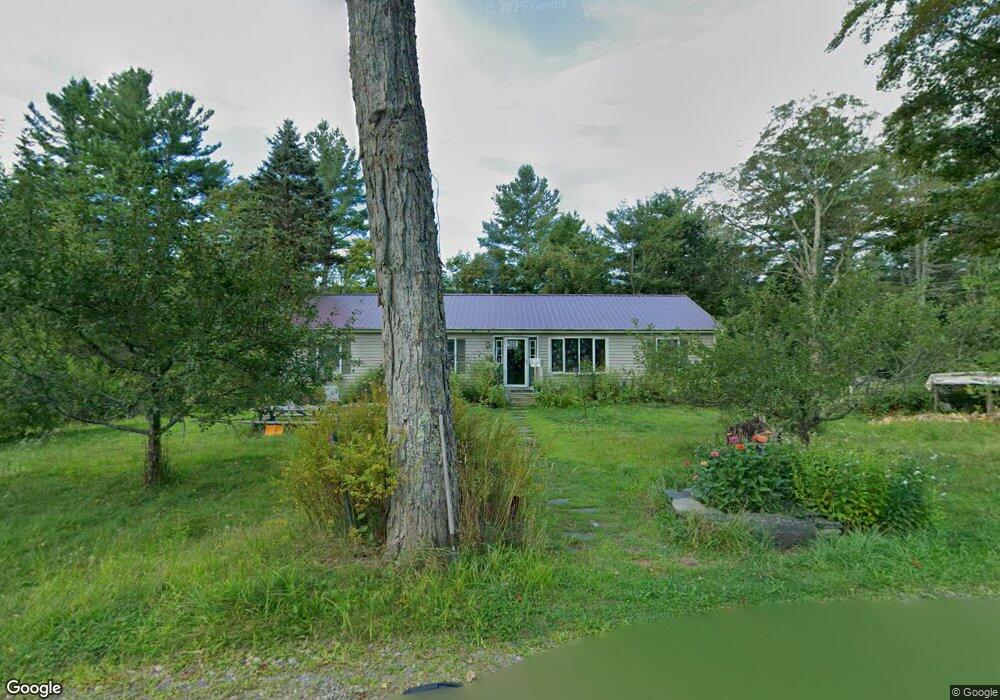
32 Corbett Rd Worthington, MA 01098
Estimated Value: $366,000 - $509,000
3
Beds
2
Baths
1,508
Sq Ft
$280/Sq Ft
Est. Value
About This Home
This home is located at 32 Corbett Rd, Worthington, MA 01098 and is currently estimated at $422,543, approximately $280 per square foot. 32 Corbett Rd is a home located in Hampshire County with nearby schools including Gateway Regional High School.
Ownership History
Date
Name
Owned For
Owner Type
Purchase Details
Closed on
Nov 23, 1999
Sold by
Brodrick Brenda L and Brodrick Robert N
Bought by
Breymann Margaret E
Current Estimated Value
Home Financials for this Owner
Home Financials are based on the most recent Mortgage that was taken out on this home.
Original Mortgage
$100,000
Interest Rate
7.76%
Mortgage Type
Purchase Money Mortgage
Create a Home Valuation Report for This Property
The Home Valuation Report is an in-depth analysis detailing your home's value as well as a comparison with similar homes in the area
Home Values in the Area
Average Home Value in this Area
Purchase History
| Date | Buyer | Sale Price | Title Company |
|---|---|---|---|
| Breymann Margaret E | $143,500 | -- |
Source: Public Records
Mortgage History
| Date | Status | Borrower | Loan Amount |
|---|---|---|---|
| Open | Breymann Margaret E | $93,000 | |
| Closed | Breymann Margaret E | $100,000 | |
| Previous Owner | Breymann Margaret E | $112,500 |
Source: Public Records
Tax History Compared to Growth
Tax History
| Year | Tax Paid | Tax Assessment Tax Assessment Total Assessment is a certain percentage of the fair market value that is determined by local assessors to be the total taxable value of land and additions on the property. | Land | Improvement |
|---|---|---|---|---|
| 2025 | $4,547 | $329,699 | $58,799 | $270,900 |
| 2024 | $4,377 | $302,923 | $51,723 | $251,200 |
| 2023 | $4,030 | $270,285 | $51,885 | $218,400 |
| 2022 | $3,892 | $242,647 | $52,047 | $190,600 |
| 2021 | $4,011 | $244,400 | $82,400 | $162,000 |
| 2020 | $4,206 | $244,400 | $82,400 | $162,000 |
| 2019 | $4,116 | $252,500 | $90,500 | $162,000 |
| 2018 | $3,898 | $246,400 | $90,500 | $155,900 |
| 2017 | $3,965 | $239,000 | $93,900 | $145,100 |
| 2016 | $3,211 | $199,960 | $54,860 | $145,100 |
| 2015 | $2,787 | $199,940 | $54,840 | $145,100 |
Source: Public Records
Map
Nearby Homes
- 90 Williamsburg Rd
- 19 Buffington Hill Rd
- 138 Ridge Rd
- LOT 1 Thayer Hill Rd
- 0 Thayer Hill Rd
- 54 Porter Hill Rd
- 458 Old Rd N
- 23 E Windsor Rd
- 527 Old Post Rd
- 155 River Rd
- 237 Trouble St
- lot 20 Parish Rd
- 204 Ireland St
- 130 Prentice Rd
- 510 Main Rd
- 00 Yale Rd
- 31 North Rd
- 0 Pynchon Rd Unit 73402258
- lot 16 Pierce Rd
- lot 18 Pierce Rd
- 22 Corbett Rd
- 7 Corbett Rd
- 102 Clark Rd
- 15 Clark Rd
- 0 Williamsburg Rd
- 166 Williamsburg Rd
- 210 Williamsburg Rd
- 199 Williamsburg Rd
- 213 Williamsburg Rd
- 232 Williamsburg Rd
- 136 Williamsburg Rd
- 235 Williamsburg Rd
- 242 Williamsburg Rd
- 113 Williamsburg Rd
- 110 Capen St
- 245 Williamsburg Rd
- 260 Williamsburg Rd
- - Thayer Hill Rd
- LOT 31 Parish Rd
- LOT 1 Ridge Rd