Estimated Value: $607,000 - $650,000
4
Beds
3
Baths
2,054
Sq Ft
$304/Sq Ft
Est. Value
About This Home
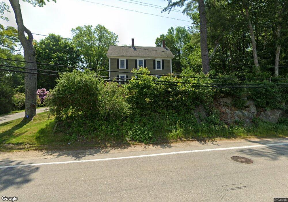
This home is located at 32 Durham Rd, Dover, NH 03820 and is currently estimated at $624,648, approximately $304 per square foot. 32 Durham Rd is a home located in Strafford County with nearby schools including Woodman Park School, Dover Middle School, and Dover Senior High School.
Ownership History
Date
Name
Owned For
Owner Type
Purchase Details
Closed on
Aug 28, 2024
Sold by
Whitehead-Hadley Cara L
Bought by
Hadley Ft and Hadley
Current Estimated Value
Purchase Details
Closed on
May 25, 1999
Sold by
Etelman Est Ann G
Bought by
Hadley Cara W
Create a Home Valuation Report for This Property
The Home Valuation Report is an in-depth analysis detailing your home's value as well as a comparison with similar homes in the area
Home Values in the Area
Average Home Value in this Area
Purchase History
| Date | Buyer | Sale Price | Title Company |
|---|---|---|---|
| Hadley Ft | -- | None Available | |
| Hadley Ft | -- | None Available | |
| Hadley Cara W | $145,000 | -- | |
| Hadley Cara W | $145,000 | -- |
Source: Public Records
Mortgage History
| Date | Status | Borrower | Loan Amount |
|---|---|---|---|
| Previous Owner | Hadley Cara W | $46,000 | |
| Previous Owner | Hadley Cara W | $200,000 | |
| Previous Owner | Hadley Cara W | $210,000 |
Source: Public Records
Tax History
| Year | Tax Paid | Tax Assessment Tax Assessment Total Assessment is a certain percentage of the fair market value that is determined by local assessors to be the total taxable value of land and additions on the property. | Land | Improvement |
|---|---|---|---|---|
| 2024 | $10,470 | $576,200 | $203,200 | $373,000 |
| 2023 | $8,802 | $470,700 | $179,600 | $291,100 |
| 2022 | $8,868 | $447,000 | $179,600 | $267,400 |
| 2021 | $8,324 | $383,600 | $151,200 | $232,400 |
| 2020 | $8,491 | $341,700 | $151,200 | $190,500 |
| 2019 | $8,157 | $323,800 | $137,100 | $186,700 |
| 2018 | $7,581 | $304,200 | $122,900 | $181,300 |
| 2017 | $7,244 | $280,000 | $104,000 | $176,000 |
| 2016 | $6,864 | $261,100 | $94,500 | $166,600 |
| 2015 | $6,464 | $242,900 | $80,400 | $162,500 |
| 2014 | $6,404 | $246,200 | $80,400 | $165,800 |
| 2011 | $5,476 | $218,000 | $74,900 | $143,100 |
Source: Public Records
Map
Nearby Homes
- 16 Porch Light Dr Unit 2
- 12 Zeland Dr
- 53-55 Cataract Ave
- 13 Stark Ave
- 20 Lenox Dr Unit c
- 22 Lenox Dr Unit D
- 29 Lenox Dr Unit B
- 16 Lenox Dr Unit C
- 26 Lenox Dr Unit D
- 15 Lenox Dr Unit A
- 23 Lenox Dr Unit A
- Lot 5 Emerson Ridge Unit 5
- 99 Back River Rd
- 181 Central Ave
- 98 Silver St
- 136 Locust St Unit 101
- 79 Silver St
- 64 Danielle Ln
- 6 Hayden Dr
- 15 Teresa Dr
- 55 Durham Rd
- 28 Durham Rd
- 22 Durham Rd
- 59 Durham Rd Unit 19
- 67 Durham Rd
- 16 Durham Rd
- 14 the Garrison Unit 14
- 42 the Garrison #42 Unit 42
- 56 the Garrison at 56 Durham Rd Unit 56
- 69 Durham Rd
- 64 Durham Rd
- 56 Durham Rd Unit 52
- 56 Durham Rd Unit 9
- 56 Durham Rd Unit 8
- 56 Durham Rd Unit 7
- 56 Durham Rd Unit 62
- 56 Durham Rd Unit 61
- 56 Durham Rd Unit 60
- 56 Durham Rd Unit 6
- 56 Durham Rd Unit 59
Your Personal Tour Guide
Ask me questions while you tour the home.