Estimated Value: $192,417 - $220,000
3
Beds
1
Bath
1,092
Sq Ft
$191/Sq Ft
Est. Value
About This Home
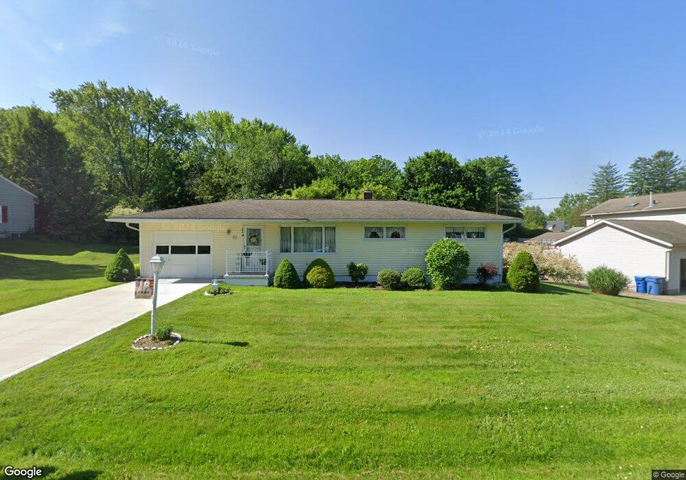
This home is located at 32 E Wellock Dr, Akron, OH 44319 and is currently estimated at $208,104, approximately $190 per square foot. 32 E Wellock Dr is a home located in Summit County with nearby schools including Coventry Middle School, Coventry High School, and St. Francis de Sales School.
Ownership History
Date
Name
Owned For
Owner Type
Purchase Details
Closed on
Jun 26, 2015
Sold by
Combus Betty Lou
Bought by
Combs Family Irrevocable Trust
Current Estimated Value
Purchase Details
Closed on
Jul 25, 1997
Sold by
Carlson Vera J
Bought by
Combs Betty L
Home Financials for this Owner
Home Financials are based on the most recent Mortgage that was taken out on this home.
Original Mortgage
$22,000
Outstanding Balance
$3,240
Interest Rate
7.81%
Mortgage Type
New Conventional
Estimated Equity
$204,864
Purchase Details
Closed on
Nov 8, 1995
Sold by
Dameff Veronica
Bought by
Carlson Vera J
Create a Home Valuation Report for This Property
The Home Valuation Report is an in-depth analysis detailing your home's value as well as a comparison with similar homes in the area
Home Values in the Area
Average Home Value in this Area
Purchase History
| Date | Buyer | Sale Price | Title Company |
|---|---|---|---|
| Combs Family Irrevocable Trust | -- | None Available | |
| Combs Betty L | $97,000 | -- | |
| Carlson Vera J | $85,000 | -- |
Source: Public Records
Mortgage History
| Date | Status | Borrower | Loan Amount |
|---|---|---|---|
| Open | Combs Betty L | $22,000 |
Source: Public Records
Tax History
| Year | Tax Paid | Tax Assessment Tax Assessment Total Assessment is a certain percentage of the fair market value that is determined by local assessors to be the total taxable value of land and additions on the property. | Land | Improvement |
|---|---|---|---|---|
| 2024 | $2,284 | $47,730 | $12,842 | $34,888 |
| 2023 | $2,285 | $47,730 | $12,842 | $34,888 |
| 2022 | $1,732 | $32,648 | $8,736 | $23,912 |
| 2021 | $1,634 | $32,648 | $8,736 | $23,912 |
| 2020 | $1,587 | $32,650 | $8,740 | $23,910 |
| 2019 | $1,736 | $32,660 | $8,740 | $23,920 |
| 2018 | $1,720 | $32,660 | $8,740 | $23,920 |
| 2017 | $1,510 | $32,660 | $8,740 | $23,920 |
| 2016 | $1,507 | $29,360 | $8,740 | $20,620 |
| 2015 | $1,510 | $29,360 | $8,740 | $20,620 |
| 2014 | $1,470 | $29,360 | $8,740 | $20,620 |
| 2013 | -- | $31,610 | $8,740 | $22,870 |
Source: Public Records
Map
Nearby Homes
- 61 Leicester Dr
- 3025 Lamb Dr
- 156 W Ingleside Dr
- 72 Weil Ave
- 196 Olivet Ave
- 0 W Warner Rd
- 206 Olivet Ave
- 202 W Warner Rd
- 231 Portage Lakes Dr
- 253 Aqua Blvd
- 449 W Long Lake Blvd
- 428 Canova Dr
- 2504 Clayton Dr
- 3085 Daisy Ave
- 347 Dorwil Dr
- 796 Portage Lakes Dr
- 265 E Pace Ave
- 584 Apple Dr
- 222 Olden Ave
- 511 Picadilly Cir
- 20 E Wellock Dr
- 44 E Wellock Dr
- 10 E Wellock Dr
- 19 Leicester Dr
- 3013 S Main St
- 29 E Wellock Dr
- 19 E Wellock Dr
- 2968 Totham Dr
- 52 E Wellock Dr
- 25 Leicester Dr
- 58 E Wellock Dr
- 3017 S Main St
- 18 E Ingleside Dr
- 28 E Ingleside Dr
- 31 Leicester Dr
- 40 E Ingleside Dr
- 64 E Wellock Dr
- 2975 S Main St
- 3037 S Main St
- 70 E Wellock Dr
Your Personal Tour Guide
Ask me questions while you tour the home.